Country:
 New Zealand
Region:
City:
Latitude and Longitude:
Time Zone:
Postal Code:
IP information under different IP Channel
ip-api
Country
Region
City
ASN
Time Zone
ISP
Blacklist
Proxy
Latitude
Longitude
Postal
Route
IPinfo
Country
Region
City
ASN
Time Zone
ISP
Blacklist
Proxy
Latitude
Longitude
Postal
Route
MaxMind
Country
Region
City
ASN
Time Zone
ISP
Blacklist
Proxy
Latitude
Longitude
Postal
Route
Luminati
Country
NZRegion
auk
City
auckland
ASN
Time Zone
Pacific/Auckland
ISP
GlobiCom Limited
Latitude
Longitude
Postal
db-ip
Country
Region
City
ASN
Time Zone
ISP
Blacklist
Proxy
Latitude
Longitude
Postal
Route
ipdata
Country
Region
City
ASN
Time Zone
ISP
Blacklist
Proxy
Latitude
Longitude
Postal
Route
Popular places and events near this IP address

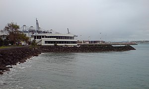
Mechanics Bay
Suburb in Auckland Council, New Zealand
Distance: Approx. 376 meters
Latitude and longitude: -36.847631,174.785149
Mechanics Bay (Māori: Te Tōangaroa) is a reclaimed bay on the Waitematā Harbour in Auckland, New Zealand. It is also the name of the area of the former bay that is now mainly occupied by commercial and port facilities. Sometimes the bay formed between Tāmaki Drive and the western reclamation edge of Fergusson Container Terminal is also referred to as Mechanics Bay.

Auckland Rescue Helicopter Trust
Helicopter Ambulance Service
Distance: Approx. 224 meters
Latitude and longitude: -36.8472015,174.7886493
The Auckland Westpac Rescue Helicopter is a New Zealand accident and emergency rescue and transport service operated by Northern Rescue Helicopter Ltd (NRHL)[1]. The operator is a joint venture between Northland Emergency Services Trust and Auckland Rescue Helicopter Trust. The trust operates two AW169 and one BK117 helicopters on behalf of the helicopter owners—the greater Auckland community.
Auckland Marine Rescue Centre
Distance: Approx. 253 meters
Latitude and longitude: -36.84693,174.78873
The Auckland Marine Rescue Centre is the control centre for the Coastguard Northern Region and Surf Lifesaving New Zealand's control centre SurfCom. It also houses other marine services such as the Harbourmaster and the Maritime Police. It is located in Mechanics Bay, Auckland, at the eastern end of the Ports of Auckland container terminal.

Auckland Council
Governing body of New Zealand's Auckland Region
Distance: Approx. 503 meters
Latitude and longitude: -36.85,174.78333333
Auckland Council (Māori: Te Kaunihera o Tāmaki Makaurau) is the local government council for the Auckland Region in New Zealand. It is a territorial authority that has the responsibilities, duties and powers of a regional council and so is a unitary authority, according to the Local Government (Auckland Council) Act 2009, which established the council. The governing body consists of a mayor and 20 councillors, elected from 13 wards.

Parnell Rose Gardens
Park in Parnell, Auckland, New Zealand
Distance: Approx. 283 meters
Latitude and longitude: -36.850718,174.786338
Dove-Myer Robinson Park, more commonly known as the Parnell Rose Garden, is a park in Parnell, Auckland, New Zealand. The park is named after Dove-Myer Robinson, the longest-serving mayor of Auckland, who served for 18 years. There are over 5,000 roses in the garden.

Quay Park
Distance: Approx. 910 meters
Latitude and longitude: -36.84792,174.7788
Quay Park is a junction on the Auckland railway network in New Zealand. It normally links Waitematā with Newmarket station for the Western and Southern lines which use a common set of tracks (the Newmarket Line) between Waitematā and Newmarket. The Strand station has been closed to suburban train services since the opening of Waitematā in 2003 and is now used as the terminus for the Auckland–Wellington Northern Explorer service via the North Island Main Trunk line and for chartered excursions.

Mandrill Studios
New Zealand recording studio
Distance: Approx. 889 meters
Latitude and longitude: -36.8511,174.7792
Founded in the early 1970s, Mandrill Studios was a recording studio in Parnell, a suburb of Auckland, New Zealand. Many of New Zealand's prominent artists had their work recorded there. The Mandrill record label grew out of the name of the studio.

Whitecliffe College of Arts and Design
Private art school in Auckland, New Zealand
Distance: Approx. 416 meters
Latitude and longitude: -36.8499,174.7843
Whitecliffe College is a private training establishment in New Zealand. Whitecliffe College was established as a fine arts, design and fashion school in Auckland by artist Greg Whitecliffe and Michele Whitecliffe in 1983. New Zealand educator Feroz Ali acquired Whitecliffe, NZ Fashion Tech, New Zealand School of Art & Fashion, and Computer Power Plus in 2018, and merged these institutions in 2019.
The Strand, Auckland
Distance: Approx. 620 meters
Latitude and longitude: -36.85,174.782
The Strand is a street in Auckland, New Zealand's most populous city. It connects the Ports of Auckland to the Auckland motorway network, and is the eastern end of State Highway 16.

Serko
Travel management company
Distance: Approx. 672 meters
Latitude and longitude: -36.850126,174.781436
Serko Limited, known as Serko, is a travel management and expense technology company headquartered in New Zealand. Serko was publicly listed on the New Zealand Stock Exchange in June 2014 and on the Australian Stock Exchange in 2018 under the ticker code SKO. In October 2019, Booking Holdings purchased 4.7% as part of a partnership deal. In 2020 Serko won the New Zealand High-Tech Awards, winning company of the year.

St George's Bay, Auckland
Waterfront feature in Auckland, New Zealand
Distance: Approx. 641 meters
Latitude and longitude: -36.8494,174.7817
St George's Bay (Māori: Te Wai o Taikehu) is a reclaimed bay on the southern side of the Waitematā Harbour that was one of the inner city bays. It was framed by two substantial headlands, Points Dunlop and Barnabas separating it from Mechanics Bay in the west, and Campbell's Point, after John Logan Campbell, separating it from Judge's Bay on the east. Point Dunlop and Point Barnabas have since been quarried away entirely, and Campbell's Point partially.

Parnell Baths
Swimming pool in Auckland, New Zealand
Distance: Approx. 278 meters
Latitude and longitude: -36.849,174.792
The Parnell Baths are a historic swimming pool in Parnell, Auckland. The pools feature the largest saltwater swimming pool in New Zealand, originally filling with seawater from the Waitematā Harbour. In the 1950s, the pool complex was redeveloped into the Lido style popular in the United Kingdom, by Hungarian architect Tibor Donner.
Weather in this IP's area
scattered clouds
14 Celsius
13 Celsius
13 Celsius
15 Celsius
1026 hPa
80 %
1026 hPa
1022 hPa
10000 meters
3.13 m/s
4.47 m/s
58 degree
40 %
06:31:11
19:40:10