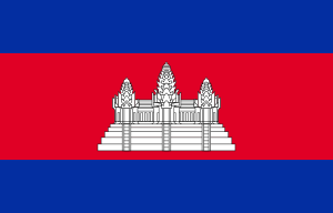
Country:
Region:
City:
Latitude and Longitude:
Time Zone:
Postal Code:
IP information under different IP Channel
ip-api
Country
Region
City
ASN
Time Zone
ISP
Blacklist
Proxy
Latitude
Longitude
Postal
Route
IPinfo
Country
Region
City
ASN
Time Zone
ISP
Blacklist
Proxy
Latitude
Longitude
Postal
Route
MaxMind
Country
Region
City
ASN
Time Zone
ISP
Blacklist
Proxy
Latitude
Longitude
Postal
Route
Luminati
Country
Region
12
City
phnompenh
ASN
Time Zone
Asia/Phnom_Penh
ISP
SINET, Cambodias specialist Internet and Telecom Service Provider.
Latitude
Longitude
Postal
db-ip
Country
Region
City
ASN
Time Zone
ISP
Blacklist
Proxy
Latitude
Longitude
Postal
Route
ipdata
Country
Region
City
ASN
Time Zone
ISP
Blacklist
Proxy
Latitude
Longitude
Postal
Route
Popular places and events near this IP address

Cambodia
Country in Southeast Asia
Distance: Approx. 1322 meters
Latitude and longitude: 11.57,104.91
Cambodia, officially the Kingdom of Cambodia, is a country in Mainland Southeast Asia. It borders Thailand to the northwest, Laos to the north, Vietnam to the east, and has a coastline along the Gulf of Thailand on the southwest. It spans an area of 181,035 square kilometres (69,898 square miles), and has a population of about 17 million.

Tuol Sleng Genocide Museum
Museum dedicated to the Cambodian Genocide
Distance: Approx. 1164 meters
Latitude and longitude: 11.54944444,104.91777778
The Tuol Sleng Genocide Museum (Khmer: សារមន្ទីរឧក្រិដ្ឋកម្មប្រល័យពូជសាសន៍ទួលស្លែង, romanized: Saromontir Ukredth Kamm Braly Pouchsasa Tuol Sleng), or simply Tuol Sleng (Khmer: ទួលស្លែង, Tuŏl Slêng [tuəl slaeŋ]; lit. "Hill of the Poisonous Trees" or "Strychnine Hill"), is a museum chronicling the Cambodian genocide. Located in Phnom Penh, the site is a former secondary school which was used as Security Prison 21 (S-21; Khmer: មន្ទីរស-២១) by the Khmer Rouge regime from 1975 until its fall in 1979.

Olympic Stadium (Phnom Penh)
Multi-purpose stadium in Phnom Penh, Cambodia
Distance: Approx. 17 meters
Latitude and longitude: 11.55833333,104.91194444
The Olympic Stadium (Khmer: ពហុកីឡាដ្ឋានជាតិអូឡាំពិក) is a multi-purpose stadium in Phnom Penh, Cambodia. It has a capacity of 50,000. Despite its name, the stadium has never hosted an Olympic Games.

Apostolic Vicariate of Phnom Penh
Catholic missionary jurisdiction in Cambodia
Distance: Approx. 297 meters
Latitude and longitude: 11.56,104.91
The Apostolic Vicariate of Phnom Penh (Khmer: សាវកជំនួសរាជធានីភ្នំពេញ) is a territorial subdivision of the Catholic Church in Cambodia. It is immediately subject to the Holy See and it is presided over by Bishop Olivier Schmitthaeusler M.E.P. since 10 October 2010. The vicariate covers an area of 32,063 km2 (12,380 sq mi) of southern Cambodia, including Phnom Penh and other main urban areas such as Kep, Sihanoukville, Kandal, Takéo, Kampot, Kampong Speu and Koh Kong provinces.
Sorya Shopping Center
Shopping mall in Phnom Penh, Cambodia
Distance: Approx. 1399 meters
Latitude and longitude: 11.5675,104.92083333
Sorya Shopping Center (Khmer: ផ្សារទំនើបសូរិយា, Phsar Tumneub Sorĭyéa) is a Western-styled shopping mall in Phnom Penh, Cambodia. It has eight stories containing shops catering to the various needs of customers. When it opened in 2003, it was the first shopping mall to open in Phnom Penh, being the first exposure to escalators for many Cambodians.
Khan Prampir Makara
Section in Phnom Penh, Cambodia
Distance: Approx. 584 meters
Latitude and longitude: 11.56333333,104.91361111
Prampir Makara (Khmer: ប្រាំពីរមករា [prampiː meakaraː]; meaning 'Seventh of January'), also 7 Makara (Khmer: ៧មករា; meaning '7th of January'), is a section (khan) in Phnom Penh, Cambodia. The section is subdivided into 8 sangkats and 33 kroms. The section has an area of 2.21 km2 (0.85 sq mi).

Sihanouk Boulevard
Boulevard in Phnom Penh
Distance: Approx. 1049 meters
Latitude and longitude: 11.555,104.92111111
Sihanouk Boulevard (Khmer: មហាវិថីព្រះសីហនុ) is a central boulevard of Phnom Penh which is the capital of Cambodia. The boulevard crosses the city in an east–west direction. It is named in honour of the late King Norodom Sihanouk, one of the country's greatest kings.
The Great Duke Phnom Penh Hotel
Hotel in Phnom Penh, Cambodia
Distance: Approx. 1343 meters
Latitude and longitude: 11.5505,104.9027
The Great Duke Phnom Penh Hotel was a 5-star hotel in Phnom Penh, Cambodia. The 15-story hotel had 346 rooms, and was located in the city centre.
Lycée Sisowath
Public school in Phnom Penh, Cambodia
Distance: Approx. 1537 meters
Latitude and longitude: 11.56404,104.92492
Lycée Sisowath (Khmer: វិទ្យាល័យព្រះស៊ីសុវត្ថិ; also Sisowath High School) is a secondary school in Phnom Penh, Cambodia. The school was founded in 1873 as a collège (middle school) and became a lycée (middle and high school) in 1933. It is named after King Sisowath.
Wat Moha Montrey
Distance: Approx. 450 meters
Latitude and longitude: 11.55444444,104.91333333
Wat Moha Montrey (Khmer: វត្តមហាមន្ត្រី, UNGEGN: Vôtt Môha Môntrei, ALA-LC: Vatt Mahā Mantrī [ʋɔət mɔhaː mɔntrəj]) is a wat located on Sihanouk Boulevard in Phnom Penh, Cambodia. Built in 1970, it was used by the Khmer Rouge between 1975 and 1979 as a storage house for rice and corn. The tower measures 35 metres in height.

Khan Boeng Keng Kang
Section in Phnom Penh, Cambodia
Distance: Approx. 1208 meters
Latitude and longitude: 11.548,104.9156
Boeng Keng Kang (Khmer: បឹងកេងកង [ɓəŋ keːŋkɑːŋ]) is a section (khan) in Phnom Penh, Cambodia. This khan was created on January 8, 2019, according to sub-decree 03 អនក្រ.បក by taking 7 quarters (sangkat) from Chamkar Mon Section. It has a population of 66,658.
Sihanouk Hospital Center of HOPE
Free non-governmental hospital in Phnom Penh, Cambodia
Distance: Approx. 1170 meters
Latitude and longitude: 11.56804417,104.91612806
Sihanouk Hospital Center of HOPE (SHCH) was established as a free non-governmental hospital in 1996 by Bernard Krisher, an American philanthropist, in Phnom Penh, Cambodia. The hospital's mission was to help rebuild the country's medical infrastructure by treating patients and training medical personnel and was named in honor of Cambodia's "King Father", Norodom Sihanouk. In 2022, SHCH faced closure by the Cambodian government, alleging unpaid taxes.
Weather in this IP's area
light rain
27 Celsius
32 Celsius
27 Celsius
27 Celsius
1011 hPa
100 %
1011 hPa
1009 hPa
9000 meters
1.03 m/s
200 degree
40 %
05:49:52
17:40:47


