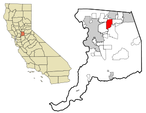
Country:
Region:
City:
Latitude and Longitude:
Time Zone:
Postal Code:
IP information under different IP Channel
ip-api
Country
Region
City
ASN
Time Zone
ISP
Blacklist
Proxy
Latitude
Longitude
Postal
Route
Luminati
Country
ASN
Time Zone
America/Chicago
ISP
NTT-GLOBAL-DATA-CENTERS-AMERICA-INC
Latitude
Longitude
Postal
IPinfo
Country
Region
City
ASN
Time Zone
ISP
Blacklist
Proxy
Latitude
Longitude
Postal
Route
db-ip
Country
Region
City
ASN
Time Zone
ISP
Blacklist
Proxy
Latitude
Longitude
Postal
Route
ipdata
Country
Region
City
ASN
Time Zone
ISP
Blacklist
Proxy
Latitude
Longitude
Postal
Route
Popular places and events near this IP address

Carmichael, California
Census-designated place in California, United States
Distance: Approx. 2553 meters
Latitude and longitude: 38.63944444,-121.32138889
Carmichael is a census-designated place (CDP) in Sacramento County, California, United States. It is an unincorporated suburb in the Greater Sacramento metropolitan area. The population was 79,793 at the 2020 census.

Rancho Cordova, California
City in California, United States
Distance: Approx. 3806 meters
Latitude and longitude: 38.58916667,-121.30277778
Rancho Cordova is a city in Sacramento County, California, United States which was incorporated in 2003. It is part of the Sacramento Metropolitan Area. The population was 79,332 at the 2020 census.

Jensen Botanical Gardens
Botanical garden in California
Distance: Approx. 2556 meters
Latitude and longitude: 38.6394,-121.321
The Charles C. Jensen Botanical Gardens are botanical gardens located at 8520 Fair Oaks Boulevard, Carmichael, California. They are open during the daylight hours without charge. The gardens exhibit a variety of flora including camellias, dogwoods, azaleas, and rhododendrons.
KYDS
Radio station in Sacramento, California
Distance: Approx. 3092 meters
Latitude and longitude: 38.609,-121.362
KYDS is a Sacramento, California FM radio station with the frequency 91.5 MHz. It is maintained at El Camino Fundamental High School, and select students from the school are allowed to participate in its operation. The original inception of KYDS was in 1976, when it broadcast only in the school cafeteria during lunch hour.
Cordova High School (California)
Public high school in Rancho Cordova, California
Distance: Approx. 2564 meters
Latitude and longitude: 38.60055556,-121.3075
Cordova High School is a comprehensive public high school in Rancho Cordova, California. It is one of five high schools in Folsom Cordova Unified School District. The school opened in 1963 with the first graduating class in 1965.
El Camino Fundamental High School
High school in Arden-Arcade, Sacramento County, California, United States
Distance: Approx. 3062 meters
Latitude and longitude: 38.60953,-121.36184
El Camino Fundamental High School is a public high school in Arden-Arcade, California, near Sacramento. It is part of the San Juan Unified School District. Built in 1951 as El Camino High School, "Fundamental" was added to the name in the late 1970s to signify the school's intention to focus upon basic (fundamental) characteristics of successful schools, in particular a return to a strong disciplinary emphasis, a stripped-down college preparatory curriculum, and a contract-supported, enroll-through-application-only process.

American River Parkway
Distance: Approx. 2457 meters
Latitude and longitude: 38.62,-121.3
The American River Parkway is a 32-mile (51 km) urban regional recreation area that runs along the American River throughout Sacramento County, California, consisting of many smaller parks and boat launching points. It can be accessed by various exits off U.S. Route 50 in Sacramento County. Levees line the river to prevent flooding of developed areas.
Carmichael Park
Distance: Approx. 1184 meters
Latitude and longitude: 38.6275,-121.33083333
Carmichael Park is a major 38-acre (150,000 m2) park in Carmichael, California, an unincorporated suburb of Sacramento, California. The park includes 5 ballfields, 6 tennis courts and a dog park. The Community Clubhouse, Veterans' Memorial Building, the Daniel Bishop Memorial Pavilion for the Performing Arts, and the Great Wall of Carmichael are all located within the park.
Yalisumni, California
Distance: Approx. 2191 meters
Latitude and longitude: 38.6071,-121.3063
Yalisumni is a former Nisenan settlement in El Dorado County, California. It was located near Salmon Falls on the south side of the South Fork of the American River; its precise location is unknown. It was a source of workers for John Sutter's New Helvetia settlement, located in present-day Sacramento between Yalisumni and another Nisenan settlement, Pujuni.
KQPT-LP
Radio station in Sacramento, California
Distance: Approx. 952 meters
Latitude and longitude: 38.625375,-121.32522778
KQPT-LP was a low-power FM radio station broadcasting out of Sacramento, California and licensed to Sacramento Area Peace Action. It began broadcasting as KAKP-LP on August 27, 2017. Sacramento Area Peace Action surrendered KQPT-LP's license to the Federal Communications Commission on June 7, 2023, and it was cancelled the next day.
Effie Yeaw Nature Center
Nature center in Carmichael, California
Distance: Approx. 1433 meters
Latitude and longitude: 38.61748406,-121.31153141
Effie Yeaw Nature Center is a nature center inside Ancil Hoffman Park in the city of Carmichael, California. The Effie Yeaw Nature Center is part of the American River Parkway. The Effie Yeaw Nature Center is east of the city of Sacramento and has a replica of a Nisenan Tribe Village hut.

Casa de los Gobernadores
Building in Carmichael, California
Distance: Approx. 1375 meters
Latitude and longitude: 38.605925,-121.321256
The Casa de los Gobernadores (Spanish for "House of the Governors") is a mansion that was originally built to serve as the official residence of the Governor of California, located in Carmichael, California, in Greater Sacramento. Today, it serves as a private residence.
Weather in this IP's area
clear sky
15 Celsius
14 Celsius
12 Celsius
19 Celsius
1017 hPa
59 %
1017 hPa
1013 hPa
10000 meters
06:41:29
16:57:01