Country:
Region:
City:
Latitude and Longitude:
Time Zone:
Postal Code:
IP information under different IP Channel
ip-api
Country
Region
City
ASN
Time Zone
ISP
Blacklist
Proxy
Latitude
Longitude
Postal
Route
Luminati
Country
ASN
Time Zone
America/Chicago
ISP
NTT-GLOBAL-DATA-CENTERS-AMERICA-INC
Latitude
Longitude
Postal
IPinfo
Country
Region
City
ASN
Time Zone
ISP
Blacklist
Proxy
Latitude
Longitude
Postal
Route
db-ip
Country
Region
City
ASN
Time Zone
ISP
Blacklist
Proxy
Latitude
Longitude
Postal
Route
ipdata
Country
Region
City
ASN
Time Zone
ISP
Blacklist
Proxy
Latitude
Longitude
Postal
Route
Popular places and events near this IP address

Alamo, California
Unincorporated community in California, United States
Distance: Approx. 504 meters
Latitude and longitude: 37.85027778,-122.03222222
Alamo (Spanish: Álamo; meaning "Poplar tree") is an unincorporated community and census-designated place (CDP) in Contra Costa County, California, in the United States. It is a suburb located in the San Francisco Bay Area's East Bay region, approximately 28 miles (45 km) east of San Francisco. Alamo is equidistant from the city of Walnut Creek and the incorporated town of Danville.

Danville, California
City in California, United States
Distance: Approx. 3789 meters
Latitude and longitude: 37.82166667,-122
The Town of Danville is located in the San Ramon Valley in Contra Costa County, California, United States. It is one of the incorporated municipalities in California that use "town" in their names instead of "city". The population was 43,582 at the 2020 census.

Iron Horse Regional Trail
Multi-use trail in East Bay, California
Distance: Approx. 3242 meters
Latitude and longitude: 37.823961,-122.00604
The Iron Horse Regional Trail is a rail trail for pedestrians, horse riders and bicycles in the East Bay Area in California. This trail is located in inland central Alameda and Contra Costa counties, mostly following a Southern Pacific Railroad right of way established in 1891 and abandoned in 1977. The two counties purchased the right of way at that time, intending to use it as a transportation corridor; the Iron Horse Trail was first established in 1986.

Eugene O'Neill National Historic Site
National Historic Site of the United States
Distance: Approx. 2411 meters
Latitude and longitude: 37.82444444,-122.02972222
The Eugene O'Neill National Historic Site, located in Danville, California, preserves Tao House, the Monterey Colonial hillside home of America's only Nobel Prize-winning playwright, Eugene O'Neill.

San Ramon Valley High School
Public school in Danville, California, United States
Distance: Approx. 3085 meters
Latitude and longitude: 37.8260372,-122.0057941
San Ramon Valley High School is a four-year public high school located in the East Bay neighborhood of Danville, California, United States. It is a part of the San Ramon Valley Unified School District. It is a National Blue Ribbon school from the Blue Ribbon Schools Program as well as a California Distinguished School.
Tassajara Formation
Geologic unit in Northern California
Distance: Approx. 3057 meters
Latitude and longitude: 37.86,-122
The Tassajara Formation is a geologic unit within the Livermore Valley of Northern California, United States. The formation surfaces only in the northern upland parts of the Livermore Valley and underlie the central part of the valley floor at a depth ranging from 250 feet (80 m) to 700 feet (200 m). The Tassajara Formation consists of sediments ranging from brown to gray mudstone, andesitic sandstone, conglomerate, and minor bentonitic and pumiceous tuff.

Las Trampas Regional Wilderness
Distance: Approx. 3396 meters
Latitude and longitude: 37.82,-122.05
Las Trampas Regional Wilderness is a 5,342-acre (21.62 km2) regional park located in Alameda and Contra Costa counties in Northern California. The nearest city is Danville, California. Las Trampas is Spanish for the traps, or the snares.
Rancho San Ramon (Pacheco-Castro)
Mexican land grant in California
Distance: Approx. 3746 meters
Latitude and longitude: 37.87,-122
Rancho San Ramon (St. Raymond Ranch in Spanish) was a 8,917-acre (36.09 km2) Mexican land grant in the northern San Ramon Valley of present-day Contra Costa County, California. Rancho San Ramon (Amador) was adjacent in the southern San Ramon Valley.
Castle Hill, California
Census-designated place in California, United States
Distance: Approx. 3838 meters
Latitude and longitude: 37.87305556,-122.05722222
Castle Hill is a census-designated place in Contra Costa County, California. Castle Hill sits at an elevation of 302 feet (92 m). The 2010 United States census reported Castle Hill's population was 1,299.
Danville station (California)
United States historic place
Distance: Approx. 3836 meters
Latitude and longitude: 37.82070556,-122.00051111
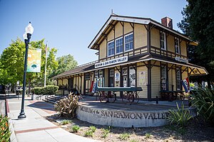
The Danville Southern Pacific Train Depot in Danville, California is located at 205 Railroad Ave. and W Prospect Ave. It was built in 1891 on land donated by John Hartz which was erected when the Martinez line was extended south to San Ramon.

Las Trampas Peak
Mountain in SF Bay Area Coast Ranges
Distance: Approx. 3368 meters
Latitude and longitude: 37.8332594,-122.064685
Las Trampas Peak is a 1,827 ft (557 m) peak in the Inner Coast Ranges in western Contra Costa County, California, in the San Francisco Bay Area.

Las Trampas Ridge
Ridge in western Contra Costa County, California
Distance: Approx. 3371 meters
Latitude and longitude: 37.83331,-122.064757
Las Trampas Ridge is an 1,827 ft (557 m) ridge in western Contra Costa County, California, in the San Francisco Bay Area. It comprises the western side of the San Ramon Valley.
Weather in this IP's area
clear sky
13 Celsius
12 Celsius
10 Celsius
15 Celsius
1021 hPa
48 %
1021 hPa
1011 hPa
10000 meters
0.76 m/s
1 m/s
48 degree
06:41:40
17:02:13
