Country:
 USA
USARegion:
City:
Latitude and Longitude:
Time Zone:
Postal Code:
IP information under different IP Channel
ip-api
Country
Region
City
ASN
Time Zone
ISP
Blacklist
Proxy
Latitude
Longitude
Postal
Route
IPinfo
Country
Region
City
ASN
Time Zone
ISP
Blacklist
Proxy
Latitude
Longitude
Postal
Route
MaxMind
Country
Region
City
ASN
Time Zone
ISP
Blacklist
Proxy
Latitude
Longitude
Postal
Route
Luminati
Country
USASN
Time Zone
America/Chicago
ISP
NTT-GLOBAL-DATA-CENTERS-AMERICA-INC
Latitude
Longitude
Postal
db-ip
Country
Region
City
ASN
Time Zone
ISP
Blacklist
Proxy
Latitude
Longitude
Postal
Route
ipdata
Country
Region
City
ASN
Time Zone
ISP
Blacklist
Proxy
Latitude
Longitude
Postal
Route
Popular places and events near this IP address
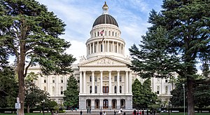
Sacramento, California
Capital city of California, United States
Distance: Approx. 39 meters
Latitude and longitude: 38.58166667,-121.49444444
Sacramento ( SAK-rə-MEN-toh; Spanish: [sakɾaˈmento]; Spanish for 'sacrament') is the capital city of the U.S. state of California and the seat of Sacramento County. Located at the confluence of the Sacramento and American Rivers in Northern California's Sacramento Valley, Sacramento's 2020 population of 524,943 makes it the fourth-most populous city in Northern California, sixth-most populous city in the state, and the ninth-most populous state capital in the United States. Sacramento is the seat of the California Legislature and the Governor of California.
University of Northern California, Lorenzo Patiño School of Law
Private law school in Sacramento, California
Distance: Approx. 235 meters
Latitude and longitude: 38.57972222,-121.49277778
The University of Northern California, Lorenzo Patiño School of Law (UNC) was a private law school located in Sacramento, California. UNC offered a part-time, four-year law program as well as a paralegal program. Law school registration was terminated during the June 28–29, 2013 meeting of the State Bar.

Cesar Chavez Plaza
Park in downtown Sacramento
Distance: Approx. 61 meters
Latitude and longitude: 38.58106,-121.4939
Cesar Chavez Plaza, or Cesar Chavez Park, is a city park in Sacramento, California, named after César Chávez. For more than a century the downtown square has been a focal point for community activities, including the Farmers' Market, music concerts, and community rallies. Occupying an entire block between I and J Streets and 9th and 10th Streets in downtown Sacramento, Cesar Chavez Park and Plaza currently stands on Old City Plaza founded in 1849 by John Sutter.
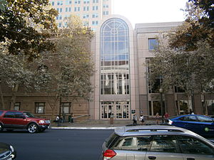
Sacramento City Library
United States historic place
Distance: Approx. 101 meters
Latitude and longitude: 38.58175,-121.49513889
The Sacramento City Library, also known as Central Branch, is part of the Sacramento Public Library system, and faces I Street in Sacramento, California near Sacramento City Hall.

Park Tower (Sacramento)
Commercial offices in Sacramento, California
Distance: Approx. 103 meters
Latitude and longitude: 38.5811,-121.495
Park Tower is a 380-foot (120 m) skyscraper in Sacramento, California, completed in 1991. The 26-story tower was the tallest in the city when completed. The building was named U.S. Bank Plaza until U.S. Bank moved to U.S. Bank Tower in 2008.

Coolot Company Building
United States historic place
Distance: Approx. 106 meters
Latitude and longitude: 38.58083333,-121.49472222
The Coolot Company Building was a historic commercial building located at 812 J Street in Sacramento, California.

Federal Building (Sacramento)
United States historic place
Distance: Approx. 112 meters
Latitude and longitude: 38.58236111,-121.49483333
The Federal Building, formerly the U.S. Post Office, Courthouse and Federal Building, is located in Downtown Sacramento, California.

Ruhstaller Building
Historic building in Downtown Sacramento, California
Distance: Approx. 117 meters
Latitude and longitude: 38.58055556,-121.49388889
The Ruhstaller Building, listed on the National Register of Historic Places, is a historic building located in the heart of Downtown Sacramento, California, USA.
Sacramento Public Library
Distance: Approx. 101 meters
Latitude and longitude: 38.58175,-121.49513889
Sacramento Public Library is a public library system in Sacramento, California. With nearly 2 million items, it is the fourth largest library system in California.
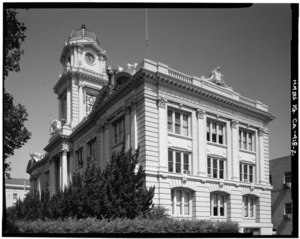
Sacramento City Hall
Distance: Approx. 51 meters
Latitude and longitude: 38.58189,-121.49355
Sacramento City Hall is a five-story, 267,000-square-foot building that combines modern and historic structures in Sacramento, California. The building can house up to 730 staff members. Prominent local architect Rudolph A. Herold designed the building in 1908.

William Coleman Memorial Fountain
Distance: Approx. 61 meters
Latitude and longitude: 38.58106,-121.4939
The William Coleman Memorial Fountain is a stone fountain created by sculptor Ralph Stackpole and located in Cesar Chavez Plaza at 10th and J streets in Sacramento, California. Florence Coleman bequeathed $30,000 to the city of Sacramento with which to erect a fountain in the memory of her late husband, William Coleman. Her chosen sculptor, Amanda Austin, was picked in 1916 to create it; but she died a year later, and it was another decade before Stackpole's work was unveiled.

Cal/EPA Building
Skyscraper in California, United States
Distance: Approx. 133 meters
Latitude and longitude: 38.58138889,-121.4925
The Cal/EPA Building is a 25-floor, 372 ft commercial office skyscraper in Downtown Sacramento that serves as the headquarters for the California Environmental Protection Agency (Cal/EPA). It also known as the Joe Serna Jr. Building, named to honor the late mayor of Sacramento, Joe Serna Jr.
Weather in this IP's area
clear sky
20 Celsius
20 Celsius
18 Celsius
23 Celsius
1012 hPa
72 %
1012 hPa
1011 hPa
10000 meters
0.45 m/s
1.79 m/s
217 degree
06:51:34
19:07:38