96.30.245.200 - IP Lookup: Free IP Address Lookup, Postal Code Lookup, IP Location Lookup, IP ASN, Public IP
Country:
Region:
City:
Location:
Time Zone:
Postal Code:
IP information under different IP Channel
ip-api
Country
Region
City
ASN
Time Zone
ISP
Blacklist
Proxy
Latitude
Longitude
Postal
Route
Luminati
Country
Region
wi
City
wauwatosa
ASN
Time Zone
America/Chicago
ISP
TSRSOLUTIONS
Latitude
Longitude
Postal
IPinfo
Country
Region
City
ASN
Time Zone
ISP
Blacklist
Proxy
Latitude
Longitude
Postal
Route
IP2Location
96.30.245.200Country
Region
wisconsin
City
cedarburg
Time Zone
America/Chicago
ISP
Language
User-Agent
Latitude
Longitude
Postal
db-ip
Country
Region
City
ASN
Time Zone
ISP
Blacklist
Proxy
Latitude
Longitude
Postal
Route
ipdata
Country
Region
City
ASN
Time Zone
ISP
Blacklist
Proxy
Latitude
Longitude
Postal
Route
Popular places and events near this IP address

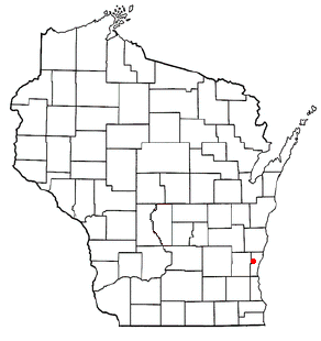
Cedarburg (town), Wisconsin
Town in Ozaukee County, Wisconsin
Distance: Approx. 3246 meters
Latitude and longitude: 43.31888889,-88.00416667
Cedarburg is a town in Ozaukee County, Wisconsin, United States, and is in the Milwaukee metropolitan area. The town was created in 1849 and at the time of the 2020 census had a population of 6,162. German and Irish immigrants first settled in Cedarburg in the 1840s.

Saukville (town), Wisconsin
Town in Ozaukee County, Wisconsin
Distance: Approx. 4848 meters
Latitude and longitude: 43.31861111,-87.98416667
Saukville is a town in Ozaukee County, Wisconsin, United States. The Village of Saukville is located in the town's southeast quadrant. The population was 1,755 at the 2000 census.
Cedarburg High School
Public secondary education school in Cedarburg, Wisconsin, United States
Distance: Approx. 4286 meters
Latitude and longitude: 43.29791,-87.9957
Cedarburg High School (CHS) is a Public Education High School in Cedarburg, Wisconsin.

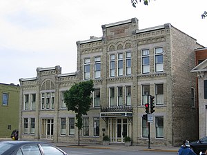
Washington Avenue Historic District (Cedarburg, Wisconsin)
Historic district in Wisconsin, United States
Distance: Approx. 4784 meters
Latitude and longitude: 43.30027778,-87.98777778
Washington Avenue Historic District is the historic center of Cedarburg, Wisconsin, the location of the early industry and commerce that was key to the community's development. The historic district was listed on the National Register of Historic Places (NRHP) in 1986. The district has 80 contributing buildings and one contributing structure in a 28 acres (11 ha) area.

Cedarburg Mill
Gristmill in Cedarburg, Wisconsin
Distance: Approx. 5053 meters
Latitude and longitude: 43.29666667,-87.98611111
The Cedarburg Mill is a former gristmill in Cedarburg, Wisconsin that is listed on the U.S. National Register of Historic Places. Located the on Cedar Creek, the building was constructed in 1855 by Frederick Hilgen and William Schroeder to replace a smaller wooden mill from the 1840s. At the time of its construction, the five-story structure was the tallest building in Cedarburg.

Wayside House
Historic house in Wisconsin, United States
Distance: Approx. 5257 meters
Latitude and longitude: 43.29194444,-87.98638889
The Wayside House (also known as the Hilgen-Schuette House) is a historic house located in Cedarburg, Wisconsin. It was built by Frederick Hilgen, who later co-owned the Cedarburg Mill, and is considered the father of Cedarburg. It was added to the National Register of Historic Places on March 17, 1982.
Cedarburg Cultural Center
Distance: Approx. 5044 meters
Latitude and longitude: 43.29558,-87.98687
The Cedarburg Cultural Center is located in the historic downtown of Cedarburg, Wisconsin. For more than 25 years it has provided a place for art, music and history to be shared with the community. The performance space presents a variety of music, theater and comedy.
Decker Corner, Wisconsin
Unincorporated community in Ozaukee County, Wisconsin
Distance: Approx. 4152 meters
Latitude and longitude: 43.35138889,-88.045
Decker Corner is an unincorporated community in the Town of Cedarburg, Ozaukee County, Wisconsin, United States. Decker Corner was named for a family who lived at the local crossroads.
Horns Corners, Wisconsin
Unincorporated community in Ozaukee County, Wisconsin
Distance: Approx. 3435 meters
Latitude and longitude: 43.34138889,-88.02388889
Horns Corners is an unincorporated community in the Town of Cedarburg, Ozaukee County, Wisconsin, United States.

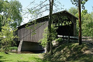
Covered Bridge (Cedarburg, Wisconsin)
United States historic place
Distance: Approx. 4075 meters
Latitude and longitude: 43.3375,-88.005
The Covered Bridge (originally called Red Bridge) in Cedarburg, Ozaukee County, Wisconsin, United States, is one of the last remaining covered bridges in that state, which once had about 40 covered bridges. Built in 1876 to cross Cedar Creek, the bridge is 120 feet (37 m) long and is made of pine with oak lattices. It was listed on the National Register of Historic Places in 1973 and is now used only for pedestrian traffic.

Hilgen and Wittenberg Woolen Mill
Historic textile mill in Wisconsin, US
Distance: Approx. 4667 meters
Latitude and longitude: 43.30119444,-87.98888889
The Hilgen and Wittenberg Woolen Mill is a textile mill in Cedarburg, Wisconsin. Built in 1864, the mill was one of many wool- and flax-processing factories that opened during the American Civil War, due to a shortage of cotton textiles formerly supplied by southern states. The mill produced yarns, blankets, and flannels, and was the largest woolen mill west of Philadelphia in the 19th century.

Columbia Historic District (Cedarburg, Wisconsin)
Historic district in Cedarburg, Wisconsin
Distance: Approx. 5006 meters
Latitude and longitude: 43.298,-87.986
The Columbia Historic District is a neighborhood in Cedarburg, Wisconsin, that is listed on the National Register of Historic Places. At the time the district was listed on the register, its contributing properties included 128 historic homes, one church, and eighty-seven historic outbuildings, including garages and barns, all constructed between 1844 and 1938. The district also contained several dozen buildings that do not contribute to the historic district, including modern homes from the post-war era as well as modern garages and other additions to historic properties.
Weather in this IP's area
overcast clouds
5 Celsius
4 Celsius
4 Celsius
7 Celsius
1019 hPa
91 %
1019 hPa
986 hPa
1048 meters
1.79 m/s
2.68 m/s
181 degree
100 %