96.16.102.195 - IP Lookup: Free IP Address Lookup, Postal Code Lookup, IP Location Lookup, IP ASN, Public IP
Country:
Region:
City:
Location:
Time Zone:
Postal Code:
IP information under different IP Channel
ip-api
Country
Region
City
ASN
Time Zone
ISP
Blacklist
Proxy
Latitude
Longitude
Postal
Route
Luminati
Country
ASN
Time Zone
Asia/Bangkok
ISP
SBN-IIGAWN-IIG transit provider
Latitude
Longitude
Postal
IPinfo
Country
Region
City
ASN
Time Zone
ISP
Blacklist
Proxy
Latitude
Longitude
Postal
Route
IP2Location
96.16.102.195Country
Region
chachoengsao
City
chachoengsao
Time Zone
Asia/Bangkok
ISP
Language
User-Agent
Latitude
Longitude
Postal
db-ip
Country
Region
City
ASN
Time Zone
ISP
Blacklist
Proxy
Latitude
Longitude
Postal
Route
ipdata
Country
Region
City
ASN
Time Zone
ISP
Blacklist
Proxy
Latitude
Longitude
Postal
Route
Popular places and events near this IP address

Chachoengsao province
Province of Thailand
Distance: Approx. 163 meters
Latitude and longitude: 13.6875,101.07027778
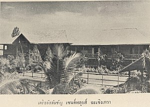
Chachoengsao (Thai: ฉะเชิงเทรา, pronounced [t͡ɕʰàʔ.t͡ɕʰɤ̄ːŋ.sāw]) is one of Thailand's seventy-six provinces (changwat), located in eastern Thailand.

Chachoengsao
Place in Chachoengsao Province, Thailand
Distance: Approx. 272 meters
Latitude and longitude: 13.69027778,101.07027778
Chachoengsao (Thai: ฉะเชิงเทรา, pronounced [t͡ɕʰàʔ.t͡ɕʰɤ̄ːŋ.sāw]) is a town (thesaban mueang) in central Thailand, capital of Chachoengsao Province. It is on the banks of the Bang Pakong River. It includes tambon Na Mueang and parts of Ban Mai, Bang Tin Pet, Wang Takhian, and Sothon of Mueang Chachoengsao District.

Mueang Chachoengsao district
District in Chachoengsao, Thailand
Distance: Approx. 95 meters
Latitude and longitude: 13.68861111,101.07083333
Mueang Chachoengsao (Thai: เมืองฉะเชิงเทรา, pronounced [mɯ̄a̯ŋ t͡ɕʰàʔ.t͡ɕʰɤ̄ːŋ.sāw]), formerly named the Mueang Paet Rio District (Thai: เมืองแปดริ้ว), is the capital district (amphoe mueang) of Chachoengsao province, Eastern Thailand.

Ban Pho district
District in Chachoengsao, Thailand
Distance: Approx. 9878 meters
Latitude and longitude: 13.59972222,101.07861111
Ban Pho (Thai: บ้านโพธิ์, pronounced [bâːn pʰōː]) is a district (amphoe) in the western part of Chachoengsao province, central Thailand.

Wat Sothonwararam
Distance: Approx. 1680 meters
Latitude and longitude: 13.6737,101.0673
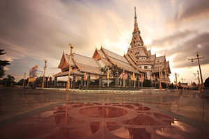
Wat Sothonwararam is a temple in Chachoengsao Province, Thailand. Located in the Municipality of Mueang Chachoengsao alongside the Bang Pakong River, it was initially named ‘Wat Hong,’ and was built in the late Ayutthaya period. The temple has the ‘Luangpho Phuttha Sothon,’ the revered Buddha image of Chachoengsao province, which is 1.48 metres high, with a lap width of 1.65 metres.
Benchamaratrungsarit 2 School
Secondary school in Chachoengsao, Thailand
Distance: Approx. 3902 meters
Latitude and longitude: 13.667002,101.100335
Benchamaratrungsarit 2 School (Thai: โรงเรียนเบญจมราชรังสฤษฎิ์ 2), informally Ben 2, is in the provincial capital of Chachoengsao, Thailand. It is a public secondary school with 1900 students secondary education 1 to 6. The curriculum covers nine subjects: mathematics, science, English, Thai, Chinese, social studies, vocational studies, art and physical education.
Chachoengsao Junction railway station
Railway station in Na Mueang, Thailand
Distance: Approx. 1705 meters
Latitude and longitude: 13.69555556,101.05777778
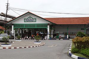
Chachoengsao Junction station (Thai: สถานีชุมทางฉะเชิงเทรา, RTGS: Sathani Chumthang Chachoengsao) is a railway station in eastern Thailand on the State Railway of Thailand's Eastern Line. In Na Mueang Sub-district, Mueang Chachoengsao District, Chachoengsao Province. Its former name was Paet Riu.

Chachoengsao Town Municipality Stadium
Distance: Approx. 392 meters
Latitude and longitude: 13.68972222,101.06833333
Chachoengsao Town Municipality Stadium (Thai: สนามเทศบาลเมืองฉะเชิงเทรา) is a multi-purpose stadium in Chachoengsao Province, Thailand. It is currently used mostly for football matches and is the home stadium of Chachoengsao Hi-Tek F.C. The stadium holds 6,000 people.

Dat Daruni School
School in Chachoengsao, Thailand
Distance: Approx. 454 meters
Latitude and longitude: 13.68981,101.075456
Dat Daruni School (Thai: โรงเรียนดัดดรุณี) is a school for girls in Chachoengsao, in Chachoengsao province in central Thailand. The school was named by King Rama VI. Its opening ceremony was on 22 February 1915. At first, Dat Daruni School was a normal school which taught both boys and girls.

Saint Louis School, Chachoengsao
School in Suppakit St., Na Mueang, Mueang Chachoengsao District, Chachoengsao, Thailand
Distance: Approx. 1633 meters
Latitude and longitude: 13.6923,101.0861
Saint Louis School, Chachoengsao (SLC) is a private Catholic school in Chachoengsao, Thailand. The school was established to teach students from the Kindergarten level to Primary level to Secondary Level (Grades 1-12). It is located at 128 Suppakit Street, Na Mueang, Mueang Chachoengsao District.

Buddhasothorn Hospital
Hospital in Chachoengsao , Thailand
Distance: Approx. 332 meters
Latitude and longitude: 13.686075,101.073751
Buddhasothorn Hospital (Thai: โรงพยาบาลพุทธโสธร) is the main hospital of Chachoengsao Province, Thailand and is classified under the Ministry of Public Health as a regional hospital. It has a CPIRD Medical Education Center which trains doctors for the Faculty of Medicine of Thammasat University.

Khlong Bang Phra railway station
Railway station in Chachoengsao, Thailand
Distance: Approx. 8855 meters
Latitude and longitude: 13.7042,100.9914
Khlong Bang Phra railway station is a railway station located in Bang Toei Subdistrict, Mueang Chachoengsao District, Chachoengsao Province. It is a class 3 railway station located 53.99 km (33.5 mi) from Bangkok railway station.
Weather in this IP's area
scattered clouds
29 Celsius
30 Celsius
29 Celsius
29 Celsius
1011 hPa
47 %
1011 hPa
1011 hPa
10000 meters
4.82 m/s
8.34 m/s
78 degree
30 %
