Country:
Region:
City:
Latitude and Longitude:
Time Zone:
Postal Code:
IP information under different IP Channel
ip-api
Country
Region
City
ASN
Time Zone
ISP
Blacklist
Proxy
Latitude
Longitude
Postal
Route
Luminati
Country
Region
vic
ASN
Time Zone
Australia/Melbourne
ISP
Kinetix Networks
Latitude
Longitude
Postal
IPinfo
Country
Region
City
ASN
Time Zone
ISP
Blacklist
Proxy
Latitude
Longitude
Postal
Route
db-ip
Country
Region
City
ASN
Time Zone
ISP
Blacklist
Proxy
Latitude
Longitude
Postal
Route
ipdata
Country
Region
City
ASN
Time Zone
ISP
Blacklist
Proxy
Latitude
Longitude
Postal
Route
Popular places and events near this IP address

Mont Albert, Victoria
Suburb of Melbourne, Victoria, Australia
Distance: Approx. 962 meters
Latitude and longitude: -37.81611111,145.11
Mont Albert is an inner eastern suburb of Melbourne, Victoria, Australia, 12 kilometres east of Melbourne's Central Business District, located within the Cities of Boroondara and Whitehorse local government areas. Mont Albert recorded a population of 4,948 at the 2021 census. The main shopping centre of Mont Albert is Hamilton Street, a small street lined with shops.
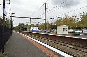
Mont Albert railway station
Former railway station in Melbourne, Australia
Distance: Approx. 977 meters
Latitude and longitude: -37.81955,145.10556
Mont Albert railway station was a commuter railway station on the Lilydale and Belgrave lines, part of the Melbourne railway network. It served the eastern Melbourne suburb of Mont Albert in Victoria, Australia. Mont Albert was a ground level unstaffed station, featuring three platforms, an island platform with two faces and one side platform.

Chatham railway station, Melbourne
Railway station in Melbourne, Australia
Distance: Approx. 1741 meters
Latitude and longitude: -37.8242,145.0887
Chatham railway station is a commuter railway station on the Belgrave and Lilydale lines, which are both part of the Melbourne railway network. It serves the eastern suburb of Surrey Hills, in Melbourne, Victoria, Australia. Chatham station is a ground level unstaffed station, featuring three platforms, an island platform with two faces and one side platform.

Surrey Hills railway station
Former railway station in Melbourne, Australia
Distance: Approx. 1365 meters
Latitude and longitude: -37.8239,145.099
Surrey Hills railway station was a commuter railway station on the Lilydale and Belgrave lines, part of the Melbourne railway network. It served the eastern Melbourne suburb of Surrey Hills in Victoria, Australia. Surrey Hills was a ground level premium station, featuring three platforms, an island platform with two faces and one side platform.
Mont Albert North, Victoria
Suburb of Melbourne, Victoria, Australia
Distance: Approx. 1237 meters
Latitude and longitude: -37.80805556,145.11388889
Mont Albert North is a suburb of Melbourne, Victoria, Australia, 13 km east of Melbourne's Central Business District, located within the City of Whitehorse local government area. Mont Albert North recorded a population of 5,609 at the 2021 census. The northern border of the suburb is the Eastern Freeway and the southern border is Kenmare Street, while Elgar Road constitutes the boundary in the east.

Maranoa Gardens
Botanical gardens in Balwyn, Melbourne
Distance: Approx. 923 meters
Latitude and longitude: -37.8106,145.0902
Maranoa Gardens is a botanical garden in Balwyn, Melbourne.

Electoral district of Box Hill
State electoral district of Victoria, Australia
Distance: Approx. 1717 meters
Latitude and longitude: -37.81,145.12
The electoral district of Box Hill is an electoral district of the Victorian Legislative Assembly, covering an area of 29 square kilometres (11 sq mi) in eastern Melbourne. It contains the suburbs of Box Hill, Box Hill North, Box Hill South, Mont Albert, Mont Albert North, most of Blackburn, Blackburn North, and Blackburn South, and parts of Balwyn North, Burwood, Burwood East, and Surrey Hills. It lies within the Eastern Metropolitan Region in the upper house, the Legislative Council.
Greythorn High School
State school in Melbourne, Victoria, Australia
Distance: Approx. 1185 meters
Latitude and longitude: -37.80166667,145.09611111
Greythorn High School was a state-run high school (years 7–12) in the suburb of Balwyn North, in Melbourne, Victoria, Australia. The school was established in February 1958, meeting for the first time at Balwyn High School as the new building at Greythorn Road was not completed at that time. After three days, the 81 students and 5 teachers transferred to temporary premises at St Silas Hall and the Scout Hall at Macleay Park.

Box Hill Institute
Educational institution in Melbourne, Australia
Distance: Approx. 1671 meters
Latitude and longitude: -37.8165,145.1186
Box Hill Institute is a provider of vocational and higher education located in the eastern suburbs of Melbourne in Victoria. The Box Hill Institute has three locations in Box Hill (Elgar, Nelson & Whitehorse), two in Lilydale (John St and Jarlo Dve), and one in Melbourne CBD, where it is co-located with the Centre for Adult Education.
Box Hill Senior Secondary College
State school in Box Hill, Victoria, Australia
Distance: Approx. 1107 meters
Latitude and longitude: -37.81027778,145.11305556
Box Hill Senior Secondary College (BHSSC) is a state-run co-educational senior secondary school located in Box Hill, Victoria, Australia. The senior school has a three-year curriculum, composed of years ten to twelve. Year 9 are offered at the Middle Years Sports Campus.
Electoral district of Balwyn
Former state electoral district of Victoria, Australia
Distance: Approx. 1616 meters
Latitude and longitude: -37.81666667,145.08333333
Electoral district of Balwyn was an electoral district of the Legislative Assembly in the Australian state of Victoria. It centered on the eastern Melbourne suburb of Balwyn.
Greythorn Park
Park in Balwyn North, Australia
Distance: Approx. 1631 meters
Latitude and longitude: -37.797966,145.094138
Greythorn Park is a park in the suburb of Balwyn North, Melbourne, Victoria, Australia. It is located in the eastern part of the suburb known as Greythorn, from which the park gets its name.
Weather in this IP's area
clear sky
11 Celsius
10 Celsius
9 Celsius
12 Celsius
1019 hPa
64 %
1019 hPa
1005 hPa
10000 meters
0.76 m/s
1.89 m/s
278 degree
06:05:25
20:01:18

