95.215.216.238 - IP Lookup: Free IP Address Lookup, Postal Code Lookup, IP Location Lookup, IP ASN, Public IP
Country:
Region:
City:
Location:
Time Zone:
Postal Code:
IP information under different IP Channel
ip-api
Country
Region
City
ASN
Time Zone
ISP
Blacklist
Proxy
Latitude
Longitude
Postal
Route
Luminati
Country
ASN
Time Zone
Europe/Kyiv
ISP
Lanet Network Ltd
Latitude
Longitude
Postal
IPinfo
Country
Region
City
ASN
Time Zone
ISP
Blacklist
Proxy
Latitude
Longitude
Postal
Route
IP2Location
95.215.216.238Country
Region
vinnytska oblast
City
vinnytsia
Time Zone
Europe/Kiev
ISP
Language
User-Agent
Latitude
Longitude
Postal
db-ip
Country
Region
City
ASN
Time Zone
ISP
Blacklist
Proxy
Latitude
Longitude
Postal
Route
ipdata
Country
Region
City
ASN
Time Zone
ISP
Blacklist
Proxy
Latitude
Longitude
Postal
Route
Popular places and events near this IP address

Werwolf (Wehrmacht headquarters)
Wehrmacht headquarters
Distance: Approx. 8456 meters
Latitude and longitude: 49.30833333,28.49333333
Führerhauptquartier Werwolf was the codename used for one of Adolf Hitler's World War II Eastern Front military headquarters located in a pine forest about 12 kilometres (7+1⁄2 miles) north of Vinnytsia, in Ukraine, which was used between 1942 and 1943. It was one of a number of Führer Headquarters throughout Europe, and the most easterly ever used by Hitler in person.

Vinnytsia
City and administrative center of Vinnytsia Oblast, Ukraine
Distance: Approx. 180 meters
Latitude and longitude: 49.23333333,28.48333333
Vinnytsia ( VIN-it-s(y)ə, VEEN-; Ukrainian: Вінниця, IPA: [ˈwinːɪtsʲɐ] ) is a city in central Ukraine, located on the banks of the Southern Bug. It serves as the administrative center of Vinnytsia Oblast. It is the largest city in the historic region of Podillia.

Vinnytsia TV Mast
Distance: Approx. 4282 meters
Latitude and longitude: 49.24167778,28.42368056
The Vinnytsia TV Mast (Ukrainian: Вінницька телевежа, romanized: Vinnyts'ka televezha) is a 354-metre, 1161 ft high guyed steel tube mast, used for FM- and TV-transmission, in Vinnytsia, Ukraine. A special feature of its structure are three crossbars arranged in 120 degree angles in two levels, running from its structure to the guys. It was built in 1961.

Tsentralnyi Stadion (Vinnytsia)
Distance: Approx. 1333 meters
Latitude and longitude: 49.24333333,28.48972222
Central City Stadium (Ukrainian: Центральний міський стадіон, Tsentralnyi miskyi stadion) is a multi-use stadium in Vinnytsia, Ukraine. It is currently used mostly for football matches, and is the home of FC Nyva Vinnytsia and FC Vinnytsia. The stadium holds 24,000 people.
Dendropark "Podillya"
Distance: Approx. 4721 meters
Latitude and longitude: 49.21777778,28.42027778
Dendropark "Podillya" is part of the "Podillya" Botanical Gardens at Vinnytsia National Agrarian University.

Vinnytsia Raion
Subdivision of Vinnytsia Oblast, Ukraine
Distance: Approx. 8083 meters
Latitude and longitude: 49.3025,28.51220583
Vinnytsia Raion (Ukrainian: Вінницький район) is one of the six raions (districts) of Vinnytsia Oblast, located in southwestern Ukraine. The administrative center of the raion is the city of Vinnytsia. Population: 647,966 (2022 estimate).

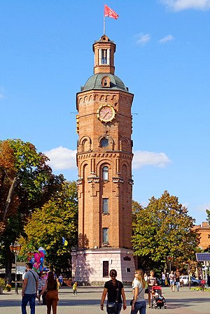
Vinnytsia water tower
Monument in
Distance: Approx. 867 meters
Latitude and longitude: 49.23472222,28.46944444
The Vinnytsia water tower is a landmark of the city of Vinnytsia, Ukraine, constructed in 1912 and located on European Square. It has served as a museum since 1985 and was listed as a cultural monument of local significance on February 17, 1983. The tower was built in 1912, when the water pipe system was laid out in Vinnytsia.

Stryzhavka
Rural locality in Vinnytsia Oblast, Ukraine
Distance: Approx. 8627 meters
Latitude and longitude: 49.3103,28.4808
Stryzhavka (Ukrainian: Стрижавка, Polish: Strzyżawka, Russian: Стрижавка) is a rural settlement in Vinnytsia Oblast in Ukraine, located in the historic region of Podolia.
Desna, Vinnytsia Oblast
Rural locality in Vinnytsia Oblast, Ukraine
Distance: Approx. 7233 meters
Latitude and longitude: 49.285,28.54027778
Desna (Ukrainian: Десна) is a rural settlement in Vinnytsia Raion of Vinnytsia Oblast in Ukraine. It is essentially a northern suburb of the city of Vinnytsia. Desna belongs to Vinnytsia urban hromada, one of the hromadas of Ukraine.

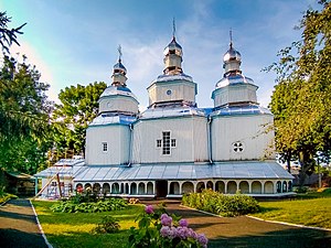
Transfiguration Cathedral, Vinnytsia
Church in Vinnytsia, Ukraine
Distance: Approx. 417 meters
Latitude and longitude: 49.23305556,28.47527778
The Transfiguration Cathedral or Saviour-Transfiguration Cathedral (Ukrainian: Спасо-Преображенський собор) is an Eastern Orthodox church in Vinnytsia, under the jurisdiction of the Orthodox Church of Ukraine. It is located in a site of a former Dominican monastery.

Vinnytsia strikes (2022–present)
2022 missile attacks on Vinnytsia, Ukraine
Distance: Approx. 1108 meters
Latitude and longitude: 49.23962,28.4921
The Russian Navy have launched several rocket attacks on Vinnytsia, Ukraine, during the Russian invasion of Ukraine. A Russian attack in July 2022 which killed 28 people including 3 children, received widespread condemnation and has been labeled as a war crime by EU officials.

State Archives of Vinnytsia Oblast
State archival institution in Vinnytsia, Ukraine
Distance: Approx. 336 meters
Latitude and longitude: 49.23305556,28.47638889
The State Archives of the Vinnytsia Oblast (Ukrainian: Державний архів Вінницької області (ДАВіО for short)) is an archive of the Ukrainian State Archive Service located in Vinnytsia, Ukraine, housing documents from the Vinnytsia Oblast. The archive contains holdings from the 18th century to the early 21st.
Weather in this IP's area
scattered clouds
1 Celsius
-2 Celsius
1 Celsius
1 Celsius
1028 hPa
86 %
1028 hPa
998 hPa
10000 meters
2.68 m/s
4.62 m/s
228 degree
50 %