95.214.149.39 - IP Lookup: Free IP Address Lookup, Postal Code Lookup, IP Location Lookup, IP ASN, Public IP
Country:
Region:
City:
Location:
Time Zone:
Postal Code:
ISP:
ASN:
language:
User-Agent:
Proxy IP:
Blacklist:
IP information under different IP Channel
ip-api
Country
Region
City
ASN
Time Zone
ISP
Blacklist
Proxy
Latitude
Longitude
Postal
Route
db-ip
Country
Region
City
ASN
Time Zone
ISP
Blacklist
Proxy
Latitude
Longitude
Postal
Route
IPinfo
Country
Region
City
ASN
Time Zone
ISP
Blacklist
Proxy
Latitude
Longitude
Postal
Route
IP2Location
95.214.149.39Country
Region
zurich
City
gossau
Time Zone
Europe/Zurich
ISP
Language
User-Agent
Latitude
Longitude
Postal
ipdata
Country
Region
City
ASN
Time Zone
ISP
Blacklist
Proxy
Latitude
Longitude
Postal
Route
Popular places and events near this IP address
Esslingen, Switzerland
Distance: Approx. 3981 meters
Latitude and longitude: 47.28333333,8.71666667
Esslingen is a village in the municipality of Egg, Switzerland, in the canton of Zürich. It is located in the Pfannenstiel region, approximately 15 km southeast of Zürich. In the local dialect it is called Esslinge.
Wetzikon
Municipality in Zurich, Switzerland
Distance: Approx. 3387 meters
Latitude and longitude: 47.31666667,8.8
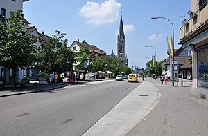
Wetzikon is a small town in the Zurich Highlands (Zürcher Oberland) area of Switzerland, in the district of Hinwil in the canton of Zürich.
Mönchaltorf
Municipality in Zurich, Switzerland
Distance: Approx. 3410 meters
Latitude and longitude: 47.31666667,8.71666667
Mönchaltorf is a municipality in the district of Uster in the canton of Zürich in Switzerland.
Gossau, Zürich
Municipality in Zurich, Switzerland
Distance: Approx. 1439 meters
Latitude and longitude: 47.31666667,8.75
Gossau is a municipality in the district of Hinwil in the canton of Zürich in Switzerland. Besides the village of Gossau itself, the municipality includes the settlements of Bertschikon, Grüt, Herschmettlen and Ottikon.
Grüningen
Municipality in Zürich, Switzerland
Distance: Approx. 2500 meters
Latitude and longitude: 47.28333333,8.76666667
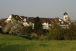
Grüningen is a town and municipality in the district of Hinwil in the canton of Zürich in Switzerland, notable for its well-preserved historic nucleus.

Wetzikon railway station
Swiss rail station in Zürich
Distance: Approx. 2871 meters
Latitude and longitude: 47.316978,8.79227
Wetzikon is a railway station in the Swiss canton of Zürich and municipality of Wetzikon. The station is located on both the Wallisellen to Rapperswil via Uster and Effretikon to Hinwil railway lines, which converge at junctions to the north and south of the station.
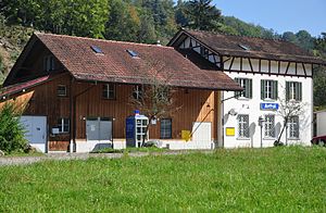
Aathal railway station
Railway station in the canton of Zürich, Switzerland
Distance: Approx. 3428 meters
Latitude and longitude: 47.335435,8.766296
Aathal is a railway station in the Swiss canton of Zürich and municipality of Seegräben. It is on the Wallisellen to Rapperswil via Uster line. The station is close to the Aathal Dinosaur Museum and a 15 minute walk from Jucker Farm in Seegräben.

Robenhausen
Distance: Approx. 3987 meters
Latitude and longitude: 47.33584722,8.7856
Robenhausen is a locality in Wetzikon, one of the municipalities of the canton of Zürich, Switzerland. The wetland Robenhauser Ried belongs to the protected area surrounding Pfäffikersee. The prehistoric pile dwelling around Lake Zurich Wetzikon-Robenhausen is part of the UNESCO-defined World Heritage Sites, the prehistoric pile dwellings around the Alps.

Aatal (Valley)
Distance: Approx. 3897 meters
Latitude and longitude: 47.3401,8.7572
The Aatal (Aa Valley) is a narrow, steep valley of about 40 metres (130 ft) depth surrounded by forests. It is situated between the towns of Wetzikon and Uster in the canton of Zürich, Switzerland. Through the valley flows the river Aabach, which starts at the effluence of the southern end of the Pfäffikersee and then enters Wetzikon where the river makes a U-turn in the middle of the town towards a southwestern direction before it enters the valley.
Wetzikon-Robenhausen
Prehistoric pile dwelling on Pfäffikersee lakeshore in Robenhausen, Switzerland
Distance: Approx. 3988 meters
Latitude and longitude: 47.33585,8.78560278
Wetzikon–Robenhausen is one of the 111 serial sites of the UNESCO World Heritage Site Prehistoric pile dwellings around the Alps, of which are 56 located in Switzerland. The site is located on Pfäffikersee lakeshore in Robenhausen, a locality of the municipality of Wetzikon in the Canton of Zürich in Switzerland.

Esslingen railway station
Railway station in Switzerland
Distance: Approx. 4146 meters
Latitude and longitude: 47.28776,8.7099
Esslingen is a railway station in the Swiss canton of Zürich and the municipality of Egg. It is the outer terminus of the Forchbahn (FB) from the city of Zürich, which is operated as Zürich S-Bahn service S18. The station is operated by the Forchbahn, and has three terminal platforms and a bus interchange located under an overall roof.
St. Francis's Church, Wetzikon
Swiss church
Distance: Approx. 3134 meters
Latitude and longitude: 47.32333333,8.79013889
The Church of Saint Francis is a Roman Catholic parish church located in Wetzikon, Switzerland.
Weather in this IP's area
heavy intensity rain
5 Celsius
1 Celsius
5 Celsius
6 Celsius
1011 hPa
90 %
1011 hPa
941 hPa
5367 meters
7.6 m/s
8.05 m/s
223 degree
99 %

