Country:
Region:
City:
Latitude and Longitude:
Time Zone:
Postal Code:
IP information under different IP Channel
ip-api
Country
Region
City
ASN
Time Zone
ISP
Blacklist
Proxy
Latitude
Longitude
Postal
Route
Luminati
Country
Region
62
City
falvaterra
ASN
Time Zone
Europe/Rome
ISP
HelloTel Telecomunicazioni srl
Latitude
Longitude
Postal
IPinfo
Country
Region
City
ASN
Time Zone
ISP
Blacklist
Proxy
Latitude
Longitude
Postal
Route
db-ip
Country
Region
City
ASN
Time Zone
ISP
Blacklist
Proxy
Latitude
Longitude
Postal
Route
ipdata
Country
Region
City
ASN
Time Zone
ISP
Blacklist
Proxy
Latitude
Longitude
Postal
Route
Popular places and events near this IP address

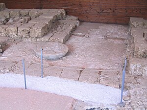
Fregellae
Ancient Italian town (Latium)
Distance: Approx. 3992 meters
Latitude and longitude: 41.53666667,13.53888889
Fregellae was an ancient town of Latium adiectum, situated on the Via Latina between Aquinum (modern Aquino) and Frusino (now Frosinone), in central Italy, near the left branch of the Liris.
Colfelice
Comune in Lazio, Italy
Distance: Approx. 8513 meters
Latitude and longitude: 41.55,13.6
Colfelice is a comune (municipality) in the Province of Frosinone in the Italian region Lazio, located about 100 kilometres (62 mi) southeast of Rome and about 25 kilometres (16 mi) southeast of Frosinone. Colfelice borders the following municipalities: Arce, Rocca d'Arce, Roccasecca, San Giovanni Incarico.

Falvaterra
Comune in Lazio, Italy
Distance: Approx. 492 meters
Latitude and longitude: 41.50472222,13.52388889
Falvaterra is a comune (municipality) in the Province of Frosinone in the Italian region Lazio, located about 100 kilometres (62 mi) southeast of Rome and about 20 kilometres (12 mi) southeast of Frosinone. Falvaterra borders the following municipalities: Arce, Castro dei Volsci, Ceprano, Pastena, San Giovanni Incarico. It is the seat of the eponymous karst grottoes, having a length of more than 5 kilometres (3 mi).

Pastena
Comune in Lazio, Italy
Distance: Approx. 5099 meters
Latitude and longitude: 41.46666667,13.48333333
Pastena is a comune (municipality) in the Province of Frosinone in the Italian region Lazio, located about 90 kilometres (56 mi) southeast of Rome and about 20 kilometres (12 mi) southeast of Frosinone.

San Giovanni Incarico
Comune in Lazio, Italy
Distance: Approx. 2712 meters
Latitude and longitude: 41.5,13.55
San Giovanni Incarico is a comune (municipality) in the Province of Frosinone in the Italian region Lazio, located about 100 kilometres (62 miles) southeast of Rome and about 20 km (12 mi) southeast of Frosinone. San Giovanni Incarico borders the following municipalities: Arce, Ceprano, Colfelice, Falvaterra, Pastena, Pico, Pontecorvo, Roccasecca.

Sacco (river)
River in Italy
Distance: Approx. 2747 meters
Latitude and longitude: 41.5203,13.5432
The Sacco is a river of central Italy, a right tributary of the Liri. It flows between the Metropolitan City of Rome Capital and the province of Frosinone in Lazio.

Pastena Caves
Distance: Approx. 2526 meters
Latitude and longitude: 41.49688056,13.48941944
The Pastena Caves (Italian: Grotte di Pastena) are a karst cave system located in the municipality of Pastena, in the province of Frosinone, Lazio.
Melfa
River
Distance: Approx. 6355 meters
Latitude and longitude: 41.5,13.594
The Melfa is a river in Lazio, Italy. It rises in the Monti della Meta, flows south-west for about 40 kilometres (25 mi) and joins the Liri near San Giovanni Incarico. The source of the Melfa issues from a high limestone chimney in the Valle di Canneto at an elevation of 1,020 metres (3,350 ft) in the Lazio watershed of the Parco Nazionale d'Abruzzo, Lazio e Molise beneath the Massiccio del Meta, in the territory of Settefrati.
Isoletta
Distance: Approx. 3462 meters
Latitude and longitude: 41.5279,13.5452
Isoletta is a village in Italy, in the Valle Latina within the Arce municipality. Isoletta is located in the province of Frosinone, of the southern Lazio region in Italy.
Weather in this IP's area
clear sky
6 Celsius
5 Celsius
4 Celsius
7 Celsius
1019 hPa
82 %
1019 hPa
982 hPa
10000 meters
1.39 m/s
1.27 m/s
22 degree
06:55:02
16:46:21
