Country:
Region:
City:
Latitude and Longitude:
Time Zone:
Postal Code:
IP information under different IP Channel
ip-api
Country
Region
City
ASN
Time Zone
ISP
Blacklist
Proxy
Latitude
Longitude
Postal
Route
IPinfo
Country
Region
City
ASN
Time Zone
ISP
Blacklist
Proxy
Latitude
Longitude
Postal
Route
MaxMind
Country
Region
City
ASN
Time Zone
ISP
Blacklist
Proxy
Latitude
Longitude
Postal
Route
Luminati
Country
ASN
Time Zone
Asia/Jerusalem
ISP
PurePeak Ltd.
Latitude
Longitude
Postal
db-ip
Country
Region
City
ASN
Time Zone
ISP
Blacklist
Proxy
Latitude
Longitude
Postal
Route
ipdata
Country
Region
City
ASN
Time Zone
ISP
Blacklist
Proxy
Latitude
Longitude
Postal
Route
Popular places and events near this IP address

De Adriaan, Haarlem
Distance: Approx. 1736 meters
Latitude and longitude: 52.38388889,4.64277778
De Adriaan (Dutch pronunciation: [də ˈʔaːdrijaːn]) is a windmill in the Netherlands that burnt down in 1932 and was rebuilt in 2002. The original windmill dates from 1779 and the mill has been a distinctive part of the skyline of Haarlem for centuries.

Amsterdamse Poort, Haarlem
Distance: Approx. 1733 meters
Latitude and longitude: 52.38055556,4.64666667
The Amsterdamse Poort is an old city gate of Haarlem, Netherlands. It is located at the end of the old route from Amsterdam to Haarlem and the only gate left from the original twelve city gates.

Hofje van Noblet
Hofje in Haarlem, Netherlands
Distance: Approx. 1717 meters
Latitude and longitude: 52.385,4.64222222
The Hofje van Noblet is a hofje in Haarlem, Netherlands.
Liede
Distance: Approx. 1561 meters
Latitude and longitude: 52.3861,4.6869
The Liede is a little river that used to connect Haarlem Lake with the Spaarne, just south of Spaarndam, at a small lake called the Mooie Nel. After the lake was pumped dry in 1852, the Liede became a side-river of the Ringvaart. The Liede and Mooie Nel are nowadays important for recreational boat sailing.

Haarlemmerliede
Place in North Holland, Netherlands
Distance: Approx. 1492 meters
Latitude and longitude: 52.38333333,4.68333333
Haarlemmerliede is a small village in the Dutch province of North Holland. It is a part of the municipality of Haarlemmermeer and lies about 4 km (2.5 mi) east of Haarlem. Haarlemmerliede was a separate municipality between 1817 and 1857, when it merged with Spaarnwoude.

Penningsveer
Town in North Holland, Netherlands
Distance: Approx. 749 meters
Latitude and longitude: 52.39277778,4.67611111
Penningsveer is a town in the Dutch province of North Holland. It is a part of the municipality of Haarlemmermeer and lies about 3 km (1.9 mi) east of Haarlem. The town is named after the ferry (Dutch:veer) that (for a penny) used to take travellers across the Liede.
Veerplas
Artificial lake in Haarlem, Netherlands
Distance: Approx. 908 meters
Latitude and longitude: 52.38666667,4.67666667
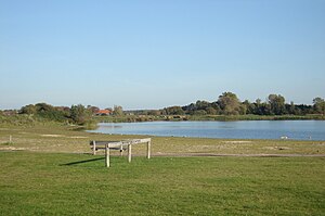
Veerplas (Dutch pronunciation: [ˌveːrˈplɑs] ) is an artificial lake directly east of the Dutch city of Haarlem. It was dug in 1994, mainly for recreation purposes and forms part of the Spaarnwoude recreational area. The lake measures 450 by 400 metres.

Haarlem Spaarnwoude railway station
Railway station in the Netherlands
Distance: Approx. 1003 meters
Latitude and longitude: 52.38277778,4.67111111
Haarlem Spaarnwoude is a railway station in Haarlem, Netherlands. It is located east of the Haarlem city centre and south of Spaarnwoude, on the Amsterdam–Rotterdam railway. The N200 road (from Amsterdam to Haarlem) runs parallel to the railway on the south side.
EvoSwitch
Dutch internet service provider
Distance: Approx. 72 meters
Latitude and longitude: 52.39162222,4.66480278
EvoSwitch is part of the Ocom Group, based in Amsterdam and described as Europe's largest privately owned Internet service provider.

Het Scheepje, Haarlem
Bier Brewery in Haarlem
Distance: Approx. 1725 meters
Latitude and longitude: 52.3814,4.64564444
Het Scheepje is the name of a former brewery in Haarlem on the Spaarne. It was owned for more than a century by the Dicx family, and it remained a brewery until the beginning of the 20th century. The historic contents of the old parlor were sold to the Philadelphia Museum of Art, where they are on show.

Koepelgevangenis (Haarlem)
Former prison in Haarlem, Netherlands
Distance: Approx. 1557 meters
Latitude and longitude: 52.3836,4.6461
The Koepelgevangenis is a former prison in Haarlem, Netherlands. It is one of three Panopticon-style buildings situated in the country. One of three designed by Willem Metzelaar, the building was completed in 1901.
Barrel Organ Museum Haarlem
Music instrument museum in Küppersweg, Haarlem
Distance: Approx. 827 meters
Latitude and longitude: 52.39093861,4.65327056
Barrel Organ Museum Haarlem (Dutch: Draaiorgelmuseum Haarlem) is a museum in Haarlem in the Netherlands. Next to the presentation of a variety of barrel organs, accessory objects and documentation material, there is a ballroom where music of the organs is being played. The museum was opened in 1969 by the foundation Het Kunkels Orgel.
Weather in this IP's area
clear sky
16 Celsius
16 Celsius
14 Celsius
17 Celsius
1027 hPa
95 %
1027 hPa
1026 hPa
7000 meters
5.14 m/s
60 degree
4 %
07:22:47
19:47:24


