95.130.22.108 - IP Lookup: Free IP Address Lookup, Postal Code Lookup, IP Location Lookup, IP ASN, Public IP
Country:
Region:
City:
Location:
Time Zone:
Postal Code:
IP information under different IP Channel
ip-api
Country
Region
City
ASN
Time Zone
ISP
Blacklist
Proxy
Latitude
Longitude
Postal
Route
Luminati
Country
ASN
Time Zone
Europe/Berlin
ISP
Key-Systems GmbH
Latitude
Longitude
Postal
IPinfo
Country
Region
City
ASN
Time Zone
ISP
Blacklist
Proxy
Latitude
Longitude
Postal
Route
IP2Location
95.130.22.108Country
Region
niedersachsen
City
wagenfeld
Time Zone
Europe/Berlin
ISP
Language
User-Agent
Latitude
Longitude
Postal
db-ip
Country
Region
City
ASN
Time Zone
ISP
Blacklist
Proxy
Latitude
Longitude
Postal
Route
ipdata
Country
Region
City
ASN
Time Zone
ISP
Blacklist
Proxy
Latitude
Longitude
Postal
Route
Popular places and events near this IP address

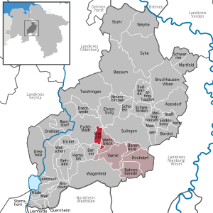
Wagenfeld
Municipality in Lower Saxony, Germany
Distance: Approx. 2170 meters
Latitude and longitude: 52.53333333,8.56666667
Wagenfeld is a municipality in the district of Diepholz, Lower Saxony, Germany. It is situated approximately 15 km east of Diepholz, and 40 km northwest of Minden.

Rehden
Municipality in Lower Saxony, Germany
Distance: Approx. 9527 meters
Latitude and longitude: 52.60888889,8.48111111
Rehden is a municipality in the district of Diepholz, in Lower Saxony, Germany. It is situated approximately eight km east of Diepholz. The 44 TWh Rehden natural gas storage facility connects to the Rehden–Hamburg gas pipeline.

Freistatt
Municipality in Lower Saxony, Germany
Distance: Approx. 8685 meters
Latitude and longitude: 52.61666667,8.65
Freistatt is a municipality in the district of Diepholz which is located in Lower Saxony, Germany.
NEL pipeline
Distance: Approx. 9658 meters
Latitude and longitude: 52.6188,8.4963
The NEL (Nordeuropäische Erdgasleitung (English: Northern European natural gas pipeline), formerly known as Norddeutsche Erdgasleitung, is a 440 kilometres (270 mi) long natural gas pipeline in Germany.

Barver
Municipality in Lower Saxony, Germany
Distance: Approx. 7507 meters
Latitude and longitude: 52.61666667,8.6
Barver is a municipality in the district of Diepholz, Lower Saxony, Germany.

Hemsloh
Municipality in Lower Saxony, Germany
Distance: Approx. 7162 meters
Latitude and longitude: 52.6,8.51666667
Hemsloh is a municipality in the district of Diepholz, in Lower Saxony, Germany.
Rehden (Samtgemeinde)
Distance: Approx. 7921 meters
Latitude and longitude: 52.6,8.5
Rehden is a Samtgemeinde ("collective municipality") in the district of Diepholz, in Lower Saxony, Germany. Its seat is in Rehden.

Oppenwehe Moor
Distance: Approx. 6704 meters
Latitude and longitude: 52.50605,8.515619
The Oppenwehe Moor (German: Oppenweher Moor) is a raised bog in the natural region of Diepholz Moor Depression (Diepholzer Moorniederung) in North Germany. It covers a total area of around 870 ha and lies in the northeastern part of the German state of North Rhine-Westphalia as well as in Lower Saxony. It is one of the most important bogs in Northwest Germany and is one of the ten most important wet meadow reserves in North Rhine-Westphalia.

Großer Dieckfluss
River in Germany
Distance: Approx. 6986 meters
Latitude and longitude: 52.5056,8.6562
The Großer Dieckfluss is a river of North Rhine-Westphalia, Germany. It flows into the Große Aue in Preußisch Ströhen.
Rehden Geest Moor
Distance: Approx. 5984 meters
Latitude and longitude: 52.57222222,8.50277778
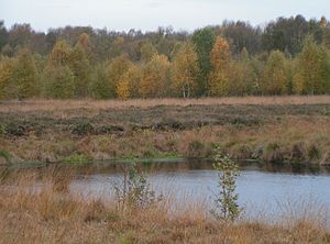
The nature reserve of Rehden Geest Moor (German: Rehdener Geestmoor) is an extensive, open raised bog in the collective municipality of Rehden, in the county of Diepholz in Lower Saxony. It is a representative raised bog for the natural region known as the Diepholz Moor Depression (Diepholzer Moorniederung). According to GIS it covers an area of 1,736 hectares, but according to the conservation act, 1,786 hectares.
Weather in this IP's area
broken clouds
5 Celsius
0 Celsius
5 Celsius
5 Celsius
1009 hPa
82 %
1009 hPa
1004 hPa
10000 meters
8.39 m/s
14.7 m/s
285 degree
56 %

