Country:
 Romania
Region:
City:
Latitude and Longitude:
Time Zone:
Postal Code:
IP information under different IP Channel
ip-api
Country
Region
City
ASN
Time Zone
ISP
Blacklist
Proxy
Latitude
Longitude
Postal
Route
IPinfo
Country
Region
City
ASN
Time Zone
ISP
Blacklist
Proxy
Latitude
Longitude
Postal
Route
MaxMind
Country
Region
City
ASN
Time Zone
ISP
Blacklist
Proxy
Latitude
Longitude
Postal
Route
Luminati
Country
ROASN
Time Zone
Europe/Bucharest
Latitude
Longitude
Postal
db-ip
Country
Region
City
ASN
Time Zone
ISP
Blacklist
Proxy
Latitude
Longitude
Postal
Route
ipdata
Country
Region
City
ASN
Time Zone
ISP
Blacklist
Proxy
Latitude
Longitude
Postal
Route
Popular places and events near this IP address

Cisnădie
Town in Sibiu, Romania
Distance: Approx. 5285 meters
Latitude and longitude: 45.71277778,24.15083333
Cisnădie (Romanian pronunciation: [t͡ʃisnəˈdi.e]; German: Heltau; Transylvanian Saxon dialect: De Hielt; Hungarian: Nagydisznód) is a town in Sibiu County, Transylvania, central Romania, approximately 10 kilometres (6.2 mi) south of Sibiu (German: Hermannstadt). It comprises the main town of Cisnădie and one village, Cisnădioara (German: Michelsberg; Hungarian: Kisdisznód). Located along Argintului and Ursului streams, at the foothills of the Cindrel Mountains, the town is known for its Transylvanian Saxon heritage, as well as for the communist-era carpet factories.
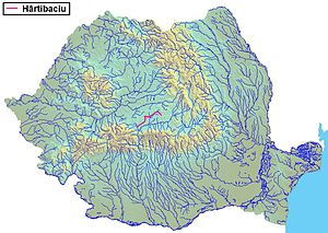
Hârtibaciu
River in Sibiu, Romania
Distance: Approx. 8484 meters
Latitude and longitude: 45.7338,24.2379
The Hârtibaciu (German: Harbach; Hungarian: Hortobágy) is a river in the Transylvania historical region of Romania. It develops in the South Carpathians and flows into the Cibin, a tributary of the Olt, in Mohu, southeast of Sibiu. It flows through the towns and villages Bărcuț, Retiș, Brădeni, Netuș, Agnita, Benești, Alțâna, Nocrich, Hosman, Cornățel and Cașolț.

Cibin
River in Sibiu County, Romania
Distance: Approx. 9076 meters
Latitude and longitude: 45.6475,24.29138889
The Cibin (German: Zibin; Hungarian: Szeben) is a river in central Romania, in the south part of Transylvania. Its source is close to the highest peak in the Cindrel Mountains (known also as Cibin Mountains) of the Southern Carpathian Mountains. Upstream from its confluence with the Râul Mic, the river is also called the Râul Mare.

Rășinari
Commune in Sibiu, Romania
Distance: Approx. 9376 meters
Latitude and longitude: 45.7,24.06666667
Rășinari (German: Städterdorf; Hungarian: Resinár) is a commune in Sibiu County, Transylvania, Romania. It has a population of 5,280 inhabitants (2011 census) and is composed of two villages, Prislop (Priszloptelep) and Rășinari. Until 2012, Rășinari was connected to Sibiu by a roughly 8-km tram line through the Dumbrava Forest, but regular service ended in 2011 and since 2013 much of the line has since been dismantled.
Tălmaciu
Town in Sibiu, Romania
Distance: Approx. 6388 meters
Latitude and longitude: 45.66666667,24.26111111
Tălmaciu (German: Talmesch; Hungarian: Nagytalmács) is a town in Sibiu County, in central Romania, 20 km (12 mi) south of the county seat, Sibiu. It lies on the eastern end of the Mărginimea Sibiului area.

Boița
Commune in Sibiu, Romania
Distance: Approx. 7333 meters
Latitude and longitude: 45.63305556,24.2575
Boița (German: Ochsendorf; Hungarian: Bojca; Latin: Caput Stenarum) is a commune in Sibiu County, Transylvania, Romania, at the foothills of the Cindrel Mountains, 22 km (14 mi) south of the county capital Sibiu, in the Mărginimea Sibiului ethnographic area, on the main road between Sibiu and the southern part of Romania, the National road 7/European route 81, at the entrance of the Olt River defile. The commune is composed of four villages: Boița, Lazaret, Lotrioara (Latorvár), and Paltin. These were part of Tălmaciu town until 2004, when they were split off.

Sadu
Commune in Sibiu, Romania
Distance: Approx. 464 meters
Latitude and longitude: 45.66666667,24.18333333
Sadu (German: Zood; Hungarian: Cód) is a commune in Sibiu County, Transylvania, Romania, at the foothills of the Cindrel Mountains, 27 km south of the county capital Sibiu, in the Mărginimea Sibiului ethnographic area. It is composed of a single village, Sadu. In 1910 the village had 2,143 inhabitants.

Valea Caselor (Sebeș)
River in Sibiu County, Romania
Distance: Approx. 9492 meters
Latitude and longitude: 45.71444444,24.07527778
The Valea Caselor (also: Sibișel) is a right tributary of the river Sebeș in Romania. It discharges into the Sebeș in Rășinari. Its length is 11 km (6.8 mi) and its basin size is 22 km2 (8.5 sq mi).

Sadu (Cibin)
River in Sibiu County, Romania
Distance: Approx. 6892 meters
Latitude and longitude: 45.6599,24.2666
The Sadu (Hungarian: Cód) is a right tributary of the river Cibin in Romania. It discharges into the Cibin in Tălmaciu. The Negovanu and Sadu II dams are located on the Sadu.

Lungșoara
River in Sibiu County, Romania
Distance: Approx. 6932 meters
Latitude and longitude: 45.65916667,24.26694444
The Lungșoara is a right tributary of the river Cibin in Romania. It discharges into the Cibin in Tălmaciu. Its length is 10 km (6.2 mi) and its basin size is 28 km2 (11 sq mi).
Valea Tocilelor
River in Sibiu County, Romania
Distance: Approx. 7522 meters
Latitude and longitude: 45.72555556,24.23333333
The Valea Tocilelor (in its upper course: Tocila Mare) is a right tributary of the river Cibin in Romania. It discharges into the Cibin near Veștem. Its length is 13 km (8.1 mi) and its basin size is 19 km2 (7.3 sq mi).

Caput Stenarum (castra)
Fort in the Roman province of Dacia
Distance: Approx. 7741 meters
Latitude and longitude: 45.63576944,24.26601111
Caput Stenarum was a fort in the Roman province of Dacia in the 2nd century AD. It is located 700 m east of the village Boița in Romania at the northern exit of the Olt gorge. It was part of the Roman frontier system of the Limes Alutanus along the Olt (river). It is located 1 km away from the mouth of Turnu Roşu Pass and was of particular importance both for the defence of the border of the Province of Dacia Inferior and for the supervision of the pass in the Carpathians and the road that forks here.
Weather in this IP's area
clear sky
-0 Celsius
-0 Celsius
-0 Celsius
-0 Celsius
1029 hPa
93 %
1029 hPa
974 hPa
10000 meters
0.51 m/s
07:43:50
18:32:36