Country:
Region:
City:
Latitude and Longitude:
Time Zone:
Postal Code:
IP information under different IP Channel
ip-api
Country
Region
City
ASN
Time Zone
ISP
Blacklist
Proxy
Latitude
Longitude
Postal
Route
Luminati
Country
Region
34
City
cesiomaggiore
ASN
Time Zone
Europe/Rome
ISP
ASDASD srl a socio unico
Latitude
Longitude
Postal
IPinfo
Country
Region
City
ASN
Time Zone
ISP
Blacklist
Proxy
Latitude
Longitude
Postal
Route
db-ip
Country
Region
City
ASN
Time Zone
ISP
Blacklist
Proxy
Latitude
Longitude
Postal
Route
ipdata
Country
Region
City
ASN
Time Zone
ISP
Blacklist
Proxy
Latitude
Longitude
Postal
Route
Popular places and events near this IP address

Feltre
Comune in Veneto, Italy
Distance: Approx. 9696 meters
Latitude and longitude: 46.01861111,11.91
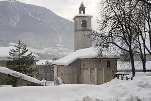
Feltre (Italian pronunciation: [ˈfeltre]; Venetian: Fèltre) is a town and comune of the province of Belluno in Veneto, northern Italy. A hill town in the southern reaches of the province, it is located on the Stizzon River, about 4 kilometres (2 miles) from its junction with the Piave, and 20 km (12 mi) southwest from Belluno. The Dolomites loom to the north of the town.

Lentiai
Comune in Veneto, Italy
Distance: Approx. 4395 meters
Latitude and longitude: 46.05,12.01666667
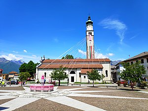
Lentiai is a comune (municipality) in the province of Belluno in the Italian region of Veneto, located about 70 kilometres (43 mi) northwest of Venice and about 20 kilometres (12 mi) southwest of Belluno. As of 31 December 2004, it had a population of 3,020 and an area of 37.6 square kilometres (14.5 sq mi). Lentiai borders the following municipalities: Cesiomaggiore, Feltre, Mel, Santa Giustina, Valdobbiadene, Vas.
Sedico
Comune in Veneto, Italy
Distance: Approx. 9121 meters
Latitude and longitude: 46.11666667,12.1
Sedico is a comune (municipality) in the Province of Belluno in the Italian region Veneto, located about 80 kilometres (50 miles) north of Venice and about 9 km (6 mi) west of Belluno. As of 31 December 2004, it had a population of 9,143 and an area of 91.4 square kilometres (35 sq mi). Sedico borders the following municipalities: Belluno, Gosaldo, La Valle Agordina, Limana, Longarone, Mel, Rivamonte Agordino, Santa Giustina, Sospirolo, Trichiana.

Sospirolo
Comune in Veneto, Italy
Distance: Approx. 8922 meters
Latitude and longitude: 46.13333333,12.08333333
Sospirolo is a comune (municipality) in the province of Belluno in the Italian region of Veneto, located about 80 kilometres (50 mi) north of Venice and about 10 kilometres (6 mi) west of Belluno.Sospirolo has an area of 65.86km² area and a population density of 46.64 per km² with an annual population change of -0.40%(2011-2023).

Pizzocco
Mountain in Italy
Distance: Approx. 4721 meters
Latitude and longitude: 46.11555556,12.03361111
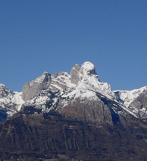
Pizzocco is a mountain of the Veneto, Italy. It has an elevation of 2,187 metres.

Zumelle Castle
Castle in Tiago, Italy
Distance: Approx. 8880 meters
Latitude and longitude: 46.03625,12.08166667
Zumelle Castle is a castle near the village of Tiago in the municipality of Borgo Valbelluna, province of Belluno, northern-eastern Italy. Nearby the castle is the early medieval church of San Donato, of Lombard origins.

Villa degli Azzoni Avogadro (Bivai)
Venetian Villa in Veneto, Italy
Distance: Approx. 1971 meters
Latitude and longitude: 46.07123,12.00659
Villa degli Azzoni Avogadro is a Venetian Villa located in the Comune of Santa Giustina in the province of Belluno. It was built on the ruins of an ancient Castle called Bivai close to the Alps Dolomites located in northeastern Italy.
Weather in this IP's area
clear sky
5 Celsius
3 Celsius
3 Celsius
6 Celsius
1025 hPa
81 %
1025 hPa
973 hPa
10000 meters
1.83 m/s
1.47 m/s
331 degree
07:07:28
16:44:52
