Country:
 Greece
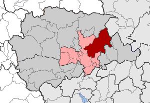
Region:
City:
Latitude and Longitude:
Time Zone:
Postal Code:
IP information under different IP Channel
ip-api
Country
Region
City
ASN
Time Zone
ISP
Blacklist
Proxy
Latitude
Longitude
Postal
Route
IPinfo
Country
Region
City
ASN
Time Zone
ISP
Blacklist
Proxy
Latitude
Longitude
Postal
Route
MaxMind
Country
Region
City
ASN
Time Zone
ISP
Blacklist
Proxy
Latitude
Longitude
Postal
Route
Luminati
Country
GRRegion
e
City
trikala
ASN
Time Zone
Europe/Athens
ISP
OTEnet S\.A\.
Latitude
Longitude
Postal
db-ip
Country
Region
City
ASN
Time Zone
ISP
Blacklist
Proxy
Latitude
Longitude
Postal
Route
ipdata
Country
Region
City
ASN
Time Zone
ISP
Blacklist
Proxy
Latitude
Longitude
Postal
Route
Popular places and events near this IP address

Trikala
Municipality in Greece
Distance: Approx. 603 meters
Latitude and longitude: 39.55,21.76666667
Trikala (Greek: Τρίκαλα) is a city in northwestern Thessaly, Greece, and the capital of the Trikala regional unit. The city straddles the Lithaios river, which is a tributary of Pineios. According to the Greek National Statistical Service, Trikala is populated by 81,355 inhabitants (2011), while in total the Trikala regional unit is populated by 131,085 inhabitants (2011).
Pigi, Trikala
Community in Greece
Distance: Approx. 7460 meters
Latitude and longitude: 39.512,21.701
Pigi (Greek: Πηγή) is a large village in the Trikala regional unit, Thessaly, Greece. It is 9 kilometers (ca. 5–6 miles) west from Trikala on the national road of Trikala-Arta.
Trikala Municipal Stadium
Distance: Approx. 952 meters
Latitude and longitude: 39.55222222,21.7775
The Trikala Municipal Stadium (Greek: Δημοτικό Στάδιο Τρικάλων, Dimotiko Stadio Trikalon) is a sports stadium in Trikala, Greece. It is used for football matches of the local team Trikala F.C. and athletics events. The stadium frequently serves as a neutral venue for penalised teams and has hosted games between major Greek Clubs in the past.

Estiaiotida
Municipal unit in Greece
Distance: Approx. 7216 meters
Latitude and longitude: 39.56666667,21.85
Estiaiotida (Greek: Εστιαιώτιδα) is a former municipality in the Trikala regional unit, Thessaly, Greece. Since the 2011 local government reform, it is part of the municipality Trikala, of which it is a municipal unit. The municipal unit has an area of 39.762 km2.

Megala Kalyvia
Municipal unit in Greece
Distance: Approx. 6321 meters
Latitude and longitude: 39.5,21.78333333
Megala Kalyvia (Greek: Μεγάλα Καλύβια) is a village and a former municipality in the Trikala regional unit, Thessaly, Greece. Since the 2011 local government reform it is part of the municipality Trikala, of which it is a municipal unit. The municipal unit has an area of 45.333 km2.
Paliokastro, Trikala
Former municipality in Greece
Distance: Approx. 6532 meters
Latitude and longitude: 39.6,21.81666667
Paliokastro (Greek: Παληόκαστρο) is a former municipality in the Trikala regional unit, Thessaly, Greece. Since the 2011 local government reform it is part of the municipality Trikala, of which it is a municipal unit. It is located in the east-northeastern part of the regional unit.
Sotira, Trikala
Settlement in Greece
Distance: Approx. 3442 meters
Latitude and longitude: 39.58333333,21.75
Sotira (Greek: Σωτήρα) is a village located 4 km north of Trikala in the southcentral part of the Trikala regional unit, Greece. The settlement, which became part of the municipality of Trikala in 1883, was dissolved in 2011. Sotira had a population of 562 in 2001.

Tricca
Distance: Approx. 544 meters
Latitude and longitude: 39.558752,21.762589
Tricca or Trikka (Ancient Greek: Τρίκκη or Τρίκκα) was a city and polis (city-state) of ancient Thessaly in the district Histiaeotis, standing upon the left bank of the Peneius, and near a small stream called Lethaeus. This city is said to have derived its name from Tricca, a daughter of Peneius. The modern city of Trikala extends over the ancient site.

Kefalovryso, Trikala
Community in Greece
Distance: Approx. 6905 meters
Latitude and longitude: 39.58,21.69333333
Kefalovryso (Greek:Κεφαλόβρυσο, Greek pronunciation: [cefaˈlovriso]) is a village in Trikala regional unit, Greece. In 2021 Kefalovryso had a population of 777. It is located 7 kilometers northwest of Trikala in the Thessalian Plain and close to the river Pineios.

Osman Shah Mosque
Mosque in Trikala, Greece
Distance: Approx. 680 meters
Latitude and longitude: 39.55010556,21.77114722
The Osman Shah Mosque (Greek: Τέμενος Οσμάν Σαχ) or Kursum Mosque (Κουρσούμ Τζαμί, from Turkish: kurşun camii, lit. 'Leaden Mosque') is a 16th-century Ottoman mosque in the city of Trikala in Greece.

Trikala Castle
Distance: Approx. 516 meters
Latitude and longitude: 39.558421,21.762633
The Trikala Castle (Greek: Κάστρο Τρικάλων) is the Byzantine-era citadel of the city of Trikala in western Thessaly, Greece.

Trikala railway station
Railway station in Trikala, Thessaly, Greece
Distance: Approx. 1162 meters
Latitude and longitude: 39.5453,21.7638
Trikala railway station (Greek: Σιδηροδρομικός σταθμός Τρικάλων) is a railway station in Trikala, Thessaly, Greece. The station is served by regional trains between Palaiofarsalos and Kalambaka.
Weather in this IP's area
few clouds
18 Celsius
17 Celsius
18 Celsius
18 Celsius
1012 hPa
59 %
1012 hPa
998 hPa
10000 meters
1.47 m/s
1.78 m/s
288 degree
15 %
07:16:08
19:38:44