Country:
Region:
City:
Latitude and Longitude:
Time Zone:
Postal Code:
IP information under different IP Channel
ip-api
Country
Region
City
ASN
Time Zone
ISP
Blacklist
Proxy
Latitude
Longitude
Postal
Route
Luminati
Country
Region
a
City
komotini
ASN
Time Zone
Europe/Athens
ISP
OTEnet S\.A\.
Latitude
Longitude
Postal
IPinfo
Country
Region
City
ASN
Time Zone
ISP
Blacklist
Proxy
Latitude
Longitude
Postal
Route
db-ip
Country
Region
City
ASN
Time Zone
ISP
Blacklist
Proxy
Latitude
Longitude
Postal
Route
ipdata
Country
Region
City
ASN
Time Zone
ISP
Blacklist
Proxy
Latitude
Longitude
Postal
Route
Popular places and events near this IP address

Komotini
Municipality in Thrace, Greece
Distance: Approx. 658 meters
Latitude and longitude: 41.12194444,25.40416667
Komotini (Greek: Κομοτηνή, Turkish: Gümülcine) is a city in the region of East Macedonia and Thrace, northeastern Greece and its capital. It is also the capital of the Rhodope. It was the administrative centre of the Rhodope-Evros super-prefecture until its abolition in 2010, by the Kallikratis Plan.

Folklore Museum of Komotini
Distance: Approx. 1040 meters
Latitude and longitude: 41.11597222,25.40486111
The Folklore Museum of Komotini (Greek: Λαογραφικό Μουσείο Κομοτηνής, Laografikó Mouseío Komotinís) is a museum in Komotini in Greece. It was founded in 1962 and since 1989 it is housed in the Peidis Mansion, itself a restored sample of local traditional architecture. The collection is displayed in the mansion's two floors, in the cellar and under a roofed part of the courtyard.
Komotini Municipal Stadium
Distance: Approx. 961 meters
Latitude and longitude: 41.11416667,25.39666667
The Municipal Athletic Centre of Komotini is a multi-purpose stadium in the administrative capital of North-eastern Greece, the city of Komotini.

Saint Gregory the Illuminator Church, Komotini
Distance: Approx. 1304 meters
Latitude and longitude: 41.115031,25.408036
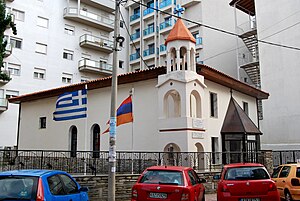
Saint Gregory the Illuminator Church (Armenian: Կոմոտինիի Սուրբ Գրիգոր Լուսավորիչ եկեղեցի, Greek: Ναός Αγίου Γρηγορίου του Φωτιστή), is an Armenian Apostolic church in central Komotini, Greece.

Yeni Mosque, Komotini
Mosque in Eastern Macedonia and Thrace, Greece
Distance: Approx. 835 meters
Latitude and longitude: 41.1189,25.4049
The Yeni Mosque (Greek: Γενί Τζαμί, from Turkish: Yeni Camii, "New Mosque") is an Ottoman mosque in the Greek town of Komotini dating back to 1585. It is the only surviving structure in Greece to feature Iznik tiles from the 1580s, the zenith of the Iznik potters' art. The mosque is located in the center of Komotini, adjacent to the Muftiate of Rhodope Prefecture.

Eski Mosque, Komotini
Mosque in Komotini, Greece
Distance: Approx. 585 meters
Latitude and longitude: 41.11987222,25.4022
The Eski Mosque (Greek: Εσκί Τζαμί, from Turkish: Eski Camii, "Old Mosque") is a mosque in the Greek town of Komotini dating back to 1608, or 1677/88, based on an inscription. Despite its name, the Eski Mosque was built after the Yeni ("New") Mosque of 1585, but it is likely that an original mosque stood at that place, dating back to the time of the Ottoman conquest of the area under Evrenos. According to the 1892 Ottoman salname, the mosque featured an inscription in a "non-Ottoman" language, hence it is possible that the mosque was built on the site of a former Byzantine church.

Komotini railway station
Distance: Approx. 1428 meters
Latitude and longitude: 41.1101,25.394
Komotini railway station (Greek: Σιδηροδρομικός Σταθμός Κομοτηνής, romanized: Sidirodromikós stathmós Komotinís) is a railway station that servers the city of Komotini, in Rhodope in East Macedonia and Thrace, Greece. The station is located 3 kilometres (1.9 mi) southeast of the city centre but within city limits. The station (as of 2019) is staffed, but only at peak times, but has waiting rooms and a bus stop in the forecourt.

Yunus Bey Mosque
Historical mosque in Komotini, Greece
Distance: Approx. 346 meters
Latitude and longitude: 41.12452778,25.39297222
The Yunus Bey Mosque (Greek: Τέμενος Γιούνους Μπέη, from Turkish: Yunus Bey Camii) was an Ottoman-era mosque in the town of Komotini, Western Thrace, in Greece. Today only ruins remain of it.

Selvili Mosque, Komotini
Historical mosque in Komotini, Greece
Distance: Approx. 288 meters
Latitude and longitude: 41.12169444,25.3995
The Selvili Mosque (Greek: Σελβιλί Τζαμί, from Turkish: Selvili Camii) also known as the Broken Mosque (Greek: Σπασμένο Τζαμί) locally, was formerly an Ottoman-era mosque in the town of Komotini, Western Thrace, in Greece. It is no longer preserved in any form, as only its minaret survives.

Imaret of Komotini
Imaret in Komotini, Greece
Distance: Approx. 631 meters
Latitude and longitude: 41.11908333,25.40208333
The Imaret of Komotini (Greek: Ιμαρέτ Κομοτηνής) is an imaret complex in the town of Komotini, in the Western Thrace region of northern Greece, and is thought to be one of the oldest surviving Ottoman monuments in Europe. It is dated between the early 1360s and the end of the fourteenth century. Its was built by Ottoman conqueror Gazi Ahmed Evrenos near the eastern walls of the Byzantine Koumoutzedes Castle.

Clock tower of Komotini
Clocktower in Komotini, Greece
Distance: Approx. 855 meters
Latitude and longitude: 41.11884,25.40514
The Clock Tower of Komotini (Greek: Πύργος του Ωρολογίου, Turkish: Saat Kule) is a clock tower of the Ottoman period built in the city center of Komotini, in the Western Thrace region of northern Greece, next to the town's Yeni Mosque. Dated to the nineteenth century, today it is located on Ermou Street.

Poshposh Tekke
Destroyed monument in Komotini, Greece
Distance: Approx. 409 meters
Latitude and longitude: 41.125,25.3925
The Poshposh Tekke also known as the Posh-Posh Baba Tekke (Greek: Ποσπός Τεκκές; Turkish: Poş-poş, Puş-puş, or Poşpoş Tekkesi) was an Alevi tekke (a khanqah) that was built in the fourteenth century near modern Nea Mosynopolis, in the Poshposh neighbourhood of Komotini, in northern Greece. It stood near the now ruined Yunus Bey Mosque, and was demolished in 1989.
Weather in this IP's area
broken clouds
14 Celsius
13 Celsius
14 Celsius
14 Celsius
1028 hPa
52 %
1028 hPa
1023 hPa
10000 meters
1.34 m/s
5.81 m/s
84 degree
83 %
06:52:02
17:11:51
