Country:
 Greece
Region:
City:
Latitude and Longitude:
Time Zone:
Postal Code:
IP information under different IP Channel
ip-api
Country
Region
City
ASN
Time Zone
ISP
Blacklist
Proxy
Latitude
Longitude
Postal
Route
IPinfo
Country
Region
City
ASN
Time Zone
ISP
Blacklist
Proxy
Latitude
Longitude
Postal
Route
MaxMind
Country
Region
City
ASN
Time Zone
ISP
Blacklist
Proxy
Latitude
Longitude
Postal
Route
Luminati
Country
GRRegion
i
City
perama
ASN
Time Zone
Europe/Athens
ISP
OTEnet S\.A\.
Latitude
Longitude
Postal
db-ip
Country
Region
City
ASN
Time Zone
ISP
Blacklist
Proxy
Latitude
Longitude
Postal
Route
ipdata
Country
Region
City
ASN
Time Zone
ISP
Blacklist
Proxy
Latitude
Longitude
Postal
Route
Popular places and events near this IP address

Battle of Salamis
480 BC naval battle of the Greco-Persian Wars
Distance: Approx. 2246 meters
Latitude and longitude: 37.95138889,23.56666667
The Battle of Salamis ( sal-ə-MISS) was a naval battle fought in 480 BC, between an alliance of Greek city-states under Themistocles, and the Achaemenid Empire under King Xerxes. It resulted in a decisive victory for the outnumbered Greeks. The battle was fought in the straits between the mainland and Salamis, an island in the Saronic Gulf near Athens, and marked the high point of the second Persian invasion of Greece.
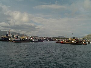
Perama
Municipality in Greece
Distance: Approx. 661 meters
Latitude and longitude: 37.96666667,23.56666667
Perama (Greek: Πέραμα) is a coastal town and a suburb of Piraeus and belongs to the Piraeus regional unit and is the southwestern limit of Athens urban area. It lies on the southwest edge of the Aegaleo mountains, on the Saronic Gulf coast. It is 8 km northwest of Piraeus, and 14 km west of the center of Athens.

Ampelakia
Municipal unit in Greece
Distance: Approx. 4611 meters
Latitude and longitude: 37.95,23.51666667
Ampelakia (Greek: Αμπελάκια, meaning vineyards) is a town and a former municipality of Salamis Island, Greece. Since the 2011 local government reform it is part of the municipality Salamis, of which it is a municipal unit. It lies on the central east coast of the island and has a land area of 15.169 km2, comprising about one-sixth of the island's area (with the balance belonging to the city of Salamina).
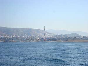
Keratsini
Municipal unit in Greece
Distance: Approx. 4841 meters
Latitude and longitude: 37.96666667,23.61666667
Keratsini (Greek: Κερατσίνι) is a suburban town in the western part of the Piraeus regional unit. Since the 2011 local government reform it is part of the municipality Keratsini-Drapetsona, of which it is the seat and a municipal unit.
Skaramagas
Settlement in Greece
Distance: Approx. 5467 meters
Latitude and longitude: 38.01,23.6
Skaramagas (also spelled Skaramangas; Greek: Σκαραμαγκάς) is a port town in the western part of the Athens agglomeration, Greece. It is part of the municipality of Haidari. It is known for its large shipyard.
German submarine U-596
German World War II submarine
Distance: Approx. 1417 meters
Latitude and longitude: 37.98333333,23.56666667
German submarine U-596 was a Type VIIC U-boat built for Nazi Germany's Kriegsmarine for service during World War II. She was laid down on 4 January 1941 by Blohm & Voss in Hamburg as yard number 572, launched on 17 September 1941 and commissioned on 13 November under Kapitänleutnant Gunter Jahn. He was replaced on 28 July 1943 by Oberleutnant zur See Victor-Whilhelm Nonn who was superseded by Oblt.z.S. Hans Kolbus in July 1944. The boat's service began on 13 November 1941 with training as part of the 8th U-boat Flotilla.

Psyttaleia
Distance: Approx. 4166 meters
Latitude and longitude: 37.94,23.588
Psyttaleia (Greek: Ψυττάλεια) is an uninhabited island in the Saronic Gulf between the harbor of Piraeus and the Kynosoura peninsula on Salamis Island, Greece. It covers an area of 0.375 square kilometers. The island houses Athens' largest sewage treatment plant, which is also the largest in Europe, with a projected daily maximum drying capacity of 750 tons of sewage.
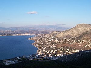
Salamina, Attica
Municipal unit in Greece
Distance: Approx. 5447 meters
Latitude and longitude: 37.96666667,23.5
Salamina (Greek: Σαλαμίνα, Katharevousa: Σαλαμίς, romanized: Salamís) or Kοullοuri (Greek: Κούλλουρη; Arvanitika: Kuluri) is the largest city and a former municipality on Salamina Island in Greece. Since the 2011 local government reform it is part of the municipality of Salamina, of which it is the seat and a municipal unit. It is part of the Islands regional unit of the Attica region.

SS Ocean Monarch (1950)
British-built passenger steamship
Distance: Approx. 2577 meters
Latitude and longitude: 37.95,23.55
Ocean Monarch was a passenger steamship that was built by Vickers-Armstrongs in 1950. She served with Furness Bermuda Line for fifteen years, then with a Bulgarian company for three years, renamed Varna. She spent much of the 1970s laid up, and was renamed Venus and then Riviera.

Keratsini-Drapetsona
Municipality in Greece
Distance: Approx. 4841 meters
Latitude and longitude: 37.96666667,23.61666667
Keratsini-Drapetsona (Greek: Κερατσίνι-Δραπετσώνα) is a municipality in the Piraeus regional unit, Attica, Greece. The seat of the municipality is the town of Keratsini. The municipality has a population of 89,386 inhabitants, according to the 2021 census and an area of 9.326 square kilometres (3.601 sq mi).
Thymoetadae
Distance: Approx. 5116 meters
Latitude and longitude: 37.967525,23.619913
Thymoetadae or Thymoitadai (Ancient Greek: Θυμοιτάδαι) or Thymaetedae or Thymaitadai (Θυμαιτάδαι), was a deme of ancient Attica. It derived its name from Thymoetas, a king of Attica, possessed a port, from which Theseus secretly set sail on his expedition to Crete. This retired port seems to have been the same as the Phoron Limen (Φώρων λιμήν) or “Thieves' port,” so called from its being frequented by smugglers.
Atalanti Island (Attica)
Island off the coast of Attica, Greece
Distance: Approx. 4138 meters
Latitude and longitude: 37.935,23.5725
Atalanti Island (Greek: Νησίδα Αταλάντη, romanized: Nisída Atalánti) is an island off the western coast of Attica region, between Salamis Island and the port of Athens, Piraeus. Anciently, the island was called Atalanta or Atalante (Αταλάντη).
Weather in this IP's area
clear sky
22 Celsius
22 Celsius
19 Celsius
24 Celsius
1011 hPa
59 %
1011 hPa
1001 hPa
10000 meters
1.54 m/s
07:09:26
19:31:05