Country:
Region:
City:
Latitude and Longitude:
Time Zone:
Postal Code:
IP information under different IP Channel
ip-api
Country
Region
City
ASN
Time Zone
ISP
Blacklist
Proxy
Latitude
Longitude
Postal
Route
Luminati
Country
ASN
Time Zone
Europe/Lisbon
ISP
Almouroltec Servicos De Informatica E Internet Lda
Latitude
Longitude
Postal
IPinfo
Country
Region
City
ASN
Time Zone
ISP
Blacklist
Proxy
Latitude
Longitude
Postal
Route
db-ip
Country
Region
City
ASN
Time Zone
ISP
Blacklist
Proxy
Latitude
Longitude
Postal
Route
ipdata
Country
Region
City
ASN
Time Zone
ISP
Blacklist
Proxy
Latitude
Longitude
Postal
Route
Popular places and events near this IP address

Alfama
Neighborhood of Lisbon
Distance: Approx. 269 meters
Latitude and longitude: 38.71222222,-9.13
The Alfama (Portuguese pronunciation: [alˈfɐmɐ]) is the oldest neighborhood of Lisbon, spreading on the slope between the São Jorge Castle and the Tagus river. The district includes the freguesias (parishes) of São Miguel, Santo Estêvão, São Vicente de Fora and part of the two streets, "Freguesia da Sé: Rua do Barão" and "Rua São João da Praça". It contains many important historical attractions, as well as an abundance of Fado bars and restaurants.
Patriarchate of Lisbon
Roman Catholic archdiocese in Portugal
Distance: Approx. 426 meters
Latitude and longitude: 38.71472222,-9.1275
The Metropolitan Patriarchate of Lisbon (Latin: Patriarchatus Metropolitæ Olisiponensis) is a Latin Church ecclesiastical territory or patriarchal archdiocese of the Catholic Church in Lisbon, the capital of Portugal. Its archiepiscopal see is the Patriarchal Cathedral of St. Mary Major, in Lisbon.

Monastery of São Vicente de Fora
17th-century church and monastery in Lisbon, Portugal
Distance: Approx. 427 meters
Latitude and longitude: 38.71472222,-9.12777778
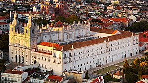
The Church and Monastery of São Vicente de Fora, meaning "Monastery of St. Vincent Outside the Walls", is a 17th-century church and monastery in the city of Lisbon, Portugal. It is one of the most important monasteries and mannerist buildings in the country.
Santiago, Lisbon
Distance: Approx. 286 meters
Latitude and longitude: 38.71166667,-9.13055556
Santiago (English: Saint James) is a former civil parish (freguesia) in the city and municipality of Lisbon, Portugal. It had a total area of 0.06 km2 and total population of 846 inhabitants (2009); density: 13,823 inhabitants/km2. At the administrative reorganization of Lisbon on 8 December 2012 it became part of the parish Santa Maria Maior.

National Industrial Property Institute (Portugal)
Distance: Approx. 469 meters
Latitude and longitude: 38.70861111,-9.13194444
The National Industrial Property Institute or the Portuguese Institute of Industrial Property, in Portuguese Instituto Nacional da Propriedade Industrial, known also by its acronym INPI, is the Portuguese office which deals with the protection of trademarks, patents, utility models and industrial design. Its headquarters is in downtown Lisbon.

Igreja do Menino Deus
Catholic church and national monument in Portugal
Distance: Approx. 459 meters
Latitude and longitude: 38.7136,-9.1314
Igreja do Menino Deus is a church in Portugal. It is classified as a National Monument. It was designed by the architect João Antunes.
Igreja de Santa Luzia (Lisbon)
Distance: Approx. 281 meters
Latitude and longitude: 38.711796,-9.130439
Igreja de Santa Luzia is a church in Lisbon, Portugal. It is classified as a National Monument.

Igreja de Santo Estêvão (Lisbon)
Distance: Approx. 150 meters
Latitude and longitude: 38.71218,-9.12796
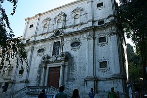
Saint Stephen Church (Portuguese: Igreja de Santo Estêvão) is a church in Alfama district of Lisbon, Portugal. It is classified as a National Monument.

Pantheon of the House of Braganza
Building in Lisbon, Lisbon District, Portugal
Distance: Approx. 427 meters
Latitude and longitude: 38.71472222,-9.12694444
The Pantheon of the House of Braganza (Portuguese: Panteão da Casa de Bragança), also known as the Pantheon of the Braganzas (Panteão dos Bragança), is the final resting place for many of the members of the House of Braganza, located in the Monastery of São Vicente de Fora in the Alfama district of Lisbon, Portugal. The pantheon's burials have included Portuguese monarchs, Brazilian monarchs, a Romanian monarch, queen consorts of Portugal, and notable Infantes of Portugal, among others.
Santa Apolónia Station (Lisbon Metro)
Metro station in Lisbon
Distance: Approx. 391 meters
Latitude and longitude: 38.71277778,-9.12361111
Santa Apolónia station is the southern terminus on the Blue Line of the Lisbon Metro.

Pantheon of the Patriarchs of Lisbon
Distance: Approx. 424 meters
Latitude and longitude: 38.7147,-9.1278
The Pantheon of the Patriarchs of Lisbon (Portuguese: Panteão dos Patriarcas de Lisboa), also known simply as the Pantheon of the Patriarchs, is the final resting place of the majority of the Cardinal-Patriarchs of Lisbon. It is located in the Monastery of São Vicente de Fora in the Alfama district of Lisbon, Portugal. The room is a simple chapel, mostly unadorned save for a stone altar.

Fado Museum
Museum dedicated to Fado music
Distance: Approx. 31 meters
Latitude and longitude: 38.7111284,-9.127618
The Fado Museum is a music museum dedicated to Fado located in the Lisbon neighbourhood of Alfama. It was inaugurated on 25 September 1998.
Weather in this IP's area
broken clouds
14 Celsius
13 Celsius
13 Celsius
14 Celsius
1013 hPa
85 %
1013 hPa
1008 hPa
10000 meters
4.12 m/s
120 degree
75 %
07:19:13
17:23:21


