94.252.40.79 - IP Lookup: Free IP Address Lookup, Postal Code Lookup, IP Location Lookup, IP ASN, Public IP
Country:
Region:
City:
Location:
Time Zone:
Postal Code:
IP information under different IP Channel
ip-api
Country
Region
City
ASN
Time Zone
ISP
Blacklist
Proxy
Latitude
Longitude
Postal
Route
Luminati
Country
Region
ca
City
schouweiler
ASN
Time Zone
Europe/Luxembourg
ISP
Proximus Luxembourg S.A.
Latitude
Longitude
Postal
IPinfo
Country
Region
City
ASN
Time Zone
ISP
Blacklist
Proxy
Latitude
Longitude
Postal
Route
IP2Location
94.252.40.79Country
Region
diekirch
City
niederfeulen
Time Zone
ISP
Language
User-Agent
Latitude
Longitude
Postal
db-ip
Country
Region
City
ASN
Time Zone
ISP
Blacklist
Proxy
Latitude
Longitude
Postal
Route
ipdata
Country
Region
City
ASN
Time Zone
ISP
Blacklist
Proxy
Latitude
Longitude
Postal
Route
Popular places and events near this IP address

Ettelbruck
Commune in Diekirch, Luxembourg
Distance: Approx. 3870 meters
Latitude and longitude: 49.8464,6.0992
Ettelbruck (Luxembourgish: Ettelbréck pronounced [ˈætəlbʀek] , German: Ettelbrück [ˈɛtl̩bʁʏk]) is a commune with town status in central Luxembourg, with a population of 9,965 inhabitants.

Feulen
Commune in Diekirch, Luxembourg
Distance: Approx. 655 meters
Latitude and longitude: 49.85,6.05
Feulen (German pronunciation: [ˈfɔʏlən]; Luxembourgish: Feelen) is a commune in central Luxembourg. It is part of the canton of Diekirch, which is part of the district of Diekirch. The commune's administrative centre is Niederfeulen.

Mertzig
Commune in Diekirch, Luxembourg
Distance: Approx. 4149 meters
Latitude and longitude: 49.83109,6.00366
Mertzig (German pronunciation: [ˈmɛʁtsɪç]; Luxembourgish: Mäerzeg) is a commune and town in central Luxembourg. It is part of Diekirch Canton. Mertzig was formed on 30 December 1874, when it was detached from the commune of Feulen.

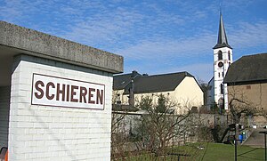
Schieren
Commune in Diekirch, Luxembourg
Distance: Approx. 4531 meters
Latitude and longitude: 49.8333,6.1
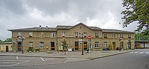
Schieren (German pronunciation: [ˈʃiːʁən]) is a commune and town in central Luxembourg. It is part of the canton of Diekirch. Schieren is served by a railway station, and the commune encompasses the hamlet of Birtrange, which contains Birtrange castle.

Wark (river)
River in Luxembourg
Distance: Approx. 4394 meters
Latitude and longitude: 49.8458,6.1065
The Wark (Luxembourgish: Waark) is a river flowing through Luxembourg, joining the Alzette at Ettelbruck. It flows through the towns of Mertzig, Feulen, Welscheid and Warken.

Welscheid
Distance: Approx. 3389 meters
Latitude and longitude: 49.88333333,6.06666667
Welscheid (Luxembourgish: Welschent) is a village in the commune of Bourscheid, in north-eastern Luxembourg. As of 2024, the village had a population of 207. Welscheid is connected to the cycling path PC16 with a short serpentine road to Bourscheid.

Warken
Town in Ettelbruck, Luxembourg
Distance: Approx. 3841 meters
Latitude and longitude: 49.85,6.1
Warken (Luxembourgish: Waarken) is a town in the commune of Ettelbruck, in central Luxembourg. The village has a population of 1,554 as of 2024 and lies near the Wark River. Warken is a part of Ettelbruck and is split in five departments: Cité Bourschterbach, Cité Warkdall, Cité Breechen.

Oberfeulen
Distance: Approx. 1174 meters
Latitude and longitude: 49.85,6.03333333
Oberfeulen (German pronunciation: [ˈoːbɐˌfɔʏlən], lit. 'Upper Feulen'; Luxembourgish: Uewerfeelen) is a small town in the commune of Feulen, in central Luxembourg. As of 2024, the town has a population of 699.

Niederfeulen
Distance: Approx. 655 meters
Latitude and longitude: 49.85,6.05
Niederfeulen (German pronunciation: [ˈniːdɐˌfɔʏlən], lit. 'Lower Feulen'; Luxembourgish: Nidderfeelen) is a small town in the commune of Feulen, in central Luxembourg. As of 2024, the town has a population of 1,741.

Stade Am Deich
Football stadium in Luxembourg
Distance: Approx. 3827 meters
Latitude and longitude: 49.84111111,6.09555556
Stade Am Deich is a football stadium in Ettelbruck, in central Luxembourg. It is currently the home stadium of FC Etzella Ettelbruck. The stadium has a capacity of about 2,020.

Ettelbruck railway station
Railway station in Luxembourg
Distance: Approx. 4389 meters
Latitude and longitude: 49.84805556,6.10722222
Ettelbruck railway station (Luxembourgish: Gare Ettelbréck, French: Gare de Ettelbruck, German: Bahnhof Ettelbrück) is a railway station serving Ettelbruck, in central Luxembourg. It is operated by Chemins de Fer Luxembourgeois, the state-owned railway company. The station is situated on Line 10, which connects Luxembourg City to the centre and north of the country.

Birtrange Castle
Castle in Luxembourg
Distance: Approx. 4429 meters
Latitude and longitude: 49.8264,6.0891
Birtrange Castle (Luxembourgish: Schlass Biertreng; French: Château de Birtrange) is a castle near Schieren, Luxembourg. The castle was constructed in the 13th century by Gaspard-Florent de Breiderbach, and built in an English Gothic style. It was acquired in 1813 by the De Blochhausen family, who held the castle until 1935, when it came to be under the control of the De Broqueville family.
Weather in this IP's area
broken clouds
-1 Celsius
-5 Celsius
-1 Celsius
0 Celsius
1030 hPa
87 %
1030 hPa
985 hPa
10000 meters
4.31 m/s
6.37 m/s
1 degree
59 %