94.252.121.109 - IP Lookup: Free IP Address Lookup, Postal Code Lookup, IP Location Lookup, IP ASN, Public IP
Country:
Region:
City:
Location:
Time Zone:
Postal Code:
IP information under different IP Channel
ip-api
Country
Region
City
ASN
Time Zone
ISP
Blacklist
Proxy
Latitude
Longitude
Postal
Route
Luminati
Country
Region
lu
City
luxembourg
ASN
Time Zone
Europe/Luxembourg
ISP
Proximus Luxembourg S.A.
Latitude
Longitude
Postal
IPinfo
Country
Region
City
ASN
Time Zone
ISP
Blacklist
Proxy
Latitude
Longitude
Postal
Route
IP2Location
94.252.121.109Country
Region
echternach
City
echternach
Time Zone
Europe/Luxembourg
ISP
Language
User-Agent
Latitude
Longitude
Postal
db-ip
Country
Region
City
ASN
Time Zone
ISP
Blacklist
Proxy
Latitude
Longitude
Postal
Route
ipdata
Country
Region
City
ASN
Time Zone
ISP
Blacklist
Proxy
Latitude
Longitude
Postal
Route
Popular places and events near this IP address

Echternach
Commune in Luxembourg
Distance: Approx. 676 meters
Latitude and longitude: 49.8116667,6.4216667
Echternach (German pronunciation: [ˈɛçtɐˌnax], French pronunciation: [ɛʃtəʁnax]; Luxembourgish: Iechternach [ˈiəɕtɐnɑχ] or locally Eechternoach) is a commune with town status in the canton of Echternach, in eastern Luxembourg. Echternach lies near the border with Germany, and is the oldest town in Luxembourg.

Canton of Echternach
Canton in Luxembourg
Distance: Approx. 1713 meters
Latitude and longitude: 49.8,6.4
Echternach (Luxembourgish: Iechternach) is a canton in the east of Luxembourg. It is largely coterminous with the Mullerthal region. It borders Germany.

Weilerbach, Luxembourg
Distance: Approx. 4162 meters
Latitude and longitude: 49.83333333,6.38333333
Weilerbach (Luxembourgish: Weilerbaach) is a small town in the commune of Berdorf, in eastern Luxembourg. As of 2024, the town has a population of 342.

Dickweiler
Distance: Approx. 4044 meters
Latitude and longitude: 49.78333333,6.46666667
Dickweiler is a village in the commune of Rosport-Mompach, in eastern Luxembourg. As of 2024, the village has a population of 131.
Osweiler, Luxembourg
Town in the Luxembourgish commune of Rosport-Mompach
Distance: Approx. 2605 meters
Latitude and longitude: 49.78333333,6.43333333
Osweiler (Luxembourgish: Uesweller) is a town in the eastern Luxembourgish commune of Rosport-Mompach, with a population of 481 as of 2024.

Steinheim, Luxembourg
Distance: Approx. 4561 meters
Latitude and longitude: 49.81666667,6.48333333
Steinheim (Luxembourgish: Steenem) is a town in the commune of Rosport-Mompach, in eastern Luxembourg. As of 2024, the town has a population of 654.

Abbey of Echternach
Benedictine monastery in Echternach, Luxembourg
Distance: Approx. 923 meters
Latitude and longitude: 49.81388889,6.4225
The Abbey of Echternach is a Benedictine monastery in the town of Echternach, in eastern Luxembourg. The abbey was founded in the 7th century by St Willibrord, the patron saint of Luxembourg. For three hundred years, it benefited from the patronage of a succession of rulers, and was the most powerful institution in Luxembourg.

Echternacherbrück
Municipality in Rhineland-Palatinate, Germany
Distance: Approx. 949 meters
Latitude and longitude: 49.81305556,6.42861111
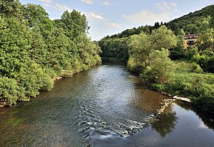
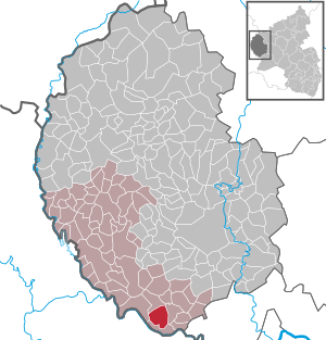
Echternacherbrück is a German municipality located on the Sauer river opposite the Luxembourgish town of Echternach. It is part of the district Bitburg-Prüm, in Rhineland-Palatinate. It includes the district of Fölkenbach.

Ernzen, Germany
Municipality in Rhineland-Palatinate, Germany
Distance: Approx. 4022 meters
Latitude and longitude: 49.84166667,6.42555556
Ernzen is a municipality in the district of Bitburg-Prüm, in Rhineland-Palatinate, western Germany.

Minden, Rhineland-Palatinate
Municipality in Rhineland-Palatinate, Germany
Distance: Approx. 3939 meters
Latitude and longitude: 49.82472222,6.46833333
Minden is a municipality in the district of Bitburg-Prüm, in Rhineland-Palatinate, western Germany.

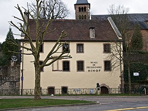
Prehistory Museum, Echternach
Museum in Echternach, Luxembourg
Distance: Approx. 804 meters
Latitude and longitude: 49.8128,6.4231
The Prehistory Museum (Luxembourgish: Musée fir Virgeschicht; French: Musée de la préhistoire) in Echternach, Luxembourg, houses a collection of prehistoric artefacts principally from Luxembourg, northern Europe and France testifying to the history of mankind for more than a million years. It is located in the 15th century Hihof building in the centre of the town.
Devil's Gorge (Eifel)
Distance: Approx. 4645 meters
Latitude and longitude: 49.84555556,6.44083333
The Devil's Gorge or Teufelsschlucht is located on the eastern edge of the Ferschweiler Plateau within the South Eifel Nature Park in the vicinity of Irrel. It was formed towards the end of the last ice age, about 10,000 years ago as the result of one or more rock collapses. The cause of this event was probably a combination of the geological and climatic circumstances.
Weather in this IP's area
light rain
4 Celsius
-1 Celsius
2 Celsius
4 Celsius
1012 hPa
91 %
1012 hPa
976 hPa
10000 meters
6.26 m/s
12.93 m/s
299 degree
19 %