Country:
 Spain
SpainRegion:
City:
Latitude and Longitude:
Time Zone:
Postal Code:
IP information under different IP Channel
ip-api
Country
Region
City
ASN
Time Zone
ISP
Blacklist
Proxy
Latitude
Longitude
Postal
Route
IPinfo
Country
Region
City
ASN
Time Zone
ISP
Blacklist
Proxy
Latitude
Longitude
Postal
Route
MaxMind
Country
Region
City
ASN
Time Zone
ISP
Blacklist
Proxy
Latitude
Longitude
Postal
Route
Luminati
Country
ESRegion
cn
City
granadilladeabona
ASN
Time Zone
Atlantic/Canary
ISP
Vodafone Spain
Latitude
Longitude
Postal
db-ip
Country
Region
City
ASN
Time Zone
ISP
Blacklist
Proxy
Latitude
Longitude
Postal
Route
ipdata
Country
Region
City
ASN
Time Zone
ISP
Blacklist
Proxy
Latitude
Longitude
Postal
Route
Popular places and events near this IP address

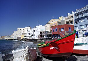
San Miguel de Abona
Municipality in Canary Islands, Spain
Distance: Approx. 6205 meters
Latitude and longitude: 28.1,-16.61666667
San Miguel de Abona is a town and a municipality in the southern part of the island of Tenerife, one of the Canary Islands, and part of the province of Santa Cruz de Tenerife, Spain. The TF-1 motorway passes through the southern part of the municipality. The population is 16,099 (2013), its area is 42.04 km2.

Tenerife South Airport
International airport serving Tenerife, Canary Islands, Spain
Distance: Approx. 3185 meters
Latitude and longitude: 28.04444444,-16.5725
Tenerife South Airport (Spanish: Aeropuerto de Tenerife Sur) (IATA: TFS, ICAO: GCTS), also known as Tenerife South–Reina Sofía Airport, is the larger of the two international airports located on the island of Tenerife (the other being Tenerife North Airport) and the second busiest in the Canary Islands (after Gran Canaria Airport). It is located in the municipality of Granadilla de Abona and handled over 11 million passengers in 2018. Combined with Tenerife North Airport, the island gathers the highest passenger movement of all the Canary Islands, with 12,248,673 passengers, surpassing Gran Canaria Airport.
El Médano
Distance: Approx. 4382 meters
Latitude and longitude: 28.04166667,-16.53333333
El Médano (Spanish, "The sand dune") is a town in the municipality of Granadilla de Abona, on the island of Tenerife, one of the Canary Islands. It is located about 11 kilometers from the town of Granadilla, reaching an average altitude of 75 meters above sea level. The town is divided into five centers: El Médano, Arenas del Mar, El Cabezo, El Topo and Ensenada Pelada.

Los Abrigos
Distance: Approx. 6455 meters
Latitude and longitude: 28.01666667,-16.58333333
Los Abrigos is a small fishing village in Granadilla de Abona, Tenerife. It has a small harbour, which developers want to expand.

Cave of Santo Hermano Pedro
Roman Catholic cave-shrine in the Canary Islands
Distance: Approx. 2416 meters
Latitude and longitude: 28.05138889,-16.55333333
The Cave-Shrine of Santo Hermano Pedro is a Roman Catholic cave-shrine dedicated to Saint Peter of Saint Joseph Betancur (Canary first saint). It is located in the municipality of Granadilla de Abona, near El Medano on the south of the island of Tenerife (Canary Islands, Spain), at the end of the Tenerife South Airport runway.

Tomás Zerolo airfield
Airport in Tenerife
Distance: Approx. 4229 meters
Latitude and longitude: 28.03583333,-16.54777778
Tomás Zerolo airfield (Spanish: aeródromo "Tomás Zerolo") was an aerodrome near El Médano, Granadilla de Abona, Tenerife, Canary Islands. It operated between 1962 and 1978. Only the remains of the control tower still exist.

Laboratorio de Energía Solar Termoeléctrica
Abandoned dish structure
Distance: Approx. 3699 meters
Latitude and longitude: 28.05777778,-16.52805556
Laboratorio de Energía Solar Termoeléctrica is an abandoned dish structure near to El Medano, Tenerife, in the Canary Islands. It was built in 2008 to generate solar energy, but was constructed without permission and was abandoned in 2009.
Weather in this IP's area
few clouds
20 Celsius
20 Celsius
19 Celsius
20 Celsius
1016 hPa
73 %
1016 hPa
995 hPa
10000 meters
1.54 m/s
30 degree
20 %
07:48:24
20:19:35