Country:
 Spain
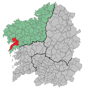
SpainRegion:
City:
Latitude and Longitude:
Time Zone:
Postal Code:
IP information under different IP Channel
ip-api
Country
Region
City
ASN
Time Zone
ISP
Blacklist
Proxy
Latitude
Longitude
Postal
Route
IPinfo
Country
Region
City
ASN
Time Zone
ISP
Blacklist
Proxy
Latitude
Longitude
Postal
Route
MaxMind
Country
Region
City
ASN
Time Zone
ISP
Blacklist
Proxy
Latitude
Longitude
Postal
Route
Luminati
Country
ESRegion
ga
City
brion
ASN
Time Zone
Europe/Madrid
ISP
Vodafone Spain
Latitude
Longitude
Postal
db-ip
Country
Region
City
ASN
Time Zone
ISP
Blacklist
Proxy
Latitude
Longitude
Postal
Route
ipdata
Country
Region
City
ASN
Time Zone
ISP
Blacklist
Proxy
Latitude
Longitude
Postal
Route
Popular places and events near this IP address

Cando, Spain
Village
Distance: Approx. 1951 meters
Latitude and longitude: 42.83722222,-8.86833333
Cando (parish of San Tirso) is a village in northwestern Spain, in Outes, province of A Coruña, and the region of Galicia, with a population of around 1000. It was the location of the observation of a fireball in early 1994, and the subsequent discovery of an explosion site (crater), which has been interpreted by some as being related to UFO activity.

Noia
Town
Distance: Approx. 5253 meters
Latitude and longitude: 42.78333333,-8.88333333
Noia (Galician pronunciation: [ˈnɔjɐ]) is a town and municipality in the autonomous community of Galicia in northwestern Spain. It is the capital of the comarca with the same name. It has a population of 14,947 inhabitants (2010), being situated in the Province of A Coruña, some 20 miles west of Santiago de Compostela near the mouth of the Tambre river.

Lousame
Place
Distance: Approx. 4739 meters
Latitude and longitude: 42.78333333,-8.86666667
Lousame is a municipality of northwestern Spain in the province of A Coruña, in the autonomous community of Galicia. It belongs to the comarca of Noia. It has a population of 3,657 inhabitants (INE, 2011).
Noia (comarca)
Comarca in Galicia, Spain
Distance: Approx. 7983 meters
Latitude and longitude: 42.76638889,-8.90916667
Noia is a comarca in the Galician Province of A Coruña. The overall population of this local region is 33,054 (2019).

Outes
Municipality in Galicia, Spain
Distance: Approx. 4845 meters
Latitude and longitude: 42.85,-8.9
Outes is a municipality in the province of A Coruña in the autonomous community of Galicia in northwestern Spain. It has a population of 6,155 (Spanish 2020 Census) and an area of 100 km². The Cando event happened in 1994 within the boundaries of Cando, in the parish of San Tirso.

Tambre (river)
River in Galicia, Spain
Distance: Approx. 1771 meters
Latitude and longitude: 42.8282,-8.873
The Tambre is a coastal river that crosses Galicia, in northwestern Spain. Its basin covers 1,531 square kilometres (591 sq mi). The river flows through the province of A Coruña; the municipalities along its course are Sobrado, Curtis, Vilasantar, Boimorto, Mesía, Frades, Arzúa, O Pino, Oroso, Ordes, Trazo, Tordoia, Santiago de Compostela, Val do Dubra, Ames, A Baña, Brion, Negreira, Outes, Mazaricos, Noia and Lousame.
O Freixo de Sabardes
Village in Galicia, Spain
Distance: Approx. 8605 meters
Latitude and longitude: 42.79294444,-8.94808333
O Freixo de Sabardes or O Freixo is a village and parish in the Outes Mountain range (Serra de Outes in Galician), which is in the county of Outes, which is in the province of A Coruña, Galiza. In 2012 the population was 991 residents (483 men and 508 women), which was a decrease of 31 from 2011. The local saint, St John the Evangelist (San Xoán Evanxelista in Galician) is celebrated on 27 of December.
Tremuzo
Distance: Approx. 8293 meters
Latitude and longitude: 42.826852,-8.953428
Tremuzo is a summit in the mountain range that limits the Galician ria Ría de Muros e Noia to the north and the highest elevation in the municipality of Outes. If forms the highest elevation close to the sea in that range and therefore offers excellent views to the ria and the Serra da Barbanza mountain range at the other side of the ria. The summit can be reached as an easy hike or as a mountain-bike tour from Ribeira do Freixo.

Monastery of San Xusto
Monastery in Galicia, Spain
Distance: Approx. 2991 meters
Latitude and longitude: 42.81166667,-8.81972222
The Monastery of San Xusto (Galician: Mosteiro dos Santos Xusto e Pastor de Toxos Outos), is an old Spanish monastery, today abandoned, in San Xusto, in the municipality of Lousame. According to Hipólito de Sa his property included part of the Mahia, inland, and along the coast from Noya to Finisterre, he owned some small enclaves in the lands of Rivadavia, Salnés Morrazo and in Portugal, the town of Paredes...
Weather in this IP's area
clear sky
11 Celsius
10 Celsius
10 Celsius
13 Celsius
1014 hPa
93 %
1014 hPa
1009 hPa
10000 meters
1.27 m/s
1.31 m/s
104 degree
4 %
08:08:02
20:58:18