94.248.163.197 - IP Lookup: Free IP Address Lookup, Postal Code Lookup, IP Location Lookup, IP ASN, Public IP
Country:
Region:
City:
Location:
Time Zone:
Postal Code:
ISP:
ASN:
language:
User-Agent:
Proxy IP:
Blacklist:
IP information under different IP Channel
ip-api
Country
Region
City
ASN
Time Zone
ISP
Blacklist
Proxy
Latitude
Longitude
Postal
Route
db-ip
Country
Region
City
ASN
Time Zone
ISP
Blacklist
Proxy
Latitude
Longitude
Postal
Route
IPinfo
Country
Region
City
ASN
Time Zone
ISP
Blacklist
Proxy
Latitude
Longitude
Postal
Route
IP2Location
94.248.163.197Country
Region
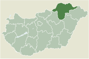
borsod-abauj-zemplen
City
rudabanya
Time Zone
Europe/Budapest
ISP
Language
User-Agent
Latitude
Longitude
Postal
ipdata
Country
Region
City
ASN
Time Zone
ISP
Blacklist
Proxy
Latitude
Longitude
Postal
Route
Popular places and events near this IP address

Alsótelekes
Place in Borsod-Abaúj-Zemplén, Hungary
Distance: Approx. 3485 meters
Latitude and longitude: 48.41106,20.65509
Alsótelekes is a village in Borsod-Abaúj-Zemplén county, Hungary.

Imola, Hungary
Place in Borsod-Abaúj-Zemplén, Hungary
Distance: Approx. 7285 meters
Latitude and longitude: 48.42027,20.55196
Imola is a village in Borsod-Abaúj-Zemplén county, Hungary. The village's name is derived from an extinct language called Ohmagyar. The name means "moss".

Szuhogy
Place in Borsod-Abaúj-Zemplén, Hungary
Distance: Approx. 3094 meters
Latitude and longitude: 48.38403,20.67513
Szuhogy is a village in Borsod-Abaúj-Zemplén county, Hungary.

Teresztenye
Place in Borsod-Abaúj-Zemplén, Hungary
Distance: Approx. 7240 meters
Latitude and longitude: 48.44552,20.60475
Teresztenye is a village in Borsod-Abaúj-Zemplén county, in the north-east region of Hungary.

Zubogy
Place in Borsod-Abaúj-Zemplén, Hungary
Distance: Approx. 4338 meters
Latitude and longitude: 48.37838,20.5751
Zubogy is a village in Borsod-Abaúj-Zemplén county, Hungary. It has road connection with Ragály and Felsőkelecsény. The nearest town is Kazincbarcika (20 km).

Rudabánya
Town in Borsod-Abaúj-Zemplén, Hungary
Distance: Approx. 1301 meters
Latitude and longitude: 48.37504,20.62085
Rudabánya is a town in Borsod-Abaúj-Zemplén county, Hungary. The town territory was the location of the discovery of a hominid from 12 million years ago, Dryopithecus brancoi (1969).
Felsőkelecsény
Village in Northern Hungary, Hungary
Distance: Approx. 4215 meters
Latitude and longitude: 48.35881111,20.58983056
Felsőkelecsény is a village in Borsod-Abaúj-Zemplén County in northeastern Hungary. As of 2022, it had a population of 354. The village is located in the valley of Csörgős with the neighbour villages Zubogy and Felsőnyárád.
Felsőnyárád
Village in Northern Hungary, Hungary
Distance: Approx. 6607 meters
Latitude and longitude: 48.328619,20.598569
Felsőnyárád is a village in Borsod-Abaúj-Zemplén County in northeastern Hungary. As of 2008, the village had a population of 1058.
Felsőtelekes
Village in Northern Hungary, Hungary
Distance: Approx. 2608 meters
Latitude and longitude: 48.4066,20.63698056
Felsőtelekes is a village in Borsod-Abaúj-Zemplén County in northeastern Hungary. As of 2008, the village had a population of 773.
Jákfalva
Village in Northern Hungary, Hungary
Distance: Approx. 6678 meters
Latitude and longitude: 48.33333333,20.58333333
Jákfalva is a village in Borsod-Abaúj-Zemplén County in northeastern Hungary.

Kánó
Village in Northern Hungary, Hungary
Distance: Approx. 6089 meters
Latitude and longitude: 48.43333333,20.6
Kánó is a village in Borsod-Abaúj-Zemplén County in northeastern Hungary. Before the Holocaust, few Jewish families lived in the village.
Ormosbánya
Village in Northern Hungary, Hungary
Distance: Approx. 5345 meters
Latitude and longitude: 48.33635,20.64843
Ormosbánya is a village in Borsod-Abaúj-Zemplén County in northeastern Hungary.
Weather in this IP's area
broken clouds
-1 Celsius
-1 Celsius
-1 Celsius
-1 Celsius
1033 hPa
92 %
1033 hPa
1004 hPa
10000 meters
0.43 m/s
0.41 m/s
99 degree
66 %