Country:
 Spain
SpainRegion:
City:
Latitude and Longitude:
Time Zone:
Postal Code:
IP information under different IP Channel
ip-api
Country
Region
City
ASN
Time Zone
ISP
Blacklist
Proxy
Latitude
Longitude
Postal
Route
IPinfo
Country
Region
City
ASN
Time Zone
ISP
Blacklist
Proxy
Latitude
Longitude
Postal
Route
MaxMind
Country
Region
City
ASN
Time Zone
ISP
Blacklist
Proxy
Latitude
Longitude
Postal
Route
Luminati
Country
ESRegion
mc
City
algar
ASN
Time Zone
Europe/Madrid
ISP
Vodafone Spain
Latitude
Longitude
Postal
db-ip
Country
Region
City
ASN
Time Zone
ISP
Blacklist
Proxy
Latitude
Longitude
Postal
Route
ipdata
Country
Region
City
ASN
Time Zone
ISP
Blacklist
Proxy
Latitude
Longitude
Postal
Route
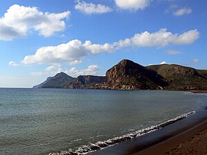
Popular places and events near this IP address

La Unión, Murcia
Municipality in Region of Murcia, Spain
Distance: Approx. 3303 meters
Latitude and longitude: 37.61916667,-0.87555556
La Unión is situated in the Region of Murcia in the southeast of Spain. It has an area of 24.6 km², and had a population of 19,907 on 1 January 2018. It has an elevation of 86 m.

La Manga Club Football Stadium
Football stadium in Spain
Distance: Approx. 6638 meters
Latitude and longitude: 37.60041,-0.80903
La Manga Club Football Stadium is a stadium in La Manga Club, south of La Manga, Spain. It was a resort stadium and was used to friendly matches and as a resting and training place for the Spain national football team.
Los Nietos, Cartagena
Distance: Approx. 6604 meters
Latitude and longitude: 37.6489,-0.7835
Los Nietos, Spain is a small fishing village with its own individual marina on the Mar Menor, which began as a very small fishing settlement and was later urbanised to allow more holiday homes by the Mar Menor. It is now a busy community with many visitors, especially in the summer, with some events at other times. Many foreigners, mainly British, live there.

El Carmolí
Place in Murcia, Spain
Distance: Approx. 4276 meters
Latitude and longitude: 37.68333333,-0.86666667
El Carmolí is an area in Los Urrutias, Cartagena municipality, in the Campo de Cartagena comarca, Region of Murcia, southeastern Spain. It used to be the site of a military air base, located near a homonymous hill in the flat Mar Menor area. One noteworthy spot in the territory is a hill which name is also El Carmolí and is an ancient volcano that started erupting seven million years ago.

El Algar
Municipality district in Murcia, Spain
Distance: Approx. 758 meters
Latitude and longitude: 37.64686989,-0.86672736
El Algar is a district of the Spanish municipality Cartagena. It is located in the east of Cartagena and has an area of 26.659 km2. It shares borders with Lentiscar at its north, San Félix at its east, La Unión municipality at its south east, El Beal at its south-west and a coastal salty lagoon named Mar Menor at its north-west.
Rincón de San Ginés
Municipality district in Murcia, Spain
Distance: Approx. 7711 meters
Latitude and longitude: 37.62181064,-0.77610406
Rincón de San Ginés is a district of the Spanish municipality Cartagena and is located in the south-east end. The territory is adjacent to the Mediterranean Sea in its south and east and is adjacent to a coastal salty lagoon named Mar Menor in its east. It has an area of 59,33 km2 and had a population of 10,558 in 2020.
Sierra Minera de Cartagena-La Unión
Mountain formation in the Region of Murcia (Spain)
Distance: Approx. 3898 meters
Latitude and longitude: 37.61055556,-0.86111111
Sierra Minera de Cartagena-La Unión is a mountainous formation that extends east–west along 26 km of coastline from the city of Cartagena to Cape Palos, through the municipality of La Unión, in the Region of Murcia in Spain. Its maximum elevation is located on the Sancti Spíritus hill near Portmán, at 431 m altitude. This mountain range was intensely exploited for its silver and lead mines and other metallic minerals in ancient times.

Llano del Beal
Locality in Cartagena, Spain
Distance: Approx. 3069 meters
Latitude and longitude: 37.62444444,-0.83583333
Llano del Beal (also known as El Llano del Beal or El Llano) is a town in the municipality of Cartagena in the autonomous community of the Region of Murcia in Spain.

Sierra de la Fausilla
Natural space in the south of the Region of Murcia, Spain
Distance: Approx. 9878 meters
Latitude and longitude: 37.56666667,-0.90972222
The Sierra de la Fausilla (or "Faucilla") natural area is located in the south of the Region of Murcia, in the municipality of Cartagena, to the east of the city in the area surrounding the Bay of Escombreras. It has a surface area of 791 ha. It is an area of great ecological importance and has been declared a Special Protection Area for Birds (SPA) and a Site of Community Importance (SCI).

Portmán
Human settlement in the Region of Murcia, Spain
Distance: Approx. 6109 meters
Latitude and longitude: 37.59083333,-0.85222222
Portmán is a locality in the Region of Murcia, Spain, located to the south of the municipality of La Unión at the foot of the mining mountain range of Cartagena-La Unión in a bay bathed by the Mediterranean Sea. Its territory has a very rugged topography, surrounded by mountains that surround the coastal plain, where the population center is located. To the north is the Sancti Spiritu hill, 434 meters high, which is the highest point of the entity, with Fortuna hill further south and the Cabezo de las Lajas, 283 meters above sea level.
Weather in this IP's area
clear sky
19 Celsius
18 Celsius
18 Celsius
19 Celsius
1021 hPa
55 %
1021 hPa
1016 hPa
10000 meters
4.92 m/s
7.15 m/s
338 degree
08:14:36
19:22:06