Country:
 Spain
SpainRegion:
City:
Latitude and Longitude:
Time Zone:
Postal Code:
IP information under different IP Channel
ip-api
Country
Region
City
ASN
Time Zone
ISP
Blacklist
Proxy
Latitude
Longitude
Postal
Route
IPinfo
Country
Region
City
ASN
Time Zone
ISP
Blacklist
Proxy
Latitude
Longitude
Postal
Route
MaxMind
Country
Region
City
ASN
Time Zone
ISP
Blacklist
Proxy
Latitude
Longitude
Postal
Route
Luminati
Country
ESRegion
an
City
seville
ASN
Time Zone
Europe/Madrid
ISP
Vodafone Spain
Latitude
Longitude
Postal
db-ip
Country
Region
City
ASN
Time Zone
ISP
Blacklist
Proxy
Latitude
Longitude
Postal
Route
ipdata
Country
Region
City
ASN
Time Zone
ISP
Blacklist
Proxy
Latitude
Longitude
Postal
Route
Popular places and events near this IP address

Andalusia
Autonomous community of Spain
Distance: Approx. 658 meters
Latitude and longitude: 37.405,-5.9875
Andalusia (UK: , US: ; Spanish: Andalucía [andaluˈθi.a] ) is the southernmost autonomous community in Peninsular Spain. Andalusia is located in the south of the Iberian Peninsula, in southwestern Europe. It is the most populous and the second-largest autonomous community in the country.

Alamillo Bridge
Bridge in Seville
Distance: Approx. 595 meters
Latitude and longitude: 37.41333333,-5.99027778
The Alamillo Bridge (Spanish: Puente del Alamillo) is a structure in Seville, Andalucia (Spain), which spans the Canal de Alfonso XIII, allowing access to La Cartuja, a peninsula located between the canal and the Guadalquivir River. The bridge was constructed as part of infrastructure improvements for Expo 92, which was held on large banana farms on the island. Construction of the bridge began in 1989 and was completed in 1992 from a design by Santiago Calatrava.

Estadio de La Cartuja
Stadium in Seville, Spain
Distance: Approx. 1378 meters
Latitude and longitude: 37.41723611,-6.00456389
Estadio La Cartuja (Spanish pronunciation: [esˈta.ðjo la kaɾˈtu.xa]), formerly Estadio Olímpico de Sevilla, officially known as Estadio La Cartuja de Sevilla, is a multi-purpose stadium situated in the Isla de la Cartuja in Seville, Spain. It is used mostly for football and it is commonly referred to as simply 'La Cartuja'. It was completed in 1999 for the World Championships in Athletics.
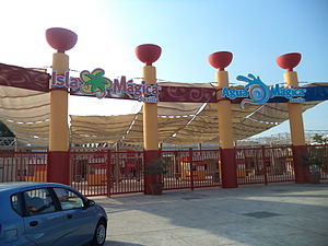
Isla Mágica
Theme park in Seville, Spain
Distance: Approx. 609 meters
Latitude and longitude: 37.40833333,-6.00027778
Isla Mágica (Spanish pronunciation: [ˈisla ˈmaxika], Magic Island) is a theme park in Seville, Spain. The park was constructed on the former grounds of the Expo '92 World's Fair and opened in June 1997. It features a large lake and many other attractions including roller coasters and various other types of rides as well as both live and cinematic shows.

Macarena, Seville
District of Seville, Andalusia, Spain
Distance: Approx. 565 meters
Latitude and longitude: 37.40416667,-5.99027778
Macarena is one of the eleven districts into which the city of Seville, capital of the autonomous community of Andalucía, Spain, is divided for administrative purposes. It is located in the north of the city, bordered to the south by the Casco Antiguo and San Pablo-Santa Justa suburbs, to the east and north by Norte and to the west by Triana. It covers the area between the Guadalquivir River and the Carmona Highway and from the SE-30 ring-road in the north to the Ronda del Casco Antiguo.

Alameda de Hércules
Distance: Approx. 1090 meters
Latitude and longitude: 37.398825,-5.99413333
The Alameda de Hércules (Hercules mall), or simply La Alameda, is a garden square or mall in Seville, southern Spain. Built in 1574, it was originally a promenaded public garden, named after the eight rows of white poplar trees (álamos in Spanish) that fill its central part. Located in the northern half of the city's casco antiguo (historic center), between the Guadalquivir River and the Macarena neighbourhood, it was the oldest public garden in Spain and Europe.

Parliament of Andalusia
Distance: Approx. 622 meters
Latitude and longitude: 37.404836,-5.988197
The Parliament of Andalusia (Spanish: Parlamento de Andalucía) is the legislature of the Spanish autonomous community of Andalusia instituted by the Andalusian Charter of Autonomy of 1981. It is elected by the residents of Andalusia every four years.

Hospital de las Cinco Llagas
Distance: Approx. 622 meters
Latitude and longitude: 37.40483611,-5.98819722
The Hospital de las Cinco Llagas (literally "Hospital of the Five Wounds") in Seville, Spain is the current seat of the Parliament of Andalusia.

Walls of Seville
Defensive fortification in Seville, Spain
Distance: Approx. 954 meters
Latitude and longitude: 37.401976,-5.986553
The Walls of Seville (Spanish: Murallas de Sevilla) are a series of defensive walls surrounding the Old Town of Seville. The city has been surrounded by walls since the Roman period, and they were maintained and modified throughout the subsequent Visigoth, Islamic and finally Castilian periods. The walls remained intact until the 19th century, when they were partially demolished after the revolution of 1868.

Alamillo Park
Distance: Approx. 1025 meters
Latitude and longitude: 37.4173,-5.9972
Alamillo Park (Spanish: Parque del Alamillo) is a metropolitan park located between the town of Santiponce (Sevilla) and Seville, Spain. The park is scheduled to begin an expansion that will make it one of Spain's largest urban parks, reaching 120 hectares in the summer of 2013.

Macarena Gate
City gate of the original walls of Seville
Distance: Approx. 745 meters
Latitude and longitude: 37.4028,-5.9892
The Puerta de la Macarena (in Arabic: Bab-al-Makrin), also known as Arco de la Macarena, is one of the only three city gates that remain today of the original walls of Seville, alongside the Postigo del Aceite and the Puerta de Córdoba. It is located in the calle Resolana, within the barrio de San Gil, which belongs to the district of Casco Antiguo of the city of Seville, in Andalusia, Spain. The gate faces the Basílica de La Macarena, which houses the image of the Our Lady of la Esperanza Macarena, one of the most characteristic images of the Holy Week in Seville.

Monastery of San Clemente (Sevilla)
Distance: Approx. 699 meters
Latitude and longitude: 37.402542,-5.995472
Monastery of San Clemente (Monasterio de San Clemente) is a Cistercian monastery with the Bien de Interés Cultural designation in the Spanish city of Seville. Architecturally, it is a heterogeneous set of buildings, built in different times and styles, from the 16th to the 17th century.
Weather in this IP's area
clear sky
19 Celsius
19 Celsius
18 Celsius
20 Celsius
1012 hPa
63 %
1012 hPa
1011 hPa
10000 meters
1.79 m/s
2.68 m/s
184 degree
08:00:33
20:42:55