94.24.63.140 - IP Lookup: Free IP Address Lookup, Postal Code Lookup, IP Location Lookup, IP ASN, Public IP
Country:
Region:
City:
Location:
Time Zone:
Postal Code:
ISP:
ASN:
language:
User-Agent:
Proxy IP:
Blacklist:
IP information under different IP Channel
ip-api
Country
Region
City
ASN
Time Zone
ISP
Blacklist
Proxy
Latitude
Longitude
Postal
Route
db-ip
Country
Region
City
ASN
Time Zone
ISP
Blacklist
Proxy
Latitude
Longitude
Postal
Route
IPinfo
Country
Region
City
ASN
Time Zone
ISP
Blacklist
Proxy
Latitude
Longitude
Postal
Route
IP2Location
94.24.63.140Country
Region
tirol
City
niederndorf
Time Zone
Europe/Vienna
ISP
Language
User-Agent
Latitude
Longitude
Postal
ipdata
Country
Region
City
ASN
Time Zone
ISP
Blacklist
Proxy
Latitude
Longitude
Postal
Route
Popular places and events near this IP address

Oberaudorf
Municipality in Bavaria, Germany
Distance: Approx. 3368 meters
Latitude and longitude: 47.6475,12.17194444
Oberaudorf (German pronunciation: [ˈoːbɐˌʔaʊdɔʁf]) is a municipality in the district of Rosenheim in Bavaria, Germany. It lies on the river Inn. Oberaudorf is the birthplace of the mother of German Pope Benedict XVI, of German politician Edmund Stoiber and footballer Bastian Schweinsteiger, who grew up there.

Erl
Municipality in Tyrol, Austria
Distance: Approx. 4434 meters
Latitude and longitude: 47.68166667,12.18083333
Erl is a municipality of 1,400 inhabitants in the Kufstein district in western Austria. It lies 15 km north of the administrative town of Kufstein in the northern part of the Tyrol, at the border with Bavaria, Germany. Settlement began in the third century; Erl is mentioned in documents dating back to A.D. 788.

Kiefersfelden
Municipality in Bavaria, Germany
Distance: Approx. 4476 meters
Latitude and longitude: 47.61666667,12.18333333
Kiefersfelden is a municipality with about 7000 inhabitants located in the district of Rosenheim in Bavaria, Germany, on the border with Tyrol, Austria.

Ebbs
Municipality in Tyrol, Austria
Distance: Approx. 2233 meters
Latitude and longitude: 47.63,12.21444444
Ebbs is a municipality in the Kufstein district of Tyrol in Austria. The village is located in the Judicial district of Kufstein and in 2016 had a population of 5,480.

Niederndorf (Austria)
Municipality in Tyrol, Austria
Distance: Approx. 86 meters
Latitude and longitude: 47.65,12.21555556
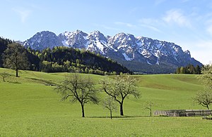
Niederndorf is a municipality in the Kufstein district in the Austrian state of Tyrol located 7 km north of Kufstein and 2 km north above Ebbs near the border to Bavaria, Germany. The main source of income is agriculture. The village was mentioned for the first time in documents in 1230.
Niederndorferberg
Municipality in Tyrol, Austria
Distance: Approx. 4175 meters
Latitude and longitude: 47.67611111,12.25666667
Niederndorferberg is a municipality in the Kufstein district in the Austrian state of Tyrol located 8 km north of Kufstein and 3.4 km north above Ebbs near the border to Bavaria, Germany. It has six parts and was once connected with Niederndorf before it became an own community. The main source of income is the production of milk & cheese.

Rettenschöss
Municipality in Tyrol, Austria
Distance: Approx. 3747 meters
Latitude and longitude: 47.65,12.26666667
Rettenschöss is a municipality in the Kufstein district in the Austrian state of Tyrol located 10.20 km northeast of Kufstein and 6 km northeast of Ebbs below the northern border to Bavaria, Germany.

Posidonia Shale
Early Jurassic geological formation of south-western Germany
Distance: Approx. 4783 meters
Latitude and longitude: 47.69,12.24
The Posidonia Shale (German: Posidonienschiefer, also called Schistes Bitumineux in Luxembourg) geologically known as the Sachrang Formation, is an Early Jurassic (Early to Late Toarcian) geological formation in Germany, northern Switzerland, northwestern Austria, southern Luxembourg and the Netherlands, including exceptionally well-preserved complete skeletons of fossil marine fish and reptiles. The Posidonienschiefer, the German translation, takes its name from the ubiquitous fossils of the oyster-related bivalve "Posidonia bronni" (synonym of Bositra buchii and Steinmannia bronni) that characterize the mollusk faunal component of the formation. The name Posidonia Shale has been used for more than a century, until revisions in 2016 proposed the Sachrang Formation as new name for the Germanic unit, in a same way Altmühltal Formation is the official name of the Solnhofen Limestone.

Reisach Priory
Monastery in Bavaria, Germany
Distance: Approx. 3460 meters
Latitude and longitude: 47.66444444,12.17583333
Reisach Priory (German: Kloster Reisach), formerly Urfahrn Priory (German: Kloster Urfahrn), was until 2019 a friary of the Discalced Carmelites in Oberaudorf in Bavaria, Germany, in the diocese of Munich and Freising.

Hocheck (Oberaudorf)
Distance: Approx. 4328 meters
Latitude and longitude: 47.64694444,12.15916667
Hocheck is a mountain in the district of Rosenheim, Bavaria, Germany. It is closely associated with the nearby town of Oberaudorf. The mountain is about 860 metres high.

Petersköpfl
Distance: Approx. 5054 meters
Latitude and longitude: 47.609306,12.246556
The Petersköpfl is a 1,745m high summit in the Zahmer Kaiser, the northern ridge of the Kaisergebirge mountain range in the Austrian state of Tyrol. To the east, the Petersköpfl is linked by a ridge to the Einserkogel; to the west it is separated from the Naunspitze by a wind gap. To the south it falls steeply into the Kaisertal valley and to the north its steep rock faces tower above Ebbs.

Kieferbach
River in Germany
Distance: Approx. 5011 meters
Latitude and longitude: 47.6061,12.2019
Kieferbach (also: Thierseer Ache) is a river of Tyrol, Austria and Bavaria, Germany. It is a left tributary of the Inn and flows into it near Kiefersfelden.
Weather in this IP's area
overcast clouds
1 Celsius
1 Celsius
1 Celsius
1 Celsius
1020 hPa
85 %
1020 hPa
919 hPa
10000 meters
1.09 m/s
1.22 m/s
181 degree
100 %
