Country:
Region:
City:
Latitude and Longitude:
Time Zone:
Postal Code:
IP information under different IP Channel
ip-api
Country
Region
City
ASN
Time Zone
ISP
Blacklist
Proxy
Latitude
Longitude
Postal
Route
Luminati
Country
Region
7
ASN
Time Zone
Europe/Vienna
ISP
myNet GmbH
Latitude
Longitude
Postal
IPinfo
Country
Region
City
ASN
Time Zone
ISP
Blacklist
Proxy
Latitude
Longitude
Postal
Route
db-ip
Country
Region
City
ASN
Time Zone
ISP
Blacklist
Proxy
Latitude
Longitude
Postal
Route
ipdata
Country
Region
City
ASN
Time Zone
ISP
Blacklist
Proxy
Latitude
Longitude
Postal
Route
Popular places and events near this IP address

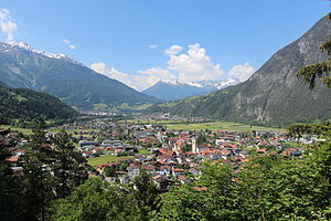
Landeck
Place in Tyrol, Austria
Distance: Approx. 1879 meters
Latitude and longitude: 47.13333333,10.56666667
Landeck (German pronunciation: [ˈlandɛk] ) is a city in the Austrian state of Tyrol, the capital of the district of Landeck.
Zams
Place in Tyrol, Austria
Distance: Approx. 2955 meters
Latitude and longitude: 47.15777778,10.58944444
Zams is a municipality in the district of Landeck in the Austrian state of Tyrol.

Fließ
Place in Tyrol, Austria
Distance: Approx. 6398 meters
Latitude and longitude: 47.12,10.6275
Fließ is a municipality in the Landeck district in the Austrian state of Tyrol located 5 km south of Landeck on the upper course of the river Inn, in the upper part of Upper Inn Valley. It has nine hamlets and was already populated at the Roman age; the village itself was founded around the 6th century. After a conflagration in 1933 Fließ was restored more spacious.

Grins, Austria
Place in Tyrol, Austria
Distance: Approx. 3009 meters
Latitude and longitude: 47.14138889,10.51472222
Grins is a municipality in the Landeck district in the Austrian state of Tyrol located 3.7 km west of Landeck and 18 km east of Sankt Anton am Arlberg. The village has 10 subdivisions. Settlement of the area already began 2000 years ago because of the sunny climate but the village was mentioned for the first time in documents in 1288 as „Grindes“.

Pians
Place in Tyrol, Austria
Distance: Approx. 3559 meters
Latitude and longitude: 47.13444444,10.51055556
Pians is a municipality in the district of Landeck in the Austrian state of Tyrol located 4.3 km west of the city of Landeck. The main source of income is tourism.

Tobadill
Place in Tyrol, Austria
Distance: Approx. 3922 meters
Latitude and longitude: 47.12527778,10.51333333
Tobadill is a municipality in the district of Landeck in the Austrian state of Tyrol located 4 km west of the town of Landeck. The village was first mentioned in documents in 1275 as „tabulat ill“. Formerly a part of Pians, the village was separated as an own community in 1949.

Landeck-Zams railway station
Railway station in Tyrol, Austria
Distance: Approx. 1901 meters
Latitude and longitude: 47.148472,10.578472
Landeck-Zams railway station, formerly Landeck, is a railway station in the city of Landeck, in the Austrian state of Tyrol. It is located on the Arlberg railway between Innsbruck and Bludenz. It is frequented by more than 2000 travellers a day, whereby a majority of them are commuters that are working or studying in Innsbruck.

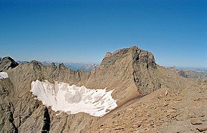
Lechtal Alps
Mountain range in Austria
Distance: Approx. 6420 meters
Latitude and longitude: 47.17444444,10.47833333
The Lechtal Alps (German: Lechtaler Alpen) are a mountain-range in western Austria, and part of the greater Northern Limestone Alps range. Named for the river Lech which drains them north-ward into Germany, the Lechtal Alps occupy the Austrian states of Tyrol and Vorarlberg and are known for their diverse rock structure. The Lechtal Alps are surrounded by the Ötztal Alps, Samnaun Alps and Verwall Alps (south) and the Allgäu Alps (north).

Sanna (Inn)
River in Tyrol, Austria
Distance: Approx. 943 meters
Latitude and longitude: 47.1439,10.5646
The Sanna is a river of Tyrol, Austria, a left tributary of the Inn. The Sanna is formed near Tobadill by the confluence of the rivers Rosanna (42 km (26 mi), from Arlberg and the valley Stanzertal) and Trisanna (31 km (19 mi), from Silvretta and Paznaun). It flows into the Inn at the small town of Landeck.

Wiesberg Castle
Distance: Approx. 5722 meters
Latitude and longitude: 47.1169,10.4928
Wiesberg Castle (German: Schloss Wiesberg) stands above the Trisanna River, where the Paznaun Valley leads into the Stanzer Valley.

Tobadill Church
Distance: Approx. 3892 meters
Latitude and longitude: 47.1259,10.5131
Tobadill Church is a church in Tobadill, Tyrol, Austria. It is dedicated to Magnus of Füssen. It originated as a 1705 chapel, replaced by a church designed by Kassian Grießer between 1735 and 1737.

Trisanna Bridge
Bridge in Tyrol, Austria
Distance: Approx. 5869 meters
Latitude and longitude: 47.11623,10.49111
The Trisanna Bridge (German: Trisannabrücke) is a 211-metre (692 feet) long viaduct carrying the Arlberg railway over the Trisanna river just southwest of Pians, a district of Landeck (Tyrol) in Austria. The bridge spans the Paznaun valley and Trisanna gorge, forming part of one of the most important east-west railway routes in the Alps. At the time of its completion in 1884, it was the longest steel support structure in the world.
Weather in this IP's area
overcast clouds
5 Celsius
3 Celsius
2 Celsius
6 Celsius
1015 hPa
83 %
1015 hPa
902 hPa
10000 meters
2.11 m/s
1.86 m/s
232 degree
88 %
07:26:25
16:39:56
