Country:
Region:
City:
Latitude and Longitude:
Time Zone:
Postal Code:
IP information under different IP Channel
ip-api
Country
Region
City
ASN
Time Zone
ISP
Blacklist
Proxy
Latitude
Longitude
Postal
Route
Luminati
Country
Region
7
ASN
Time Zone
Europe/Vienna
ISP
myNet GmbH
Latitude
Longitude
Postal
IPinfo
Country
Region
City
ASN
Time Zone
ISP
Blacklist
Proxy
Latitude
Longitude
Postal
Route
db-ip
Country
Region
City
ASN
Time Zone
ISP
Blacklist
Proxy
Latitude
Longitude
Postal
Route
ipdata
Country
Region
City
ASN
Time Zone
ISP
Blacklist
Proxy
Latitude
Longitude
Postal
Route
Popular places and events near this IP address

Fiss
Place in Tyrol, Austria
Distance: Approx. 4735 meters
Latitude and longitude: 47.05527778,10.61972222
Fiss is a municipality in the Landeck district in the Austrian state of Tyrol located 10.5 kilometers (6.5 mi) south of Landeck on the upper course of the Inn River. The main source of income is tourism.
Faggen
Place in Tyrol, Austria
Distance: Approx. 518 meters
Latitude and longitude: 47.08055556,10.67222222
Faggen is a municipality in the Landeck district in the Austrian state of Tyrol located 10.5 km south of Landeck at the entrance of the Kauner Valley which is a side valley on the upper course of the Inn River. It has six hamlets and is very weak in structure. The main source of income is „gentle“ agriculture but many inhabitants are commuters because there are hardly jobs.
Fendels
Place in Tyrol, Austria
Distance: Approx. 3386 meters
Latitude and longitude: 47.05361111,10.67638889
Fendels is a municipality in the Landeck district in the Austrian state of Tyrol located 13 km south of Landeck on the upper course of the Inn River. The village was mentioned for the first time in documents in 1297. Until 1959 it was only reachable by cable car.

Kaunerberg
Municipality in Tyrol, Austria
Distance: Approx. 3457 meters
Latitude and longitude: 47.08138889,10.71222222
Kaunerberg is a municipality in the district of Landeck in the Austrian state of Tyrol located 12.6 km southeast of Landeck in a valley with the same name at the upper course of the Inn River. The main source of income is agriculture.

Kauns
Place in Tyrol, Austria
Distance: Approx. 1910 meters
Latitude and longitude: 47.07777778,10.69055556
Kauns is a tiny municipality in the district of Landeck in the Austrian state of Tyrol located about 12 km southeast of Landeck and 1 km below Kaunerberg at the upper course of the Inn River. Several fires have tortured the village; only a few houses survived the catastrophes.

Ladis
Place in Tyrol, Austria
Distance: Approx. 4221 meters
Latitude and longitude: 47.06666667,10.61666667
Ladis is a municipality in the district of Landeck (district) in the Austrian state of Tyrol located 9.5 km south of Landeck and 1.4 km west of Faggen. The village is known because of its sulphur and sour springs. Another important source of income is ski tourism.

Prutz
Place in Tyrol, Austria
Distance: Approx. 804 meters
Latitude and longitude: 47.07638889,10.66361111
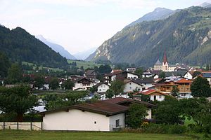
Prutz is a municipality in the Landeck district in the Austrian state of Tyrol. Located at the mouth of the Kauner valley on the upper Inn, it is 10 km south of the city of Landeck and 36 km north of Reschen Pass, that forms the border to Italy. The border to Switzerland is located 23 km away towards the south-west.

Ried im Oberinntal
Place in Tyrol, Austria
Distance: Approx. 3255 meters
Latitude and longitude: 47.05527778,10.65444444
Ried im Oberinntal is a municipality in the district of Landeck in the Austrian state of Tyrol located 12 km south of the city of Landeck and 3 km below Prutz. It was first mentioned in documents in the 12th century. Tourism is the main source of income.

Burg Bideneck
Distance: Approx. 4832 meters
Latitude and longitude: 47.121,10.6351
Burg Bideneck is a castle in Tyrol, Austria. Burg Bideneck is 198 metres (650 ft) above sea level. Bidenegg Castle , [1] also known as Biedenegg, Bideneck, Biedeneck and as Burg, is a castle in the municipality of Fließ in western Austria .

Laudegg Castle
Distance: Approx. 1324 meters
Latitude and longitude: 47.07625,10.65263889
Burg Laudegg is a restored castle ruin near the three villages of Ladis, Serfaus, and Fiss, Bezirk Landeck, in the state of Tyrol, Austria. Across the Oberinntal valley lies Castle Berneck at Kauns.

Berneck Castle
Castle in Kauns, Austria
Distance: Approx. 2796 meters
Latitude and longitude: 47.0758,10.7019
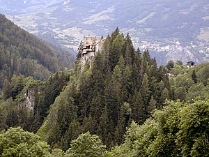
Berneck Castle is a 13th-century castle in Kauns, Austria.
Oberes Gericht
Distance: Approx. 1602 meters
Latitude and longitude: 47.0692,10.6625
Oberes Gericht is an area in the southwest of Austria and one of 36 microregions of the federal state of Tirol. The area located in the Landeck District reaches from Pontlatzbrücke to Finstermünzpass. It borders Switzerland in the southwest and Italy in the south.
Weather in this IP's area
overcast clouds
7 Celsius
5 Celsius
3 Celsius
7 Celsius
1014 hPa
72 %
1014 hPa
914 hPa
10000 meters
2.13 m/s
2.01 m/s
221 degree
90 %
07:25:45
16:39:41

