Country:
Region:
City:
Latitude and Longitude:
Time Zone:
Postal Code:
IP information under different IP Channel
ip-api
Country
Region
City
ASN
Time Zone
ISP
Blacklist
Proxy
Latitude
Longitude
Postal
Route
Luminati
Country
Region
pac
City
hyeres
ASN
Time Zone
Europe/Paris
ISP
KOESIO Networks SAS
Latitude
Longitude
Postal
IPinfo
Country
Region
City
ASN
Time Zone
ISP
Blacklist
Proxy
Latitude
Longitude
Postal
Route
db-ip
Country
Region
City
ASN
Time Zone
ISP
Blacklist
Proxy
Latitude
Longitude
Postal
Route
ipdata
Country
Region
City
ASN
Time Zone
ISP
Blacklist
Proxy
Latitude
Longitude
Postal
Route
Popular places and events near this IP address
Hyères
Commune in Provence-Alpes-Côte d'Azur, France
Distance: Approx. 707 meters
Latitude and longitude: 43.1199,6.1316
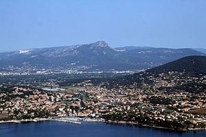
Hyères (French pronunciation: [jɛʁ] ), Provençal Occitan: Ieras in classical norm, or Iero in Mistralian norm) is a commune in the Var department in the Provence-Alpes-Côte d'Azur region in southeastern France. The old town lies 4 km (2.5 mi) from the sea clustered around the Castle of Saint Bernard, which is set on a hill. Between the old town and the sea lies the pine-covered hill of Costebelle, which overlooks the peninsula of Giens.
Toulon–Hyères Airport
Airport in Toulon, France
Distance: Approx. 3451 meters
Latitude and longitude: 43.09722222,6.14611111
Toulon–Hyères Airport (French: Aéroport de Toulon – Hyères, IATA: TLN, ICAO: LFTH) is an airport serving Toulon and Hyeres The airport is located 3 kilometres (2 mi) southeast of Hyères, and 19 kilometres (12 mi) east of Toulon. It is also known as Hyères Le Palyvestre Airport. The airport opened in 1966.
Espace 3000
Distance: Approx. 2160 meters
Latitude and longitude: 43.105,6.129
Espace 3000 is an indoor sporting arena located in Hyères, France. The capacity of the arena is 2,500 people. It is currently home to the Hyères-Toulon Var Basket basketball team.
Carqueiranne
Commune in Provence-Alpes-Côte d'Azur, France
Distance: Approx. 5213 meters
Latitude and longitude: 43.0958,6.0742
Carqueiranne (French: [kaʁkeʁan], locally [kaʁkɛˈʁanə]; Occitan: Carcairana [kaɾkajˈɾanɔ] or Carqueirana [kaɾkejˈɾanɔ]) is a commune in the Var department, administrative region of Provence-Alpes-Côte d'Azur (historically Provence), Southeastern France. It is known now as a tourist seaside resort with good windsurfing nearby, at Almanarre Beach.

Stade Perruc
Distance: Approx. 1429 meters
Latitude and longitude: 43.12027778,6.14194444
The Stade Perruc is a stadium in Hyères, France. It is currently used mostly for football matches and is the home stadium of Hyères FC. It hosted the club's matches in the 1932–33 Division 1, the first professional football season in France. The stadium has a capacity of 1,760.
Costebelle
Hyères town quarter in France
Distance: Approx. 1088 meters
Latitude and longitude: 43.11666667,6.11666667
Costebelle is a quarter of the town of Hyères in the southeast of France, in the Var département.
La Crau
Commune in Provence-Alpes-Côte d'Azur, France
Distance: Approx. 5046 meters
Latitude and longitude: 43.1506,6.0747
La Crau (French pronunciation: [la kʁo]; Occitan: La Crau d'Ieras) is a commune in the Var department in the Provence-Alpes-Côte d'Azur region in southeastern France.
Villa Noailles
Modernist house by Robert Mallet-Stevens
Distance: Approx. 162 meters
Latitude and longitude: 43.1240111,6.12717778
Villa Noailles (French pronunciation: [vi.la no.aj]) is an early modernist house, built by architect Robert Mallet-Stevens for art patrons Charles and Marie-Laure de Noailles, between 1923 and 1927. It is located in the hills above Hyères, in the Var, southeastern France.
Castel Sainte-Claire
Villa in Var, France
Distance: Approx. 345 meters
Latitude and longitude: 43.1211,6.125
The Castel Sainte-Claire is a villa in the hills above Hyères, in the Var Département of France, which was the residence of Olivier Voutier, a French officer who brought the Venus de Milo to France in 1820, and later of the American novelist Edith Wharton. Its garden is classified as one of the Remarkable Gardens of France.
Parc Olbius Riquier
Distance: Approx. 1742 meters
Latitude and longitude: 43.1106,6.1358
Parc Olbius Riquier is a municipal park located in the city of Hyères in the Var Department of France. It is classified by the French Ministry of Culture as one of the Remarkable Gardens of France.

Hyères station
Distance: Approx. 1706 meters
Latitude and longitude: 43.10888889,6.12416667
Gare d'Hyères is a railway station serving the town Hyères, Var department, southeastern France. The station is served by regional trains (TER Provence-Alpes-Côte d'Azur) to Marseille and Toulon.
Canton of Hyères
Distance: Approx. 609 meters
Latitude and longitude: 43.12,6.13
The canton of Hyères is an administrative division of the Var department, southeastern France. It was created at the French canton reorganisation which came into effect in March 2015. Its seat is in Hyères.
Weather in this IP's area
clear sky
17 Celsius
16 Celsius
15 Celsius
17 Celsius
1012 hPa
49 %
1012 hPa
996 hPa
10000 meters
3.13 m/s
5.81 m/s
319 degree
07:32:28
17:09:18


