Country:
Region:
City:
Latitude and Longitude:
Time Zone:
Postal Code:
IP information under different IP Channel
ip-api
Country
Region
City
ASN
Time Zone
ISP
Blacklist
Proxy
Latitude
Longitude
Postal
Route
Luminati
Country
Region
sv
City
dornesti
ASN
Time Zone
Europe/Bucharest
ISP
Dc Fiber Home Srl
Latitude
Longitude
Postal
IPinfo
Country
Region
City
ASN
Time Zone
ISP
Blacklist
Proxy
Latitude
Longitude
Postal
Route
db-ip
Country
Region
City
ASN
Time Zone
ISP
Blacklist
Proxy
Latitude
Longitude
Postal
Route
ipdata
Country
Region
City
ASN
Time Zone
ISP
Blacklist
Proxy
Latitude
Longitude
Postal
Route
Popular places and events near this IP address
Rădăuți
Municipality in Suceava, Romania
Distance: Approx. 6662 meters
Latitude and longitude: 47.8425,25.91916667
Rădăuți (Romanian pronunciation: [rədəˈut͡sʲ]; German: Radautz; Hungarian: Radóc; Polish: Radowce; Ukrainian: Радівці, Radivtsi; Yiddish: ראַדעװיץ Radevits; Turkish: Radoviçe) is a town in Suceava County, north-eastern Romania. It is situated in the historical region of Bukovina. According to the 2021 census, Rădăuți is the second largest urban settlement in the county.

Bogdana Monastery
Distance: Approx. 6773 meters
Latitude and longitude: 47.8426,25.91741389
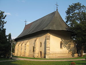
Bogdana Monastery is a Romanian Orthodox monastery in the town of Rădăuți, northern Romania. Its church is the oldest still standing religious building in Moldavia. The monastery was built by Bogdan I of Moldavia (1359–1365) sometime around 1360.

Sucevița (river)
River in Suceava County, Romania
Distance: Approx. 7797 meters
Latitude and longitude: 47.8015,26.0105
The Sucevița is a right tributary of the river Suceava in Romania. It discharges into the Suceava in Milișăuți. Its length is 41 km (25 mi) and its basin size is 199 km2 (77 sq mi).
Volovăț (Sucevița)
River in Suceava County, Romania
Distance: Approx. 7578 meters
Latitude and longitude: 47.8183,25.9334
The Volovăț is a right tributary of the river Sucevița in Romania. It flows into the Sucevița near Rădăuți. Its length is 13 km (8.1 mi) and its basin size is 27 km2 (10 sq mi).

Pozen (river)
River in Suceava County, Romania
Distance: Approx. 5960 meters
Latitude and longitude: 47.8177,26.0051
The Pozen is a right tributary of the river Suceava in Romania. It discharges into the Suceava in the village Satu Mare. Its length is 32 km (20 mi) and its basin size is 148 km2 (57 sq mi).
Climăuț
River in Ukraine, Romania
Distance: Approx. 3470 meters
Latitude and longitude: 47.8944,25.9669
The Climăuț (also: Moise, Ukrainian: Мойсе, romanized: Moise) is a left tributary of the river Suceava in Ukraine and Romania. Its source is located near Stary Vovchynets, Ukraine. The river then crosses the border into Romania, crosses the village of Climăuți, joining the Suceava near the village of Iaz.
Ruda (Suceava)
River in Ukraine, Romania
Distance: Approx. 247 meters
Latitude and longitude: 47.8732,25.9972
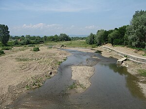
The Ruda is a left tributary of the river Suceava. Its source is located in Ukraine, in the proximity of the village of Bahrynivka. The river then flows across the border into Romania, where it crosses the villages of Baineț, Vicșani, and laz before joining the Suceava near the village of Dornești.

Burla, Suceava
Commune in Suceava, Romania
Distance: Approx. 6662 meters
Latitude and longitude: 47.8425,25.91916667
Burla is a commune located in Suceava County, Romania. It is composed of a single village, Burla, part of Volovăț Commune until 2004, when it was split off.

Satu Mare, Suceava
Commune in Suceava, Romania
Distance: Approx. 6051 meters
Latitude and longitude: 47.81666667,26
Satu Mare (German: Grossdorf) is a commune located in Suceava County, Bukovina, Romania. It is composed of two villages, Satu Mare (German: Deutsch Satulmare) and Țibeni (Hungarian: Istensegíts). From 1776 to 1941, Țibeni village was inhabited by the Székelys of Bukovina.

Bălcăuți, Suceava
Commune in Suceava, Romania
Distance: Approx. 7168 meters
Latitude and longitude: 47.9,26.08333333
Bălcăuți (Ukrainian: Белкеуць; also Балківці) is a commune located in Suceava County, in the historical region of Bukovina, northeastern Romania. It is composed of three villages, namely: Bălcăuți, Gropeni, and Negostina. At the 2011 Romanian census, 70.3% of inhabitants were Ukrainians and 29.6% Romanians.

Dornești
Commune in Suceava, Romania
Distance: Approx. 1503 meters
Latitude and longitude: 47.86666667,26.01666667
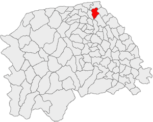
Dornești (German: Kriegsdorf, Hungarian: Hadikfalva, popularly also known in Romanian as Hadic, a shortened form of its Hungarian name) is a commune located in Suceava County, in the historical region of Bukovina, northeastern Romania. It is composed of two villages, Dornești and Iaz. From 1786 to 1941, the village of Dornești was inhabited by the Székelys of Bukovina.
Eudoxiu Hurmuzachi National College
Distance: Approx. 6411 meters
Latitude and longitude: 47.8416,25.9238
Eudoxiu Hurmuzachi National College (Romanian: Colegiul Național Eudoxiu Hurmuzachi) is a high school located at 5 Bucovinei Way, Rădăuți, Romania. In 1865, a fund was established for opening a secondary school in Rădăuți. In 1871, the fund administrators received imperial approval for establishing a Realgymnasium with instruction in German; at the time, the area was part of the Duchy of Bukovina within Austria-Hungary.
Weather in this IP's area
scattered clouds
6 Celsius
6 Celsius
3 Celsius
6 Celsius
1029 hPa
79 %
1029 hPa
987 hPa
10000 meters
0.9 m/s
0.95 m/s
103 degree
26 %
07:03:57
16:55:07

