94.177.130.232 - IP Lookup: Free IP Address Lookup, Postal Code Lookup, IP Location Lookup, IP ASN, Public IP
Country:
Region:
City:
Location:
Time Zone:
Postal Code:
IP information under different IP Channel
ip-api
Country
Region
City
ASN
Time Zone
ISP
Blacklist
Proxy
Latitude
Longitude
Postal
Route
Luminati
Country
Region
eng
City
catterick
ASN
Time Zone
Europe/London
ISP
Razorblue Ltd
Latitude
Longitude
Postal
IPinfo
Country
Region
City
ASN
Time Zone
ISP
Blacklist
Proxy
Latitude
Longitude
Postal
Route
IP2Location
94.177.130.232Country
Region
england
City
north yorkshire
Time Zone
Europe/London
ISP
Language
User-Agent
Latitude
Longitude
Postal
db-ip
Country
Region
City
ASN
Time Zone
ISP
Blacklist
Proxy
Latitude
Longitude
Postal
Route
ipdata
Country
Region
City
ASN
Time Zone
ISP
Blacklist
Proxy
Latitude
Longitude
Postal
Route
Popular places and events near this IP address

Barton-le-Willows
Village and civil parish in North Yorkshire, England
Distance: Approx. 3007 meters
Latitude and longitude: 54.06102,-0.90966
Barton-le-Willows is a village and civil parish in North Yorkshire, England, situated near the River Derwent, about eight miles south-west of Malton. The parish had a population (including Harton) of 186 according to the 2001 census increasing to 284 at the 2011 Census. The village is recorded as Bartun in the Domesday Book.

Bulmer, North Yorkshire
Village and civil parish in North Yorkshire, England
Distance: Approx. 3108 meters
Latitude and longitude: 54.09972222,-0.93305556
Bulmer is a village and civil parish in North Yorkshire, England. According to the 2001 census it had a population of 174, increasing to 202 at the census 2011. The village is about 7 miles (11 km) south-west of Malton.
Flaxton Rural District
Distance: Approx. 2554 meters
Latitude and longitude: 54.052,-0.963
Flaxton was a rural district in the North Riding of Yorkshire from 1894 to 1974. It was formed under the Local Government Act 1894 (56 & 57 Vict. c.

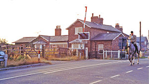
Flaxton railway station
Disused railway station in North Yorkshire, England
Distance: Approx. 1991 meters
Latitude and longitude: 54.061575,-0.972711
Flaxton railway station was a railway station on the York to Scarborough Line serving the village of Flaxton, North Yorkshire, England. It was opened to traffic on 7 July 1845 along with all the other stations on the line. Excluding York it was the seventh busiest station on the line in terms of passenger numbers recording an annual average of 13,502 passengers between 1902 and 1914.

Barton Hill railway station
Disused railway station in North Yorkshire, England
Distance: Approx. 2049 meters
Latitude and longitude: 54.069959,-0.91959
Barton Hill railway station was a minor railway station serving the villages of Barton Hill and Barton-le-Willows in North Yorkshire, England. Located on the York to Scarborough Line it was opened on 5 July 1845 by the York and North Midland Railway. It closed on 22 September 1930.

Foston, North Yorkshire
Village and civil parish in North Yorkshire, England
Distance: Approx. 1135 meters
Latitude and longitude: 54.0775,-0.93416667
Foston is a small village and civil parish in North Yorkshire, England. The population of the civil parish as of the 2011 census was 263. Details are included in the civil parish of Whitwell-on-the-Hill.

Thornton-le-Clay
Village and civil parish in North Yorkshire, England
Distance: Approx. 484 meters
Latitude and longitude: 54.07741,-0.95417
Thornton-le-Clay is a village and civil parish in the Ryedale district of North Yorkshire, England. It is about 8 miles (13 km) north-east of York.

Flaxton, North Yorkshire
Village and civil parish in North Yorkshire, England
Distance: Approx. 2552 meters
Latitude and longitude: 54.05238,-0.96465
Flaxton is a small village and civil parish in North Yorkshire, England. It is close to the A64 between York and Malton. The village lies entirely within a Conservation Area as defined by Planning (Listed Building and Conservation Areas Act) 1990.

Barton Hill, North Yorkshire
Village in North Yorkshire, England
Distance: Approx. 2001 meters
Latitude and longitude: 54.07127,-0.91994
Barton Hill is a village in North Yorkshire, off the A64 road, near Barton-le-Willows. Barton Hill was served by Barton Hill railway station on the York to Scarborough Line between 1845 and 1930.

St Martin's Church, Bulmer
Distance: Approx. 3145 meters
Latitude and longitude: 54.09984,-0.93201
St Martin's Church is the parish church of Bulmer, North Yorkshire, a village in England. The oldest part of the church is the nave, which dates from the 11th century, and may be before or after the Norman Conquest. The chancel dates from the early 12th century, while the south nave door was added in the second half of the century.

Foston Rectory
Distance: Approx. 159 meters
Latitude and longitude: 54.07508,-0.95093
Foston Rectory is a historic building in Foston, North Yorkshire, a village in England. Sydney Smith was appointed as rector of All Saints' Church, Foston in 1806. He wished to build a new rectory, but found architects' quotes to be too expensive.

All Saints' Church, Foston
Anglican church in North Yorkshire, England
Distance: Approx. 1219 meters
Latitude and longitude: 54.0778,-0.933
All Saints' Church is the parish church of Foston, North Yorkshire, a village in England. The church was built in the early 12th century, from which period most of the walls survive. It is known that there was further work on the church in the late 13th century, although nothing from this time survives.
Weather in this IP's area
clear sky
3 Celsius
-1 Celsius
3 Celsius
3 Celsius
1014 hPa
84 %
1014 hPa
1006 hPa
10000 meters
4.05 m/s
10.78 m/s
292 degree
7 %