94.143.90.40 - IP Lookup: Free IP Address Lookup, Postal Code Lookup, IP Location Lookup, IP ASN, Public IP
Country:
Region:
City:
Location:
Time Zone:
Postal Code:
IP information under different IP Channel
ip-api
Country
Region
City
ASN
Time Zone
ISP
Blacklist
Proxy
Latitude
Longitude
Postal
Route
Luminati
Country
Region
gr
City
trin
ASN
Time Zone
Europe/Zurich
ISP
Quickline AG
Latitude
Longitude
Postal
IPinfo
Country
Region
City
ASN
Time Zone
ISP
Blacklist
Proxy
Latitude
Longitude
Postal
Route
IP2Location
94.143.90.40Country
Region
graubunden
City
flims
Time Zone
Europe/Zurich
ISP
Language
User-Agent
Latitude
Longitude
Postal
db-ip
Country
Region
City
ASN
Time Zone
ISP
Blacklist
Proxy
Latitude
Longitude
Postal
Route
ipdata
Country
Region
City
ASN
Time Zone
ISP
Blacklist
Proxy
Latitude
Longitude
Postal
Route
Popular places and events near this IP address

Ruinaulta
Canyon in Switzerland
Distance: Approx. 3967 meters
Latitude and longitude: 46.808138,9.314947
Ruinaulta is a canyon created by the Anterior Rhine by Ilanz/Glion and Reichenau in the debris of the Flims Rockslide just upstream of its confluence with the Posterior Rhine at Reichenau in the Grisons, eastern Switzerland. It is sometimes known as the Rhine Gorge, or sometimes rather ironically called the Swiss Grand Canyon. Protected by cliffs several hundred metres high, the area is forested and a haven for wildlife.

Flims
Municipality in Graubünden, Switzerland
Distance: Approx. 430 meters
Latitude and longitude: 46.83333333,9.28333333
Flims (Romansh: Flem) is a municipality in the Imboden Region in the Swiss canton of Graubünden. The town of Flims is dominated by the Flimserstein which one can see from almost anywhere in the area. Flims consists of the village of Flims (called Flims Dorf) and the hamlets of Fidaz and Scheia as well as Flims-Waldhaus, the initial birthplace of tourism in Flims, where most of the hotels were built before and after around 1900.

Caumasee
Lake in the Grisons, Switzerland
Distance: Approx. 2059 meters
Latitude and longitude: 46.82027778,9.29583333
Caumasee (Romansh: Lag la Cauma or Lai da Cauma) is a lake near Flims, in the Grisons, Switzerland. It is one of the lakes on the Flims Rockslide deposits. The lake is fed from underground sources.

Crestasee
Lake in the Grisons, Switzerland
Distance: Approx. 2846 meters
Latitude and longitude: 46.83166667,9.32111111
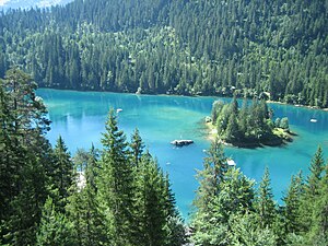
Crestasee (Romansh: Lag la Cresta) is a small lake shared by the municipalities of Flims and Trin in the Grisons, Switzerland. From 1892 a guest house on its northern end served as pension and still is a restaurant today in its original state. There is no tributary to the lake.

Laaxersee
Lake in the Grisons, Switzerland
Distance: Approx. 3847 meters
Latitude and longitude: 46.80805556,9.25722222
Laaxersee or Lag Grond is a lake in the village of Laax, Grisons, Switzerland. Its surface area is 5 ha (12 acres) and maximum depth 5.5 m. Fishing season is from May 1 to September 15.

Fil de Cassons
Mountain in Switzerland
Distance: Approx. 4618 meters
Latitude and longitude: 46.87847222,9.28013889
Fil de Cassons (also known as Cassonsgrat) is a mountain in the Glarus Alps, located near Flims in the canton of Graubünden, Switzerland. The southern face is referred to as "Flimserstein", dominating the appearance of the town of Flims. In its east lies Bargis from where a valley leads to its north face, while to its western face the sliding surface tears off of the biggest visible landslide in the world, Flims Rockslide.

Lag Tuleritg
Part time lake in Flims, Grisons
Distance: Approx. 1796 meters
Latitude and longitude: 46.821,9.283
Lag Tuleritg is a lake at Flims in the canton of Grisons, Switzerland.

Versam-Safien railway station
Railway station in Switzerland
Distance: Approx. 3844 meters
Latitude and longitude: 46.80738,9.3103
Versam-Safien railway station is a station on the Reichenau-Tamins–Disentis/Mustér railway of the Rhaetian Railway in the Swiss canton of Graubünden. It is situated alongside the Anterior Rhine, in the railway's scenic passage through the Ruinaulta or Rhine Gorge. The station is located on the south bank of the river in the municipality of Safiental, and serves the village of Versam that lies some 3.6 km (2.2 mi) to the south and some 250 metres (820 ft) higher than the station.

Lag Prau Pulté
Lake in the Grisons, Switzerland
Distance: Approx. 1393 meters
Latitude and longitude: 46.8266,9.27464
Lag Prau Pulté is a lake at Flims in the canton of Grisons, Switzerland.

Il spir
Platform
Distance: Approx. 3746 meters
Latitude and longitude: 46.813,9.31893
Il Spir is a viewing platform at Conn, a location near Flims in the canton of Graubünden in Switzerland. The platform overlooking the Ruinaulta gorge of the Vorderrhein river was designed by Corinna Menn and opened in 2006. It allows a good view of the gorge and the river lying some 400 meters below.

Belmont Castle, Graubünden
Ruined castle near Flims, Graubünden, Switzerland
Distance: Approx. 3890 meters
Latitude and longitude: 46.84555556,9.33416667
Belmont Castle (German: Burg Belmont) is a ruined castle near Flims, Graubünden, Switzerland. It was the home of the Barons of Belmont.

Lag digl Oberst
Lake in the Grisons, Switzerland
Distance: Approx. 4789 meters
Latitude and longitude: 46.8,9.25277778
Lag digl Obert or Lag Pign is a lake in the village of Laax, Grisons, Switzerland.
Weather in this IP's area
few clouds
-4 Celsius
-10 Celsius
-4 Celsius
-4 Celsius
1029 hPa
73 %
1029 hPa
847 hPa
10000 meters
4.1 m/s
4.93 m/s
226 degree
22 %