94.142.223.47 - IP Lookup: Free IP Address Lookup, Postal Code Lookup, IP Location Lookup, IP ASN, Public IP
Country:
 Germany
Region:
City:
Location:
Time Zone:
Postal Code:
ISP:
ASN:
language:
User-Agent:
Proxy IP:
Blacklist:
IP information under different IP Channel
ip-api
Country
Region
City
ASN
Time Zone
ISP
Blacklist
Proxy
Latitude
Longitude
Postal
Route
db-ip
Country
Region
City
ASN
Time Zone
ISP
Blacklist
Proxy
Latitude
Longitude
Postal
Route
IPinfo
Country
Region
City
ASN
Time Zone
ISP
Blacklist
Proxy
Latitude
Longitude
Postal
Route
IP2Location
94.142.223.47Country
deRegion
bayern
City
wolnzach
Time Zone
Europe/Berlin
ISP
Language
User-Agent
Latitude
Longitude
Postal
ipdata
Country
Region
City
ASN
Time Zone
ISP
Blacklist
Proxy
Latitude
Longitude
Postal
Route
Popular places and events near this IP address

Au in der Hallertau
Municipality in Bavaria, Germany
Distance: Approx. 9975 meters
Latitude and longitude: 48.5575,11.74166667
The municipality of Au in der Hallertau is located in the north of the district of Freising and in the southern part of the Hallertau, in Bavaria, Germany. Au is famous for its important role in hop planting and hop distribution.

Wolnzach
Municipality in Bavaria, Germany
Distance: Approx. 788 meters
Latitude and longitude: 48.6,11.61666667
Wolnzach (German pronunciation: [ˈvɔlntsax], locally [ˈvɔɪntsɔ(x)]) is a municipality in the district of Pfaffenhofen in Bavaria, Germany. It is also a "seal district" ("Siegelbezirk") of the hop-planting area Hallertau, and home of important hops-related institutions such as the German Hops Museum ("Deutsches Hopfenmuseum") and the Hop Research Center Hüll.
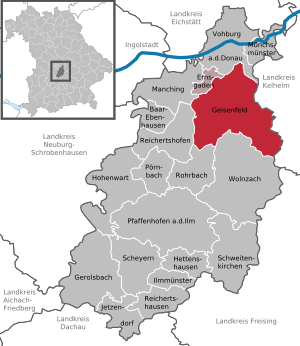
Geisenfeld
Town in Bavaria, Germany
Distance: Approx. 7249 meters
Latitude and longitude: 48.66666667,11.6
Geisenfeld is a town in the district of Pfaffenhofen, in Bavaria, Germany. It is situated on the river Ilm, 16 km (9.94 mi) southeast of Ingolstadt. The town grew up around Geisenfeld Abbey, a convent founded in 1037.

Rohrbach, Bavaria
Municipality in Bavaria, Germany
Distance: Approx. 4575 meters
Latitude and longitude: 48.61666667,11.56666667
Rohrbach (German: [ˈʁoːɐ̯bax] ) is a municipality in the district of Pfaffenhofen in Bavaria in Germany.

Rohr, Pfaffenhofen
Village in Bavaria, Germany
Distance: Approx. 7195 meters
Latitude and longitude: 48.602,11.528
Rohr is a small village in the municipality of Rohrbach in the district of Pfaffenhofen in Upper Bavaria in Bavaria, Germany and had a population of 160 in 2007.

Affalterbach, Pfaffenhofen an der Ilm
Distance: Approx. 8279 meters
Latitude and longitude: 48.56388889,11.53083333
Affalterbach is a village (Ortsteil) of the Bavarian municipality of Pfaffenhofen an der Ilm. There is a fossil site about 800 m northwest of the church; the site has been dated to about 16 million years ago (MN 5) on the basis of the presence of the small rodent Megacricetodon aff. bavaricus and the local stratigraphy.

Geisenfeld Abbey
Distance: Approx. 8891 meters
Latitude and longitude: 48.683256,11.613472
Geisenfeld Abbey (German: Kloster Geisenfeld) was a convent in Bavaria, Germany, in the town of Geisenfeld. It was founded in 1037 and dissolved in 1804. At one time it was one of the most prosperous convents in Bavaria.

Engelbrechtsmünster
Village in Bavaria, Germany
Distance: Approx. 9983 meters
Latitude and longitude: 48.693333,11.633333
Engelbrechtsmünster is a village in Bavaria, Germany, now part of the municipality of Geisenfeld. It lies near the Ilm river.

Rottenegg, Geisenfeld
Village in Bavaria, Germany
Distance: Approx. 5961 meters
Latitude and longitude: 48.65,11.666667
Rottenegg is a village in the Hallertau of Bavaria, Germany. Formerly a separate municipality, it is now part of the municipality of Geisenfeld in the Upper Bavarian district of Pfaffenhofen.

Langenbruck bus crash
Bus crash in Germany in 1985
Distance: Approx. 8709 meters
Latitude and longitude: 48.639,11.52
The Langenbruck bus crash, occurred on 11 February 1985 (1985-02-11), when a double-decker bus carrying up to 40 musicians from the Band of the Royal Air Force Germany (RAFG), crashed on an autobahn between Nuremberg and Munich. The fatal crash happened near to the village of Langenbruck, 18 miles (29 kilometres) north of Munich, in what was West Germany (now Germany). Twenty-one of the occupants were killed in the crash, which included the driver and one RAF policeman, the other 19 were RAF bandsmen.

Rohrbach (Ilm) station
Railway station in Bavaria, Germany
Distance: Approx. 3865 meters
Latitude and longitude: 48.60615,11.57331111
Rohrbach (Ilm) station (German: Bahnhof Rohrbach (Ilm)) is a railway station in the town of Rohrbach, in Bavaria, Germany. Until 2000, it was called Wolnzach Bahnhof after the larger town Wolnzach five kilometers to the east.
Weather in this IP's area
mist
4 Celsius
2 Celsius
4 Celsius
5 Celsius
1017 hPa
93 %
1017 hPa
965 hPa
2500 meters
2.06 m/s
20 degree
75 %