94.142.221.61 - IP Lookup: Free IP Address Lookup, Postal Code Lookup, IP Location Lookup, IP ASN, Public IP
Country:
Region:
City:
Location:
Time Zone:
Postal Code:
ISP:
ASN:
language:
User-Agent:
Proxy IP:
Blacklist:
IP information under different IP Channel
ip-api
Country
Region
City
ASN
Time Zone
ISP
Blacklist
Proxy
Latitude
Longitude
Postal
Route
db-ip
Country
Region
City
ASN
Time Zone
ISP
Blacklist
Proxy
Latitude
Longitude
Postal
Route
IPinfo
Country
Region
City
ASN
Time Zone
ISP
Blacklist
Proxy
Latitude
Longitude
Postal
Route
IP2Location
94.142.221.61Country
Region
bayern
City
bad koetzting
Time Zone
Europe/Berlin
ISP
Language
User-Agent
Latitude
Longitude
Postal
ipdata
Country
Region
City
ASN
Time Zone
ISP
Blacklist
Proxy
Latitude
Longitude
Postal
Route
Popular places and events near this IP address

Rimbach, Upper Palatinate
Municipality in Bavaria, Germany
Distance: Approx. 6766 meters
Latitude and longitude: 49.23083333,12.87944444
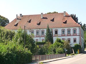
Rimbach is a municipality in the district of Cham (district) in the Upper Palatinate in Bavaria in Germany. Rimbach is a village at the foot of the Hoher Bogen (a seven-peaked mountain ridge in the Northern Bavarian Forest National Park). In the village is the Baroque 'Church of Saint Michael' built in 1719.

Bad Kötzting
Town in Bavaria, Germany
Distance: Approx. 575 meters
Latitude and longitude: 49.17694444,12.855
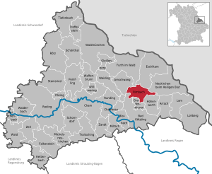
Bad Kötzting (German: [baːt ˈkœt͡stɪŋ] ; before 2005: Kötzting; Northern Bavarian: Bad Ketzing) is a town in the district of Cham, in Bavaria, Germany, near the Czech border. It is situated in the Bavarian Forest, 15 km (9.3 mi) southeast of Cham.
Blaibach
Municipality in Bavaria, Germany
Distance: Approx. 2971 meters
Latitude and longitude: 49.16666667,12.81666667
Blaibach (Northern Bavarian: Bloaba) is a municipality in the district of Cham in Bavaria in Germany.
Grafenwiesen
Municipality in Bavaria, Germany
Distance: Approx. 3211 meters
Latitude and longitude: 49.2,12.86666667
Grafenwiesen is a municipality in the district of Cham in Bavaria in Germany.
Miltach
Municipality in Bavaria, Germany
Distance: Approx. 6993 meters
Latitude and longitude: 49.15,12.76666667
Miltach is a municipality in the district of Cham, which is located in Bavaria, Germany.
Runding
Municipality in Bavaria, Germany
Distance: Approx. 8230 meters
Latitude and longitude: 49.21666667,12.76666667
Runding is a municipality in the district of Cham in Bavaria in Germany.
Prackenbach
Municipality in Bavaria, Germany
Distance: Approx. 8183 meters
Latitude and longitude: 49.1,12.83333333
Prackenbach is a municipality in the district of Regen in Bavaria in Germany.
Hohenwarth
Municipality in Bavaria, Germany
Distance: Approx. 6393 meters
Latitude and longitude: 49.2,12.93333333
Hohenwarth is a municipality in the district of Cham in Bavaria in Germany.
Mittagstein
Mountain in Germany
Distance: Approx. 6168 meters
Latitude and longitude: 49.1738,12.9414
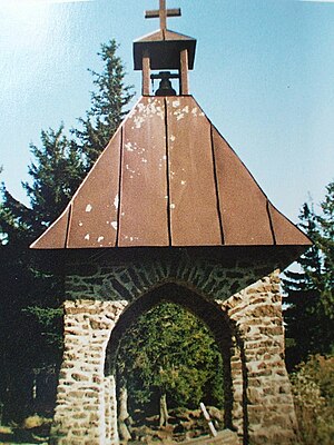
The Mittagstein is a 1,034-metre-high (3,392 ft) mountain peak which rises in the middle of the Kaitersberg in the Bavarian Forest in southern Germany. On its forested summit is a chapel built in memory of those who have fallen in war. There is also a rocky viewpoint with views into the Zeller Valley and across to the Großer Riedelstein.
Kreuzfelsen
Mountain in Germany
Distance: Approx. 4835 meters
Latitude and longitude: 49.17638889,12.92277778
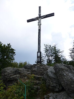
The Kreuzfelsen is a 999 m (3,278 ft) high rock outcrop, that forms the western cornerstone of the Kaitersberg mountain ridge in the Bavarian Forest in southern Germany. From the giant cross on its summit the view sweeps down into the Zeller Valley and over to the town of Bad Kötzting and also far over the western part of the Bavarian Forest. Below the Kreuzfelsen is "Highwayman Heigl's Cave" (Räuber-Heigl's-Höhle), the hideout of a 19th-century robber.

Geodetic Observatory Wettzell
Distance: Approx. 3521 meters
Latitude and longitude: 49.14388889,12.87916667
The Geodetic Observatory Wettzell is located atop the 616 meter-high mountain Wagnerberg, west of the village Wettzell in the German district Cham in the Bavarian Forest.

Kreuzfelsen (Upper Palatine Forest)
Mountain in Germany
Distance: Approx. 4845 meters
Latitude and longitude: 49.1765,12.9229
The Kreuzfelsen is a mountain in the Upper Palatine Forest in Germany, near the border with the Czech Republic. With an elevation of 938 m (3,077 ft), the Kreuzfelsen is the sixth-highest mountain in the Upper Palatine Forest and the highest mountain on the German side of the mountain range. The Kreuzfelsen is located at the southern end of the Upper Palatine Forest, between the cities of Furth im Wald and Waldmünchen.
Weather in this IP's area
clear sky
6 Celsius
5 Celsius
6 Celsius
6 Celsius
1020 hPa
84 %
1020 hPa
953 hPa
10000 meters
1.62 m/s
1.42 m/s
24 degree


