Country:
Region:
City:
Latitude and Longitude:
Time Zone:
Postal Code:
IP information under different IP Channel
ip-api
Country
Region
City
ASN
Time Zone
ISP
Blacklist
Proxy
Latitude
Longitude
Postal
Route
Luminati
Country
ASN
Time Zone
Europe/Madrid
ISP
TELXIUS TELXIUS Cable
Latitude
Longitude
Postal
IPinfo
Country
Region
City
ASN
Time Zone
ISP
Blacklist
Proxy
Latitude
Longitude
Postal
Route
db-ip
Country
Region
City
ASN
Time Zone
ISP
Blacklist
Proxy
Latitude
Longitude
Postal
Route
ipdata
Country
Region
City
ASN
Time Zone
ISP
Blacklist
Proxy
Latitude
Longitude
Postal
Route
Popular places and events near this IP address

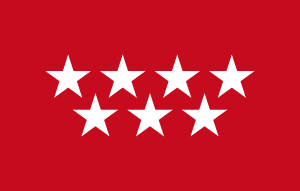
Community of Madrid
Autonomous community of Spain
Distance: Approx. 1663 meters
Latitude and longitude: 40.5,-3.66666667
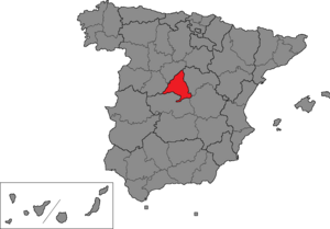
The Community of Madrid (Spanish: Comunidad de Madrid [komuniˈðað ðe maˈðɾið] ) is one of the seventeen autonomous communities of Spain. It is located in the centre of the Iberian Peninsula, and of the Central Plateau (Meseta Central). Its capital and largest municipality is the City of Madrid, which is also the capital of the country.

Madrid (Congress of Deputies constituency)
Constituency of the Spanish Congress of Deputies
Distance: Approx. 1663 meters
Latitude and longitude: 40.5,-3.66666667
Madrid is one of the 52 constituencies (Spanish: circunscripciones) represented in the Congress of Deputies, the lower chamber of the Spanish parliament, the Cortes Generales. The constituency currently elects 36 deputies. Its boundaries correspond to those of the Spanish province of Madrid.

Distrito Telefónica
Offices in Madrid, Spain
Distance: Approx. 163 meters
Latitude and longitude: 40.51472222,-3.66333333
Distrito Telefónica is the headquarters of the Spanish telecom company Telefónica, S.A. in Las Tablas, a neighborhood in the Fuencarral-El Pardo district of Madrid, Spain, accessible from the A-1 "Autovía del Norte" and the M-40 ring road. The complex was known as Distrito C or Distrito de las Comunicaciones ("Communications District") until 2011.

La Moraleja
Affluent residential district of Alcobendas municipality in Spain
Distance: Approx. 1972 meters
Latitude and longitude: 40.515,-3.64194444
La Moraleja [la mo.ɾaˈle.xa] is an affluent residential district of Alcobendas municipality in northern Community of Madrid, Spain, in the Madrid metropolitan area; located next to El Soto and El Encinar de los Reyes. The Spanish version of Greenwich, it is home to some of Spain's wealthiest people with sprawling mansions and several luxury golf courses such as La Moraleja Golf Club Madrid. One author describes it as a "moneyed enclave of the rich and famous, including politicians, actors, top businessmen" with property prices which "range from the merely extortionate to the outright laughable." People such as Rocío Jurado, Isabel Pantoja, José Antonio Camacho, Lola Flores, Ava Gardner, David Beckham, Bing Crosby, Karim Benzema, Ronaldo, Ana Obregón, Belinda Peregrín Schüll, and Gonzalo Higuaín live or have lived in La Moraleja.

Ronda de la Comunicación (Madrid Metro)
Madrid Metro station
Distance: Approx. 221 meters
Latitude and longitude: 40.5155389,-3.6627708
Ronda de la Comunicación [ˈronda ðe la komunikaˈθjon] is a station on Line 10 of the Madrid Metro, located under the Ronda de la Comunicación ("Communication Ring Road").

Las Tablas (Madrid Metro)
Madrid Metro station
Distance: Approx. 813 meters
Latitude and longitude: 40.5083299,-3.669439
Las Tablas [las ˈtaβlas] is a station on Line 10 of the Madrid Metro and Line 1 of the Metro Ligero, serving the Las Tablas barrio.
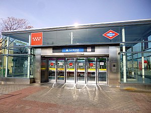
La Granja (Madrid Metro)
Madrid Metro station
Distance: Approx. 1521 meters
Latitude and longitude: 40.5275987,-3.6585919
La Granja [la ˈɣɾaŋxa] is a station on Line 10 of the Madrid Metro, on the Calle de la Granja ("Farm Street"). It is located in fare Zone B1.

Palas de Rey (Madrid Metro)
Distance: Approx. 1054 meters
Latitude and longitude: 40.5054357,-3.6650673
Palas de Rey [ˈpalas ðe ˈrej] is a station on Line 1 of the Metro Ligero.

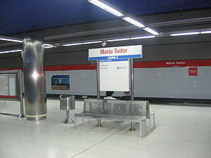
María Tudor (Madrid Metro)
Distance: Approx. 2046 meters
Latitude and longitude: 40.4971648,-3.6588846
María Tudor [maˈɾi.a tuˈðoɾ] is a station on Line 1 of the Metro Ligero.

Valverde (Madrid)
City neighborhood in Madrid, Spain
Distance: Approx. 2014 meters
Latitude and longitude: 40.50583333,-3.68583333
Valverde is an administrative neighborhood (barrio) of Madrid belonging to the district of Fuencarral-El Pardo. It has an area of 8.977802 km2 (3.466349 sq mi). As of 1 March 2020, it has a population of 65,022.

Madrid (Senate constituency)
Distance: Approx. 1663 meters
Latitude and longitude: 40.5,-3.66666667
Madrid is one of the 59 constituencies (Spanish: circunscripciones) represented in the Senate of Spain, the upper chamber of the Spanish parliament, the Cortes Generales. The constituency elects four senators. Its boundaries correspond to those of the Spanish province of Madrid.
1992 World Cup (men's golf)
Golf tournament
Distance: Approx. 1972 meters
Latitude and longitude: 40.515,-3.64194444
The 1992 World Cup took place 5–8 November 1992 at the Real Club La Moraleja in Madrid, Spain. It was the 38th World Cup event. The tournament was a 72-hole stroke play team event.
Weather in this IP's area
broken clouds
15 Celsius
14 Celsius
13 Celsius
16 Celsius
1021 hPa
83 %
1021 hPa
939 hPa
10000 meters
2.06 m/s
40 degree
75 %
07:48:25
18:08:01
