Country:
Region:
City:
Latitude and Longitude:
Time Zone:
Postal Code:
IP information under different IP Channel
ip-api
Country
Region
City
ASN
Time Zone
ISP
Blacklist
Proxy
Latitude
Longitude
Postal
Route
Luminati
Country
Region
idf
City
paris
ASN
Time Zone
Europe/Paris
ISP
VERIXI SA
Latitude
Longitude
Postal
IPinfo
Country
Region
City
ASN
Time Zone
ISP
Blacklist
Proxy
Latitude
Longitude
Postal
Route
db-ip
Country
Region
City
ASN
Time Zone
ISP
Blacklist
Proxy
Latitude
Longitude
Postal
Route
ipdata
Country
Region
City
ASN
Time Zone
ISP
Blacklist
Proxy
Latitude
Longitude
Postal
Route
Popular places and events near this IP address
Charenton-le-Pont
Commune in Île-de-France, France
Distance: Approx. 671 meters
Latitude and longitude: 48.8265,2.405
Charenton-le-Pont (French pronunciation: [ʃaʁɑ̃tɔ̃ lə pɔ̃] ) is a commune situated to the southeast of Paris, France. It is located 6.2 km (3.9 mi) from the centre of Paris, to the north of the confluence of the Seine and Marne rivers; the Pont (French for 'Bridge') part of the name refers to the stone bridge across the Marne. It is one of the most densely populated municipalities in Europe.

Porte Dorée station
Metro station in Paris, France
Distance: Approx. 369 meters
Latitude and longitude: 48.835481,2.4061
Porte Dorée (French pronunciation: [pɔʁt dɔʁe]) is a station on line 8 of the Paris Métro in the 12th arrondissement. The station opened on 5 May 1931 with the extension of the line from Richelieu–Drouot to Porte de Charenton. It is named after the Porte Dorée, one of the former gates of Paris.

Porte de Charenton station
Metro station in Paris, France
Distance: Approx. 523 meters
Latitude and longitude: 48.83278,2.4004
Porte de Charenton (French pronunciation: [pɔʁt də ʃaʁɑ̃tɔ̃]) is a station on Line 8 of the Paris Métro located in the 12th arrondissement of Paris.

Liberté station
Metro station in Paris, France
Distance: Approx. 715 meters
Latitude and longitude: 48.825882,2.407022
Liberté (French pronunciation: [libɛʁte] ) is a station on line 8 of the Paris Métro in the commune of Charenton-le-Pont. It is named after the nearby avenue de la Liberté which runs above the station, it refers to the motto of the France: Liberté, égalité, fraternité.

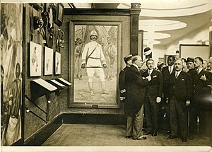
Paris Colonial Exposition
Paris Exposition of 1931
Distance: Approx. 515 meters
Latitude and longitude: 48.8307,2.4141
The Paris Colonial Exhibition (or "Exposition coloniale internationale", International Colonial Exhibition) was a six-month colonial exhibition held in Paris, France, in 1931 that attempted to display the diverse cultures and immense resources of France's colonial possessions.
Musée national des Arts d'Afrique et d'Océanie
Distance: Approx. 361 meters
Latitude and longitude: 48.83527778,2.40944444
The Musée national des Arts d'Afrique et d'Océanie (National Museum of Arts of Africa and Oceania) was a museum formerly located in the Palais de la Porte Dorée on the edge of the Bois de Vincennes at 293, avenue Daumesnil in the 12th arrondissement of Paris, France. The museum began as the colonial exhibition of 1931, was renamed in 1935 the Musée de la France d’Outre-mer, then in 1960 the Musée des Arts africains et océaniens, and finally in 1990 the Musée national des Arts d'Afrique et d'Océanie. In 2003 the museum's collection was merged into the Musée du quai Branly, and in its place the Palais de la Porte Dorée now houses the Cité nationale de l'histoire de l'immigration.

Palais de la Porte Dorée
Museum and aquarium in Paris
Distance: Approx. 361 meters
Latitude and longitude: 48.83527778,2.40944444
The Palais de la Porte Dorée (French pronunciation: [palɛ də la pɔʁt dɔʁe], literally Palace of the Golden Gate) is an exhibit hall located on the edge of the Bois de Vincennes at 293, avenue Daumesnil, 12th arrondissement of Paris, France. It now houses the Musée de l'Histoire de l'Immigration, as well as a tropical aquarium in its cellar. The building was constructed for the Paris Colonial Exposition of 1931 to designs by French architect Albert Laprade, Léon Jaussely and Léon Bazin.

Cité nationale de l'histoire de l'immigration
Museum in Paris, France
Distance: Approx. 361 meters
Latitude and longitude: 48.83527778,2.40944444
The Cité nationale de l'histoire de l'immigration is a museum of immigration history located in the 12th arrondissement of Paris at 293, avenue Daumesnil. The nearest métro station is Porte Dorée. It is open Tuesday through Friday from 10 a.m.
Lac Daumesnil
Lake in bois de Vincennes, Paris, France
Distance: Approx. 621 meters
Latitude and longitude: 48.830556,2.415556
Lac Daumesnil is a lake in the Bois de Vincennes, a public park in Paris, France. Its surface area is 0.12 km2. It is surrounded by "promenade Maurice Boitel".

Pagode de Vincennes
Distance: Approx. 686 meters
Latitude and longitude: 48.82861111,2.415
The Pagode du bois de Vincennes is the seat of the Institut international bouddhique founded by Jean Sainteny who was the manager of the institute. It is located in a former building of the exposition coloniale de 1931, designed by the architect Louis-Hippolyte Boileau. On this 8 000 m2 site on the edge of the lac Daumesnil are located two buildings of remarkable architecture.

Kagyu-Dzong
Buddhist temple located in Paris, France
Distance: Approx. 633 meters
Latitude and longitude: 48.82877778,2.41427778
The Kagyu-Dzong center is a Buddhist center in Paris, affiliated to the Karma Kagyu school of Tibetan Buddhism. This center is linked to the 17th Karmapa, Orgyen Trinley Dorje.

Château de Bercy
Distance: Approx. 643 meters
Latitude and longitude: 48.82873,2.4006
The Château de Bercy was a Louis XIII château located in Bercy, a part of modern-day Charenton-le-Pont in Paris, France.
Weather in this IP's area
fog
8 Celsius
6 Celsius
7 Celsius
8 Celsius
1022 hPa
99 %
1022 hPa
1016 hPa
500 meters
2.06 m/s
130 degree
100 %
07:43:59
17:23:56

