Country:
Region:
City:
Latitude and Longitude:
Time Zone:
Postal Code:
IP information under different IP Channel
ip-api
Country
Region
City
ASN
Time Zone
ISP
Blacklist
Proxy
Latitude
Longitude
Postal
Route
Luminati
Country
Region
30
City
kyiv
ASN
Time Zone
Europe/Kyiv
ISP
gigatrans Ukraine, LLC
Latitude
Longitude
Postal
IPinfo
Country
Region
City
ASN
Time Zone
ISP
Blacklist
Proxy
Latitude
Longitude
Postal
Route
db-ip
Country
Region
City
ASN
Time Zone
ISP
Blacklist
Proxy
Latitude
Longitude
Postal
Route
ipdata
Country
Region
City
ASN
Time Zone
ISP
Blacklist
Proxy
Latitude
Longitude
Postal
Route
Popular places and events near this IP address

Boiarka
City in Kyiv Oblast, Ukraine
Distance: Approx. 7290 meters
Latitude and longitude: 50.32916667,30.28861111
Boiarka or Boyarka (Ukrainian: Боярка) is a city in Fastiv Raion of Kyiv Oblast (region) of Ukraine, about 20 km SW from Kyiv. It hosts the administration of Boiarka urban hromada, one of the hromadas of Ukraine. Population: 34,394 (2022 estimate).

Vasylkiv Air Base
Ukrainian Air Force
Distance: Approx. 4903 meters
Latitude and longitude: 50.23333333,30.3
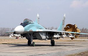
Vasylkiv (also Vasyl'kiv) was an air base of the Ukrainian Air Force located near Vasylkiv, Kyiv Oblast, Ukraine. The base was home to the 40th Tactical Aviation Brigade.
Hlevakha
Rural locality in Kyiv Oblast, Ukraine
Distance: Approx. 3433 meters
Latitude and longitude: 50.26222222,30.28944444
Hlevakha (Ukrainian: Глеваха) is a rural settlement in Fastiv Raion of Kyiv Oblast (region) of Ukraine. It hosts the administration of Hlevakha settlement hromada, one of the hromadas of Ukraine. Population: 8,800 (2022 estimate).
Zelenyi Bir
Distance: Approx. 3380 meters
Latitude and longitude: 50.25,30.37
Zelenyi Bir is a small village in Fastiv Raion, Kyiv Oblast of central Ukraine. It belongs to Hlevakha settlement hromada, one of the hromadas of Ukraine. Zelenyi Bir has 794 inhabitants.
Krushynka
Rural locality in Kyiv Oblast, Ukraine
Distance: Approx. 5112 meters
Latitude and longitude: 50.23055556,30.36972222
Krushynka (Ukrainian: Крушинка) is a small village in Fastiv Raion in the Kyiv Oblast (province) of northern Ukraine. It belongs to Hlevakha settlement hromada, one of the hromadas of Ukraine. Krushynka has 347 inhabitants.

Chabany
Rural locality in Kyiv Oblast, Ukraine
Distance: Approx. 9890 meters
Latitude and longitude: 50.34027778,30.42277778
Chabany (Ukrainian: Чабани) is a rural settlement in Fastiv Raion of Kyiv Oblast (province), located on the southern border of Kyiv. It hosts the administration of Chabany settlement hromada, one of the hromadas of Ukraine. Population: 5,334 (2022 estimate).
Kalynivka, Fastiv Raion, Kyiv Oblast
Rural locality in Kyiv Oblast, Ukraine
Distance: Approx. 8952 meters
Latitude and longitude: 50.22555556,30.23194444
Kalynivka (Ukrainian: Калинівка) is a rural settlement in Fastiv Raion (district) of Kyiv Oblast (region) in northern Ukraine. It hosts the administration of Kalynivka settlement hromada, one of the hromadas of Ukraine. Its population was 5,704 as of 2001 Ukrainian Census.
Putrivka
Rural locality in Kyiv Oblast, Ukraine
Distance: Approx. 8634 meters
Latitude and longitude: 50.20416667,30.27416667
Putrivka (Ukrainian: Путрівка) is a village in the Fastiv Raion, Kyiv Oblast, Ukraine. It belongs to Hlevakha settlement hromada, one of the hromadas of Ukraine. The village has a population of 1,567.
Markhalivka
Rural locality in Kyiv Oblast, Ukraine
Distance: Approx. 2618 meters
Latitude and longitude: 50.27388889,30.37222222
Markhalivka (Ukrainian: Мархалівка) is a village in Fastiv Raion of Kyiv Oblast, Ukraine. It belongs to Hlevakha settlement hromada, one of the hromadas of Ukraine. The population is 1316 people.
Weather in this IP's area
broken clouds
7 Celsius
3 Celsius
7 Celsius
7 Celsius
1028 hPa
50 %
1028 hPa
1004 hPa
10000 meters
5.39 m/s
12.03 m/s
269 degree
83 %
06:56:03
16:28:26
