94.124.210.8 - IP Lookup: Free IP Address Lookup, Postal Code Lookup, IP Location Lookup, IP ASN, Public IP
Country:
Region:
City:
Location:
Time Zone:
Postal Code:
IP information under different IP Channel
ip-api
Country
Region
City
ASN
Time Zone
ISP
Blacklist
Proxy
Latitude
Longitude
Postal
Route
Luminati
Country
Region
bw
City
nagold
ASN
Time Zone
Europe/Berlin
ISP
NetCom BW GmbH
Latitude
Longitude
Postal
IPinfo
Country
Region
City
ASN
Time Zone
ISP
Blacklist
Proxy
Latitude
Longitude
Postal
Route
IP2Location
94.124.210.8Country
Region
baden-wurttemberg
City
echterdingen
Time Zone
Europe/Berlin
ISP
Language
User-Agent
Latitude
Longitude
Postal
db-ip
Country
Region
City
ASN
Time Zone
ISP
Blacklist
Proxy
Latitude
Longitude
Postal
Route
ipdata
Country
Region
City
ASN
Time Zone
ISP
Blacklist
Proxy
Latitude
Longitude
Postal
Route
Popular places and events near this IP address
SchwabenQuellen
Distance: Approx. 3815 meters
Latitude and longitude: 48.722364,9.160837
Schwaben Quellen (in English, "Swabian Springs") is a large spa/waterpark complex located in Stuttgart, Germany. The Schwaben Quellen is associated with the SI-Centrum (Stuttgart International Centrum), an entertainment complex in Stuttgart. It is a member of the European Waterparks Association (EWA), and provides saunas, steamrooms, and various kinds of baths.

Filderstadt
Town in Baden-Württemberg, Germany
Distance: Approx. 3822 meters
Latitude and longitude: 48.68027778,9.21833333
Filderstadt (German pronunciation: [ˈfɪldɐˌʃtat] ; Swabian: Fildorsdadd) is a town in the district of Esslingen in Baden-Württemberg in southern Germany. It is located approximately 13 km south of Stuttgart. Filderstadt is located next to the Stuttgart Airport and the new Trade Fair.

Leinfelden-Echterdingen
Town in Baden-Württemberg, Germany
Distance: Approx. 1902 meters
Latitude and longitude: 48.69277778,9.14277778
Leinfelden-Echterdingen (Swabian: Laefälda-Ächdordeng) is a town in the district of Esslingen, in Baden-Württemberg, Germany. It is located approximately 10 km south of Stuttgart, near the Stuttgart Airport and directly adjacent to the newly built Stuttgart Trade Fair. The town was formed on 1 January 1975 by the merging of four former municipalities: Leinfelden, Echterdingen, Musberg and Stetten auf den Fildern.
Stuttgart Institute of Management and Technology
Distance: Approx. 3508 meters
Latitude and longitude: 48.7113273,9.2005504
The Stuttgart Institute of Management and Technology (SIMT) was founded in 1998 as an international Business School and Further Education Institute offering both full-time and part-time programs leading to the academic degree "Master of Business Administration (MBA)" of the Universität Stuttgart. The cooperation of both higher education institutions also includes further education programs in the fields of Business Administration, Engineering, Natural and Social Sciences. SIMT is an advanced education institute of the Steinbeis University Berlin (SHB).
Messe Stuttgart convention center
Messe Stuttgart convention center in Stuttgart, Baden-Württemberg, Germany
Distance: Approx. 1522 meters
Latitude and longitude: 48.69361111,9.18694444
Messe Stuttgart is a convention center next to Stuttgart Airport, 12 km south of Stuttgart, Germany. It is the ninth-biggest convention center in Germany. The new Messe Stuttgart site, completed in 2007, is right next to the A8 autobahn (highway).

Landesarboretum Baden-Württemberg
Distance: Approx. 3733 meters
Latitude and longitude: 48.7083,9.2087
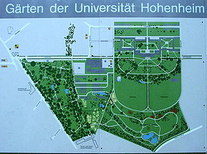
The Landesarboretum Baden-Württemberg (16.5 hectares) is a historic arboretum and part of the Hohenheim Gardens maintained by the University of Hohenheim, on Garbenstrasse in the Hohenheim district of Stuttgart, Baden-Württemberg, Germany. The arboretum was begun as a landscape garden in the years 1776-1793 by Karl Eugen, Duke of Württemberg, on a site southwest of Schloss Hohenheim. It contained two major collections - a botanical garden of plants from the Württemberg region, and an arboretum of North American trees (the Exotischer Garten) - which by 1783 contained a total of 120 species.
Stuttgart Flughafen/Messe station
Station on the network of the Stuttgart S-Bahn
Distance: Approx. 1601 meters
Latitude and longitude: 48.69,9.18944444
Stuttgart Flughafen/Messe (German for Stuttgart Airport/Trade Fair) station is a station on the network of the Stuttgart S-Bahn. Despite its name the station is not in the city of Stuttgart, rather it is in Leinfelden-Echterdingen.
Oberaichen station
Railway station in Leinfelden-Echterdingen, Germany
Distance: Approx. 3490 meters
Latitude and longitude: 48.705,9.1275
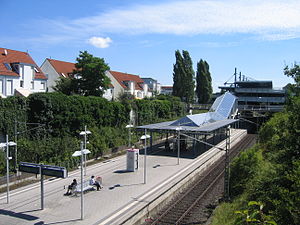
Oberaichen station is located in Leinfelden-Echterdingen at the 18.9 kilometre point of the Stuttgart-Rohr–Filderstadt railway in the German state of Baden-Württemberg and is a station on the Stuttgart S-Bahn network.

Leinfelden station
Railway station in Leinfelden-Echterdingen, Germany
Distance: Approx. 2061 meters
Latitude and longitude: 48.69638889,9.1425
Leinfelden station is located in Leinfelden-Echterdingen at the 20.6 kilometre point of the Stuttgart-Rohr–Filderstadt railway in the German state of Baden-Württemberg and is a station on the Stuttgart S-Bahn network. From 23 June 1928 to 1 October 1971, Leinfelden was at the junction of the Siebenmuehlental Railway (dismantled 1972) and the Rohr–Neuhausen line. Passenger services ended on both lines on 22 May 1955.

Echterdingen station
Railway station in Leinfelden-Echterdingen, Baden-Württemberg, Germany
Distance: Approx. 413 meters
Latitude and longitude: 48.69194444,9.16944444
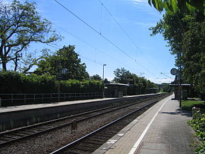
Echterdingen station is located in Leinfelden-Echterdingen at the 22.7 kilometre point of the Stuttgart-Rohr–Filderstadt railway in the German state of Baden-Württemberg and is a station on the Stuttgart S-Bahn network.
Plieningen
Borough of Stuttgart in Baden-Württemberg, Germany
Distance: Approx. 3450 meters
Latitude and longitude: 48.701,9.2107
Plieningen is the southernmost borough (Stadtbezirk) of Stuttgart in the state of Baden-Württemberg. Plieningen is located about 10 kilometres (6.2 mi) from the city center of Stuttgart on the Filder Plain. Schloss Hohenheim, part of the Stuttgart Airport, and the parking garage for the Stuttgart Trade Fair are located here.

German Playing Card Museum
Museum in Baden-Württemberg, Germany
Distance: Approx. 2163 meters
Latitude and longitude: 48.69015,9.13848
The German Playing Card Museum (German: Deutsches Spielkartenmuseum) in Leinfelden-Echterdingen is a branch of the Württemberg State Museum and houses one of the largest public playing cards collections in Europe. It is open to all ludologists and those with private interests. Playing cards are systematically collected, archived and researched.
Weather in this IP's area
clear sky
-1 Celsius
-3 Celsius
-2 Celsius
0 Celsius
1037 hPa
87 %
1037 hPa
985 hPa
10000 meters
1.54 m/s
350 degree


