94.101.40.202 - IP Lookup: Free IP Address Lookup, Postal Code Lookup, IP Location Lookup, IP ASN, Public IP
Country:
Region:
City:
Location:
Time Zone:
Postal Code:
IP information under different IP Channel
ip-api
Country
Region
City
ASN
Time Zone
ISP
Blacklist
Proxy
Latitude
Longitude
Postal
Route
Luminati
Country
Region
sn
City
leipzig
ASN
Time Zone
Europe/Berlin
ISP
HL komm Telekommunikations GmbH
Latitude
Longitude
Postal
IPinfo
Country
Region
City
ASN
Time Zone
ISP
Blacklist
Proxy
Latitude
Longitude
Postal
Route
IP2Location
94.101.40.202Country
Region
bayern
City
markt
Time Zone
Europe/Berlin
ISP
Language
User-Agent
Latitude
Longitude
Postal
db-ip
Country
Region
City
ASN
Time Zone
ISP
Blacklist
Proxy
Latitude
Longitude
Postal
Route
ipdata
Country
Region
City
ASN
Time Zone
ISP
Blacklist
Proxy
Latitude
Longitude
Postal
Route
Popular places and events near this IP address

Thierhaupten Abbey
Distance: Approx. 8505 meters
Latitude and longitude: 48.56138889,10.91138889
Thierhaupten Abbey (German: Kloster Thierhaupten) was a Benedictine monastery in Thierhaupten near the Lech River and near Augsburg in Bavaria, Germany.
Meitingen
Municipality in Bavaria, Germany
Distance: Approx. 2218 meters
Latitude and longitude: 48.53333333,10.83333333
Meitingen is a market town in the district of Augsburg, in Bavaria, Germany. It is situated on the left bank of the Lech, 20 km (12 mi) south of Donauwörth, and 21 km (13 mi) north of Augsburg.
Biberbach, Bavaria
Municipality in Bavaria, Germany
Distance: Approx. 2226 meters
Latitude and longitude: 48.51666667,10.81666667
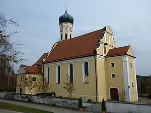
Biberbach is a municipality in the northern part of the district of Augsburg in Bavaria in Germany. A famous baroque pilgrimage church (Holy Cross) is located on the hill above the village. First mentioned in 1070, the village was part of the Duchy of Swabia.
Nordendorf
Municipality in Bavaria, Germany
Distance: Approx. 7609 meters
Latitude and longitude: 48.6,10.83333333
Nordendorf is a municipality in the district of Augsburg in Bavaria in Germany.
Westendorf (Schmutter)
Municipality in Bavaria, Germany
Distance: Approx. 4200 meters
Latitude and longitude: 48.56666667,10.83333333
Westendorf is a municipality in the district of Augsburg in Bavaria in Germany. It lies on the river Schmutter.

Laugna
Municipality in Bavaria, Germany
Distance: Approx. 7616 meters
Latitude and longitude: 48.53333333,10.7
Laugna is a municipality in the district of Dillingen in Bavaria in Germany. The town is a member of the municipal association Wertingen.
Ehingen, Swabia
Municipality in Bavaria, Germany
Distance: Approx. 7284 meters
Latitude and longitude: 48.6,10.8
Ehingen is a municipality in the district of Augsburg in Bavaria in Germany.

Kühlenthal
Municipality in Bavaria, Germany
Distance: Approx. 3703 meters
Latitude and longitude: 48.56666667,10.81666667
Kühlenthal is a municipality in the district of Augsburg in Bavaria in Germany.
Langweid am Lech
Municipality in Bavaria, Germany
Distance: Approx. 6666 meters
Latitude and longitude: 48.48333333,10.85
Langweid am Lech is a municipality and a village in the district of Augsburg in Bavaria, Germany. The municipality is located on the river Lech, 9 miles north of Augsburg. On 28 July 2023, three people were killed and two others injured in a spree shooting.
Aindlinger Baggersee
A lake in Bavaria, Germany
Distance: Approx. 6175 meters
Latitude and longitude: 48.51788333,10.88316111
Aindlinger Baggersee is a lake in Swabia, Bavaria, Germany. At an elevation of 434 m, its surface area is 9 ha. It is just west of the town Todtenweis.
Erlingen
Ortsteil of Meitingen in Bavaria, Germany
Distance: Approx. 2772 meters
Latitude and longitude: 48.52968,10.840156
Erlingen is a small village and also an Ortsteil of the municipality Meitingen. The village belongs to the administrative district Augsburg in Bavaria, southern Germany. It is located between the cities Augsburg and Donauwörth.

Holzen Abbey
Distance: Approx. 7791 meters
Latitude and longitude: 48.60419444,10.8145
Holzen Abbey (Kloster Holzen) was a convent of Benedictine nuns situated in the village of Holzen (west of the B2 at Nordendorf above the Schmutter) in Allmannshofen in Bavaria, Germany.
Weather in this IP's area
clear sky
-3 Celsius
-5 Celsius
-3 Celsius
-2 Celsius
1039 hPa
80 %
1039 hPa
980 hPa
10000 meters
1.54 m/s
280 degree


