Country:
 Italy
ItalyRegion:
City:
Latitude and Longitude:
Time Zone:
Postal Code:
IP information under different IP Channel
ip-api
Country
Region
City
ASN
Time Zone
ISP
Blacklist
Proxy
Latitude
Longitude
Postal
Route
IPinfo
Country
Region
City
ASN
Time Zone
ISP
Blacklist
Proxy
Latitude
Longitude
Postal
Route
MaxMind
Country
Region
City
ASN
Time Zone
ISP
Blacklist
Proxy
Latitude
Longitude
Postal
Route
Luminati
Country
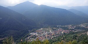
ITRegion
21
City
dronero
ASN
Time Zone
Europe/Rome
ISP
ISI Line srl
Latitude
Longitude
Postal
db-ip
Country
Region
City
ASN
Time Zone
ISP
Blacklist
Proxy
Latitude
Longitude
Postal
Route
ipdata
Country
Region
City
ASN
Time Zone
ISP
Blacklist
Proxy
Latitude
Longitude
Postal
Route
Popular places and events near this IP address
Caraglio
Comune in Piedmont, Italy
Distance: Approx. 7956 meters
Latitude and longitude: 44.41666667,7.43333333
Caraglio is a comune (municipality) in the Province of Cuneo in the Italian region Piedmont, located about 80 kilometres (50 mi) southwest of Turin and about 10 kilometres (6 mi) northwest of Cuneo. As of 1 January 2018, it had a population of 6,782 and an area of 41.68 square kilometres (16.09 sq mi). The municipality of Caraglio contains the frazioni (subdivisions, mainly villages and hamlets) Bottonasco, Cascina Bianca, Cascina Sottana, Grassini, Monturone, Oltre Grana, Palazzasso, Paschera San Carlo (Soprana), Paschera San Defendente (Sottana), Roata Bacias, Roata Borghi, Roata Bruno, Roata Chiabò, Roata Delfino, Roata Fresia, Roata Galliano, Roata Ghio, Roata Lorenzot, Roata Muschia, Rosata Armando, San Lorenzo, Tetto Bellino, Tetto Bianco, Tetto Boscasi.

Cartignano
Comune in Piedmont, Italy
Distance: Approx. 6351 meters
Latitude and longitude: 44.48333333,7.28333333
Cartignano is a comune (municipality) in the Province of Cuneo in the Italian region Piedmont, located about 70 kilometres (43 mi) southwest of Turin and about 25 kilometres (16 mi) northwest of Cuneo. Cartignano borders the following municipalities: Dronero, Melle, Roccabruna, and San Damiano Macra.
Pradleves
Comune in Piedmont, Italy
Distance: Approx. 8000 meters
Latitude and longitude: 44.41666667,7.28333333
Pradleves is a comune (municipality) in the Province of Cuneo in the Italian region Piedmont, located about 80 kilometres (50 mi) southwest of Turin and about 20 kilometres (12 mi) west of Cuneo. As of 31 December 2004, it had a population of 306 and an area of 19.2 square kilometres (7.4 sq mi). Pradleves borders the following municipalities: Castelmagno, Demonte, Dronero, and Monterosso Grana.

Roccabruna
Comune in Piedmont, Italy
Distance: Approx. 4456 meters
Latitude and longitude: 44.5,7.33333333
Roccabruna (Italian pronunciation: [ˌrɔkkaˈbruːna]; Occitan: La Ròcha de Draonier or Ròcabruna; Piedmontese: La Ròcia ëd Droné) is a commune in the Province of Cuneo and the Italian region of Piedmont, located about 70 kilometres (43 mi) southwest of Turin and about 20 kilometres (12 mi) northwest of Cuneo. Roccabruna borders the following municipalities: Cartignano, Dronero, Melle, San Damiano Macra, Busca and Villar San Costanzo.

Rossana, Piedmont
Comune in Piedmont, Italy
Distance: Approx. 9704 meters
Latitude and longitude: 44.53333333,7.43333333
Rossana is a comune (municipality) in the Province of Cuneo in the Italian region Piedmont, located about 60 kilometres (37 mi) southwest of Turin and about 20 kilometres (12 mi) northwest of Cuneo. As of 31 December 2004, it had a population of 950 and an area of 19.9 square kilometres (7.7 sq mi). Rossana borders the following municipalities: Busca, Costigliole Saluzzo, Piasco and Venasca.
San Damiano Macra
Comune in Piedmont, Italy
Distance: Approx. 8891 meters
Latitude and longitude: 44.48333333,7.25
San Damiano Macra (Occitan: Sant Damian; Piedmontese: San Damian) is a comune (municipality) in the Province of Cuneo in the Italian region of Piedmont, located about 70 kilometres (43 mi) southwest of Turin and about 25 kilometres (16 mi) northwest of Cuneo. San Damiano Macra borders the following municipalities: Cartignano, Castelmagno, Celle di Macra, Dronero, Frassino, Macra, Melle, Roccabruna, and Sampeyre.

Valmala, Piedmont
Frazione in Piedmont, Italy
Distance: Approx. 9565 meters
Latitude and longitude: 44.55,7.35
Valmala was a comune (municipality) in the Province of Cuneo in the Italian region Piedmont, located about 60 kilometres (37 mi) southwest of Turin and about 25 kilometres (16 mi) northwest of Cuneo. As of 31 December 2004, it had a population of 61 and an area of 11.0 square kilometres (4.2 sq mi).

Villar San Costanzo
Comune in Piedmont, Italy
Distance: Approx. 2884 meters
Latitude and longitude: 44.48333333,7.38333333
Villar San Costanzo is a comune (municipality) in the Province of Cuneo in the Italian region Piedmont, located about 70 kilometres (43 mi) southwest of Turin and about 15 kilometres (9 mi) northwest of Cuneo. As of 31 August 2007, it had a population of 1,474 and an area of 19.5 square kilometres (7.5 sq mi). Sights to see in Villar San Costanzo include the natural reserve known as Ciciu del Villar; the Abbey built in early 700 AD; and the very ancient church of San Costanzo al Monte, a stunning example of Romanesque-Gothic architecture dating back to the 12th century.

Valle Grana
Valley in Italy
Distance: Approx. 7636 meters
Latitude and longitude: 44.41,7.3
The Valle Grana is a valley in the province of Cuneo, Piedmont, northern Italy.
Weather in this IP's area
broken clouds
15 Celsius
15 Celsius
14 Celsius
17 Celsius
1016 hPa
93 %
1016 hPa
945 hPa
10000 meters
0.93 m/s
1.45 m/s
41 degree
81 %
07:49:36
18:41:23