93.189.156.79 - IP Lookup: Free IP Address Lookup, Postal Code Lookup, IP Location Lookup, IP ASN, Public IP
Country:
Region:
City:
Location:
Time Zone:
Postal Code:
IP information under different IP Channel
ip-api
Country
Region
City
ASN
Time Zone
ISP
Blacklist
Proxy
Latitude
Longitude
Postal
Route
Luminati
Country
Region
bw
City
karlsruhe
ASN
Time Zone
Europe/Berlin
ISP
TelemaxX Telekommunikation GmbH
Latitude
Longitude
Postal
IPinfo
Country
Region
City
ASN
Time Zone
ISP
Blacklist
Proxy
Latitude
Longitude
Postal
Route
IP2Location
93.189.156.79Country
Region
bayern
City
sachsenheim
Time Zone
Europe/Berlin
ISP
Language
User-Agent
Latitude
Longitude
Postal
db-ip
Country
Region
City
ASN
Time Zone
ISP
Blacklist
Proxy
Latitude
Longitude
Postal
Route
ipdata
Country
Region
City
ASN
Time Zone
ISP
Blacklist
Proxy
Latitude
Longitude
Postal
Route
Popular places and events near this IP address
Würzburg (district)
District in Bavaria, Germany
Distance: Approx. 7882 meters
Latitude and longitude: 49.66,10
Würzburg is a Landkreis (district) in the northwestern part of Bavaria, Germany. Neighboring districts are (from the north, clockwise) Main-Spessart, Schweinfurt, Kitzingen, Neustadt (Aisch)-Bad Windsheim, and the district Main-Tauber in Baden-Württemberg. The city Würzburg is not part of the district, although it is completely enclosed by it.
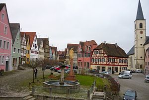
Aub
Town in Bavaria, Germany
Distance: Approx. 9091 meters
Latitude and longitude: 49.53333333,10.05
Aub (German: [aʊp] ) is a town in the district of Würzburg, in Bavaria, Germany, 29 kilometres (18 mi) southeast of Würzburg and 21 kilometres (13 mi) northwest of Rothenburg ob der Tauber, near the border of Baden-Württemberg. It is fed by the river Gollach and divided into three parts: Aub, Baldersheim and Burgerroth.

Hemmersheim
Municipality in Bavaria, Germany
Distance: Approx. 9088 meters
Latitude and longitude: 49.56666667,10.08333333
Hemmersheim is a municipality in the district of Neustadt (Aisch)-Bad Windsheim in Bavaria in Germany.
Gaukönigshofen
Municipality in Bavaria, Germany
Distance: Approx. 5170 meters
Latitude and longitude: 49.63333333,10
Gaukönigshofen is a municipality in the district of Würzburg in Bavaria in Germany.

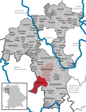
Giebelstadt
Municipality in Bavaria, Germany
Distance: Approx. 6416 meters
Latitude and longitude: 49.65,9.95
Giebelstadt is a municipality in the district of Würzburg in Bavaria in Germany.

Bieberehren
Municipality in Bavaria, Germany
Distance: Approx. 9188 meters
Latitude and longitude: 49.51555556,10.00777778
Bieberehren is a municipality in the district of Würzburg in Bavaria, Germany. It lies on the river Tauber.

Bütthard
Municipality in Bavaria, Germany
Distance: Approx. 5885 meters
Latitude and longitude: 49.6,9.88333333
Bütthard is a municipality in the district of Würzburg in Bavaria, Germany.
Gelchsheim
Municipality in Bavaria, Germany
Distance: Approx. 4796 meters
Latitude and longitude: 49.56666667,10.01666667
Gelchsheim is a market town and municipality in the district of Würzburg in Bavaria, Germany.

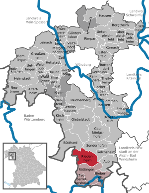
Riedenheim
Municipality in Bavaria, Germany
Distance: Approx. 4993 meters
Latitude and longitude: 49.55,9.98333333
Riedenheim is a municipality in the district of Würzburg in Bavaria, Germany.

Sonderhofen
Municipality in Bavaria, Germany
Distance: Approx. 2695 meters
Latitude and longitude: 49.6,10
Sonderhofen is a municipality in the district of Würzburg in Bavaria, Germany.
Tückelhausen Charterhouse
Carthusian monastery in Ochsenfurt, Bavaria
Distance: Approx. 7951 meters
Latitude and longitude: 49.6526,10.0252
Tückelhausen Charterhouse (German: Kartause or Kloster Tückelhausen) is a former Carthusian monastery, or charterhouse, in Ochsenfurt in Bavaria, Germany.

Gollach
River in Germany
Distance: Approx. 8670 meters
Latitude and longitude: 49.5196,10.0039
Gollach is a river of Bavaria, Germany. It flows into the Tauber in Bieberehren.
Weather in this IP's area
overcast clouds
4 Celsius
-1 Celsius
3 Celsius
5 Celsius
1021 hPa
85 %
1021 hPa
982 hPa
10000 meters
5.41 m/s
8.88 m/s
274 degree
100 %


