Country:
Region:
City:
Latitude and Longitude:
Time Zone:
Postal Code:
IP information under different IP Channel
ip-api
Country
Region
City
ASN
Time Zone
ISP
Blacklist
Proxy
Latitude
Longitude
Postal
Route
Luminati
Country
ASN
Time Zone
Europe/Berlin
ISP
VSE NET GmbH
Latitude
Longitude
Postal
IPinfo
Country
Region
City
ASN
Time Zone
ISP
Blacklist
Proxy
Latitude
Longitude
Postal
Route
db-ip
Country
Region
City
ASN
Time Zone
ISP
Blacklist
Proxy
Latitude
Longitude
Postal
Route
ipdata
Country
Region
City
ASN
Time Zone
ISP
Blacklist
Proxy
Latitude
Longitude
Postal
Route
Popular places and events near this IP address

Morbach
Municipality in Rhineland-Palatinate, Germany
Distance: Approx. 1250 meters
Latitude and longitude: 49.81666667,7.11666667
Morbach is a municipality that belongs to no Verbandsgemeinde – a kind of collective municipality – in the Bernkastel-Wittlich district in Rhineland-Palatinate, Germany. It is also a state-recognized climatic resort (Luftkurort).
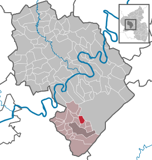
Etgert
Municipality in Rhineland-Palatinate, Germany
Distance: Approx. 8188 meters
Latitude and longitude: 49.77944444,7.02194444
Etgert is an Ortsgemeinde – a municipality belonging to a Verbandsgemeinde, a kind of collective municipality – in the Bernkastel-Wittlich district in Rhineland-Palatinate, Germany.

Kommen
Municipality in Rhineland-Palatinate, Germany
Distance: Approx. 8018 meters
Latitude and longitude: 49.87972222,7.12861111
Kommen is an Ortsgemeinde – a municipality belonging to a Verbandsgemeinde, a kind of collective municipality – in the Bernkastel-Wittlich district in Rhineland-Palatinate, Germany.

Rorodt
Municipality in Rhineland-Palatinate, Germany
Distance: Approx. 6909 meters
Latitude and longitude: 49.76972222,7.05111111
Rorodt is an Ortsgemeinde – a municipality belonging to a Verbandsgemeinde, a kind of collective municipality – in the Bernkastel-Wittlich district in Rhineland-Palatinate, Germany.

Allenbach
Municipality in Rhineland-Palatinate, Germany
Distance: Approx. 6437 meters
Latitude and longitude: 49.75555556,7.16583333
Allenbach is an Ortsgemeinde – a municipality belonging to a Verbandsgemeinde, a kind of collective municipality – in the Birkenfeld district in Rhineland-Palatinate, Germany. It belongs to the Verbandsgemeinde Herrstein-Rhaunen, whose seat is in Herrstein.
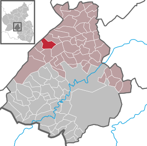
Bruchweiler
Municipality in Rhineland-Palatinate, Germany
Distance: Approx. 7042 meters
Latitude and longitude: 49.798,7.224
Bruchweiler is an Ortsgemeinde – a municipality belonging to a Verbandsgemeinde, a kind of collective municipality – in the Birkenfeld district in Rhineland-Palatinate, Germany. It belongs to the Verbandsgemeinde Herrstein-Rhaunen, whose seat is in Herrstein.
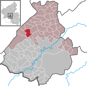
Sensweiler
Municipality in Rhineland-Palatinate, Germany
Distance: Approx. 6711 meters
Latitude and longitude: 49.77,7.2
Sensweiler is an Ortsgemeinde – a municipality belonging to a Verbandsgemeinde, a kind of collective municipality – in the Birkenfeld district in Rhineland-Palatinate, Germany. It belongs to the Verbandsgemeinde Herrstein-Rhaunen, whose seat is in Herrstein.
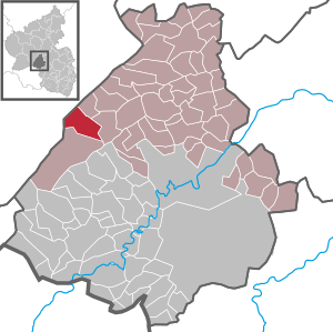
Wirschweiler
Municipality in Rhineland-Palatinate, Germany
Distance: Approx. 5863 meters
Latitude and longitude: 49.76416667,7.17305556
Wirschweiler is an Ortsgemeinde – a municipality belonging to a Verbandsgemeinde, a kind of collective municipality – in the Birkenfeld district in Rhineland-Palatinate, Germany. It belongs to the Verbandsgemeinde Herrstein-Rhaunen, whose seat is in Herrstein.

Schauren
Municipality in Rhineland-Palatinate, Germany
Distance: Approx. 7970 meters
Latitude and longitude: 49.80916667,7.23805556
Schauren is an Ortsgemeinde – a municipality belonging to a Verbandsgemeinde, a kind of collective municipality – in the Birkenfeld district in Rhineland-Palatinate, Germany. It belongs to the Verbandsgemeinde Herrstein-Rhaunen, whose seat is in Herrstein.

Langweiler, Birkenfeld
Municipality in Rhineland-Palatinate, Germany
Distance: Approx. 5133 meters
Latitude and longitude: 49.78361111,7.18805556
Langweiler is an Ortsgemeinde – a municipality belonging to a Verbandsgemeinde, a kind of collective municipality – in the Birkenfeld district in Rhineland-Palatinate, Germany. It belongs to the Verbandsgemeinde Herrstein-Rhaunen, whose seat is in Herrstein. For its particularly attractive location with a view of the Wildenburg (a nearby castle) and the Steinbachsee (a lake), the inhabitants sometimes call their municipality the Perle des Hochwalds (“Pearl of the High Forest”).

An den zwei Steinen
Distance: Approx. 7723 meters
Latitude and longitude: 49.834438,7.226371
An den zwei Steinen is a mountain, 766.2 m above sea level (NHN), in the Idar Forest (part of the Hunsrück mountains) in the counties of Birkenfeld and Bernkastel-Wittlich in Rhineland-Palatinate, Germany. The wooded peak is the second-highest in Rhineland-Palatinate after the Erbeskopf (816.3 m), 15 kilometres to the southwest (with its southwestern spur, the Springenkopf, 784.2 m) in the Schwarzwälder Hochwald, and ahead of the Kahlheid (766.0 m), 12 kilometres southwest, also in the Idar Forest. Its summit lies on the boundary of Stipshausen to the northeast, Hottenbach to the east-southeast and Hinzerath (part of Morbach) to the northwest; other municipalities nearby are: Hochscheid to the north and Hellertshausen to the southeast.
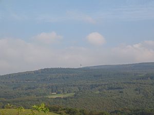
Kahlheid
Distance: Approx. 6717 meters
Latitude and longitude: 49.748,7.113556
The Kahlheid near Morscheid-Riedenburg in the Idar Forest (Hunsrück) is a mountain, 766 m above sea level (NHN), on the boundary between the counties of Birkenfeld and Bernkastel-Wittlich in the German state of Rhineland-Palatinate. The mountain is the third highest in Rhineland-Palatinate after the Erbeskopf (816.3 m), 2.6 km to the southwest and its southwestern subpeak, the Springenkopf (784.2 m), in the Schwarzwälder Hochwald, and the peak of An den zwei Steinen (766.2 m), 12 km to the northeast (both distances as the crow flies), also in the Idar Forest.
Weather in this IP's area
clear sky
5 Celsius
5 Celsius
5 Celsius
7 Celsius
1027 hPa
89 %
1027 hPa
970 hPa
10000 meters
0.45 m/s
0.49 m/s
237 degree
9 %
07:36:01
16:54:59