Country:
Region:
City:
Latitude and Longitude:
Time Zone:
Postal Code:
IP information under different IP Channel
ip-api
Country
Region
City
ASN
Time Zone
ISP
Blacklist
Proxy
Latitude
Longitude
Postal
Route
Luminati
Country
ASN
Time Zone
Europe/Amsterdam
ISP
DutchIS
Latitude
Longitude
Postal
IPinfo
Country
Region
City
ASN
Time Zone
ISP
Blacklist
Proxy
Latitude
Longitude
Postal
Route
db-ip
Country
Region
City
ASN
Time Zone
ISP
Blacklist
Proxy
Latitude
Longitude
Postal
Route
ipdata
Country
Region
City
ASN
Time Zone
ISP
Blacklist
Proxy
Latitude
Longitude
Postal
Route
Popular places and events near this IP address

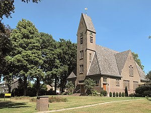
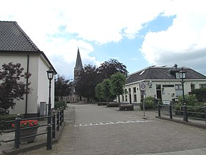
Epe, Netherlands
Municipality in Gelderland, Netherlands
Distance: Approx. 4141 meters
Latitude and longitude: 52.35,5.98333333
Epe (Dutch pronunciation: [ˈeːpə] ) is a municipality and a town in the eastern Netherlands. The municipality has a population of 32,191 (2015, source: CBS), and the town itself has a population of 15,552. The town hall stands in Epe, which is situated about 16 km (9.9 mi) north of Apeldoorn and 21 km (13 mi) south of Zwolle.
Zuuk
Hamlet in Gelderland, Netherlands
Distance: Approx. 4476 meters
Latitude and longitude: 52.33444444,6.00333333
Zuuk is a hamlet in the Netherlands, south of Zwolle, in the province of Gelderland in the municipality of Epe.

Emst
Village in Gelderland, Netherlands
Distance: Approx. 2440 meters
Latitude and longitude: 52.315,5.9725
Emst is a village in the municipality of Epe in the province of Gelderland in the Netherlands. It is the birthplace of former footballer Marc Overmars. Emst is located in the forest area of Veluwe.

Wissel
Hamlet in Gelderland, Netherlands
Distance: Approx. 2213 meters
Latitude and longitude: 52.34166667,5.95472222
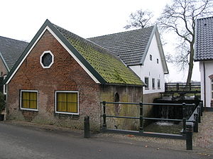
Wissel is a hamlet in the Dutch province of Gelderland. It is located in the municipality of Epe, about 2 km west of the town of Epe. It was first mentioned in 1273 as de Wischele.

Nijbroek
Village in Gelderland, Netherlands
Distance: Approx. 9046 meters
Latitude and longitude: 52.29277778,6.0625
Nijbroek is a village in the Dutch province of Gelderland. It is located in the municipality of Voorst, about 12 km northeast of Apeldoorn. Nijbroek was a separate municipality until 1818, when it was merged with Voorst.

Vaassen
Town in Gelderland, Netherlands
Distance: Approx. 4481 meters
Latitude and longitude: 52.28805556,5.96944444
Vaassen (Dutch pronunciation: [ˈvaːsə(n)]; Low German: Vaossen) is one of four villages in the Dutch municipality of Epe. Vaassen is situated between Apeldoorn and Zwolle, on the eastern edge of the Veluwe in the province of Gelderland. Vaassen was an independent municipality up to 1 January 1818, when it merged with Epe.

Jonas, Netherlands
Hamlet in Gelderland, Netherlands
Distance: Approx. 5610 meters
Latitude and longitude: 52.28416667,5.99027778
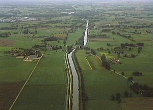
Jonas (sometimes "De Jonas" or Hafkamp) is a hamlet in the Dutch province of Gelderland. It lies east of the village of Vaassen, on the western side of the Apeldoornsch Kanaal. Jonas lies on the border of the municipalities Epe and Apeldoorn.

Hacking at Random
Hacker conference in Netherlands
Distance: Approx. 7907 meters
Latitude and longitude: 52.33,5.824
Hacking at Random was an outdoor hacker conference that took place in the Netherlands from August 13 to August 16, 2009. It had an attendance of 2300 people. It was situated on a large camp-site near the small town Vierhouten in the Netherlands called the Paasheuvel.
De Leest
Restaurant in Vaassen, Netherlands
Distance: Approx. 4399 meters
Latitude and longitude: 52.28823889,5.9673
De Leest (Dutch pronunciation: [də ˈleːst]) was a fine dining restaurant located in Vaassen in the Netherlands. The restaurant was awarded one Michelin star in the period 2003–2006, two Michelin stars in the period 2007–2013, and three Michelin stars since 2014 until it was closed on 27 December 2019. On 7 October 2019 the restaurant announced that it will close down "later this year".

Het Oude Loo
Dutch castle
Distance: Approx. 9878 meters
Latitude and longitude: 52.23527778,5.9425
Het Oude Loo (Dutch pronunciation: [ɦɛt ˈʌudə loː]; The Old Woods) is a 15th-century castle on the estate of Het Loo Palace in Apeldoorn in the Netherlands. The castle was built as a hunting lodge and is surrounded by a moat. The castle is currently used by the Dutch royal family as a country house and guest residence.

Cannenburgh Castle
Castle in Netherlands
Distance: Approx. 4037 meters
Latitude and longitude: 52.29166667,5.96666667
Cannenburg Castle (Dutch: Kasteel De Cannenburgh) or Cannenburch Castle (Dutch: Cannenburch) is a castle with a moat in the Netherlands. It is situated in Vaassen, a town in the province of Gelderland.

Wenum-Wiesel
Twin village in Gelderland, Netherlands
Distance: Approx. 7887 meters
Latitude and longitude: 52.2537,5.9542
Wenum-Wiesel is a twin village in the municipality of Apeldoorn, in the province of Gelderland in the Netherlands. In 1978, the hamlets of Wenum and Wiesel merged into a village.
Weather in this IP's area
scattered clouds
7 Celsius
6 Celsius
6 Celsius
8 Celsius
1029 hPa
83 %
1029 hPa
1026 hPa
10000 meters
1.57 m/s
1.54 m/s
83 degree
39 %
07:36:07
17:03:25
