93.180.146.96 - IP Lookup: Free IP Address Lookup, Postal Code Lookup, IP Location Lookup, IP ASN, Public IP
Country:
Region:
City:
Location:
Time Zone:
Postal Code:
ISP:
ASN:
language:
User-Agent:
Proxy IP:
Blacklist:
IP information under different IP Channel
ip-api
Country
Region
City
ASN
Time Zone
ISP
Blacklist
Proxy
Latitude
Longitude
Postal
Route
db-ip
Country
Region
City
ASN
Time Zone
ISP
Blacklist
Proxy
Latitude
Longitude
Postal
Route
IPinfo
Country
Region
City
ASN
Time Zone
ISP
Blacklist
Proxy
Latitude
Longitude
Postal
Route
IP2Location
93.180.146.96Country
Region
republika srpska
City
mrkonjic grad
Time Zone
Europe/Sarajevo
ISP
Language
User-Agent
Latitude
Longitude
Postal
ipdata
Country
Region
City
ASN
Time Zone
ISP
Blacklist
Proxy
Latitude
Longitude
Postal
Route
Popular places and events near this IP address

Vrbas Banovina
Distance: Approx. 9137 meters
Latitude and longitude: 44.44083333,17.19555556
The Vrbas Banovina or Vrbas Banate (Serbo-Croatian: Vrbaska banovina / Врбаска бановина), was a province (banovina) of the Kingdom of Yugoslavia between 1929 and 1941. It was named after the Vrbas River and consisted mostly of territory in western Bosnia (part of historical and present-day Bosnia and Herzegovina) with its capital at Banja Luka. Dvor district of present-day Croatia was also part of the Vrbas Banovina.
Mrkonjić Grad
Town and municipality
Distance: Approx. 240 meters
Latitude and longitude: 44.41666667,17.08333333
Mrkonjić Grad (Serbian Cyrillic: Мркоњић Град, pronounced [mr̩koɲit͡ɕ grad]) is a town and municipality in Republika Srpska, Bosnia and Herzegovina. It is located in the Bosanska Krajina region, between Banja Luka and Jajce. As of 2013, the municipality has a population of 16,671 inhabitants, while the town of Mrkonjić Grad has a population of 7,915 inhabitants.
Rogolji
Village in Republika Srpska, Bosnia and Herzegovina
Distance: Approx. 3471 meters
Latitude and longitude: 44.43333333,17.05
Rogolji (Serbian Cyrillic: Рогољи) is a village in the municipality of Gradiška, Republika Srpska, Bosnia and Herzegovina.
Kovačevac, Jezero
Village in Republika Srpska, Bosnia and Herzegovina
Distance: Approx. 7211 meters
Latitude and longitude: 44.36138889,17.13527778
Kovačevac (Serbian Cyrillic: Ковачевац) is a village in the municipality of Jezero, Bosnia and Herzegovina.

Balkana Lake
Distance: Approx. 2893 meters
Latitude and longitude: 44.41527778,17.04972222
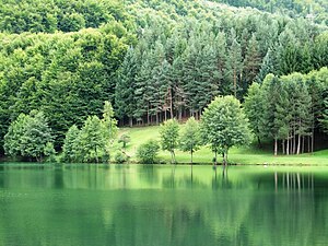
Balkana (Bosnian/Serbian cyrillic: Балкана) is an artificial lake located on the slopes of Lisina mountain, in the municipality of Mrkonjić Grad, entity of Republika Srpska, in the western part of Bosnia and Herzegovina. The lake, actually, consists of two separate, though connected via small outcomes, basins, upper as larger and lower as smaller, with very small difference in water tables levels. Total area of both basins is 56.000 m2 (602.78 sq ft).
Gradski stadion Luke (Mrkonjić Grad)
Stadium in Bosnia and Herzegovina
Distance: Approx. 518 meters
Latitude and longitude: 44.411214,17.084974
Gradski Stadion Luke is a multi-purpose stadium in Mrkonjić Grad, Bosnia and Herzegovina. It is currently used mostly for football matches and is the home ground of FK Sloboda Mrkonjić Grad of the Second League of the Republika Srpska. The stadium holds 2,000 spectators.

Saints Philip and James Church, Mrkonjić Grad
Church in Mrkonjić Grad, Bosnia and Herzegovina
Distance: Approx. 423 meters
Latitude and longitude: 44.4194,17.0844
The Saints Philip and James Church (Croatian: Crkva svetog Filipa i Jakova) is a Roman Catholic church in Mrkonjić Grad, Bosnia and Herzegovina.
Operation Southern Move
Part of the Bosnian War in 1995
Distance: Approx. 716 meters
Latitude and longitude: 44.41,17.09
Operation Southern Move (Croatian: Operacija Južni potez) was the final Croatian Army (HV) and Croatian Defence Council (HVO) offensive of the Bosnian War. It took place in western Bosnia and Herzegovina on 8–11 October 1995. Its goal was to help the Army of the Republic of Bosnia and Herzegovina (ARBiH) whose positions around the town of Ključ, captured by them during Operation Sana, were endangered by a counteroffensive by the Army of Republika Srpska (VRS).

Skakavac Waterfall (Mrkonjić Grad)
Waterfall in near Balkana Lake
Distance: Approx. 2805 meters
Latitude and longitude: 44.41519444,17.05083333
Skakavac Waterfall is located near Mrkonjić Grad in western Bosnia and Herzegovina. River Skakavac, from which occurs the mentioned waterfall is one of the small rivers that flow into the Balkana Lake.

Bjelajce
Village in Republika Srpska, Bosnia and Herzegovina
Distance: Approx. 4799 meters
Latitude and longitude: 44.43,17.1431
Bjelajce (Serbian Cyrillic: Бјелајцe) is a village in the municipality of Mrkonjic Grad, Republika Srpska, Bosnia and Herzegovina.
Crna River (Vrbas)
River in Bosnia and Herzegovina
Distance: Approx. 9274 meters
Latitude and longitude: 44.4663,17.1789
Crna River (Bosnian: Crna rijeka / Црна ријека, "Black River") is left tributary of Vrbas. It arises from Malo Lake (Malo jezero, "Little Lake", 780 m) of Balkana, Mrkonjić Grad Municipality. The lake fed by streams Cjepalo (1320 m) and Skakavac with mountain Lisina, as well as sublacustric sources under the Veliko Lake (Veliko jezero, "Great Lake").
Lisina (Bosnia and Herzegovina mountain)
Distance: Approx. 4064 meters
Latitude and longitude: 44.39739,17.041971
Lisina is a mountain of volcanic origin, located between the Municipality of Mrkonjić Grad and the Municipality of Šipovo, Bosnia and Herzegovina. Its highest peak, Bandira, is at a height of 1.467 m (4 ft 9.8 in). Thanks to its geological structure, it is characterized by the great biodiversity of plant and animal species.
Weather in this IP's area
overcast clouds
7 Celsius
7 Celsius
7 Celsius
7 Celsius
1030 hPa
85 %
1030 hPa
933 hPa
10000 meters
1.05 m/s
1.16 m/s
19 degree
100 %


