93.175.251.97 - IP Lookup: Free IP Address Lookup, Postal Code Lookup, IP Location Lookup, IP ASN, Public IP
Country:
Region:
City:
Location:
Time Zone:
Postal Code:
ISP:
ASN:
language:
User-Agent:
Proxy IP:
Blacklist:
IP information under different IP Channel
ip-api
Country
Region
City
ASN
Time Zone
ISP
Blacklist
Proxy
Latitude
Longitude
Postal
Route
db-ip
Country
Region
City
ASN
Time Zone
ISP
Blacklist
Proxy
Latitude
Longitude
Postal
Route
IPinfo
Country
Region
City
ASN
Time Zone
ISP
Blacklist
Proxy
Latitude
Longitude
Postal
Route
IP2Location
93.175.251.97Country
Region
lombardia
City
tremosine
Time Zone
Europe/Rome
ISP
Language
User-Agent
Latitude
Longitude
Postal
ipdata
Country
Region
City
ASN
Time Zone
ISP
Blacklist
Proxy
Latitude
Longitude
Postal
Route
Popular places and events near this IP address

Limone sul Garda
Comune in Lombardy, Italy
Distance: Approx. 4704 meters
Latitude and longitude: 45.80833333,10.7875
Limone sul Garda (Gardesano: Limù) is a town and comune in the province of Brescia, in Lombardy (northern Italy), at the western bank of Lake Garda.

Tremosine sul Garda
Comune in Lombardy, Italy
Distance: Approx. 90 meters
Latitude and longitude: 45.77222222,10.75833333
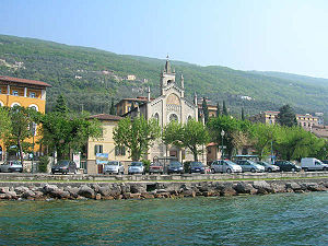
Tremosine sul Garda (Brescian: Tremuzen) is a comune in the Italian province of Brescia, in Lombardy, near Lake Garda. It is one of I Borghi più belli d'Italia ("The most beautiful villages of Italy"). It is divided into 18 frazioni; Pieve is the frazione which has the town hall.

Brenzone sul Garda
Comune in Veneto, Italy
Distance: Approx. 7989 meters
Latitude and longitude: 45.7,10.76666667
Brenzone sul Garda is a comune (municipality) in the Province of Verona in the Italian region of Veneto, located on the eastern shore of Lake Garda about 120 kilometres (75 miles) west of Venice and about 35 km (22 mi) northwest of Verona. The municipality of Brenzone is formed by the frazioni (subdivisions, mainly villages and hamlets) of Assenza, Biaza, Campo, Castelletto, Castello, Magugnano (municipal seat), Marniga, Porto, and Sommavilla. Brenzone borders the following municipalities: Ferrara di Monte Baldo, Gargnano, Malcesine, San Zeno di Montagna, Tignale, Torri del Benaco, and Tremosine.

Malcesine
Comune in Veneto, Italy
Distance: Approx. 4603 meters
Latitude and longitude: 45.76666667,10.81666667
Malcesine is a comune (municipality) on the eastern shore of Lake Garda in the Province of Verona in the Italian region Veneto, located about 120 kilometres (75 miles) northwest of Venice and about 40 kilometres (25 miles) northwest of Verona. It is one of I Borghi più belli d'Italia ("The most beautiful villages of Italy").

Tremalzo Pass
Mountain pass in Trentino, Italy
Distance: Approx. 8610 meters
Latitude and longitude: 45.83888889,10.70333333
The Tremalzo Pass (Italian: Passo di Tremalzo) (el. 1702 m.) is a mountain pass in Trentino in Italy. It lies near Trento and Lake Garda.

Monte Baldo
Mountain in Italy; in Germany named Bubeskopf
Distance: Approx. 8363 meters
Latitude and longitude: 45.72638889,10.84388889
Monte Baldo (German: Waldberg) is a mountain range in the Italian Alps, located in the provinces of Trento and Verona. Its ridge is orientated in a northeast-southwest direction and it is bounded to the south by the highland ending at Caprino Veronese, to the west by Lake Garda, to the north by the valley joining Rovereto to Nago-Torbole and, to the east, the Val d'Adige. The name derives from the German Wald ("forest"); it appears for the first time in a German map in 1163.

Monte Caplone
Mountain in Italy
Distance: Approx. 9651 meters
Latitude and longitude: 45.80194444,10.64138889
Monte Caplone is a mountain between Lombardy and Trentino-Alto Adige/Südtirol, Italy. It has an elevation of 1,976 metres.

Garda Mountains
Northern Italian mountain range
Distance: Approx. 8438 meters
Latitude and longitude: 45.72353648,10.84190549
The Garda Mountains (Italian: Prealpi Gardesane), occasionally also the Garda Hills, are an extensive mountain range of the Southern Limestone Alps in northern Italy.

Cima Valdritta
Mountain in Italy
Distance: Approx. 8363 meters
Latitude and longitude: 45.72638889,10.84388889
Cima Valdritta is the highest summit of the Monte Baldo mountain range and thereby part of the Garda Mountains in northern Italy.
Cima delle Pozzette
Mountain in Italy
Distance: Approx. 8235 meters
Latitude and longitude: 45.734583,10.849671
Cima delle Pozzette is one of the highest summits of the Monte Baldo mountain range and thereby part of the Garda Mountains in northern Italy.
Bocca di Navene
Mountain pass in Italy
Distance: Approx. 9103 meters
Latitude and longitude: 45.787996,10.872642
Bocca di Navene is a mountain saddle in the Monte Baldo range in the Garda Mountains in northern Italy. The saddle separates the more solitary Monte Altissimo di Nago (2078 m) in the north from the rest of the range with the long ridge with Cima Valdritta (2292 m) in the south. On the western side a steep hiking path leads down to lake Garda, while at the eastern side the slopes are more gentle and fall down to the small barrier lake Lago di Prà della Stua.
Malga Artillone
Mountain pasture located on Monte Baldo
Distance: Approx. 9505 meters
Latitude and longitude: 45.73373,10.86755
The Artillone hut (or Artilone or Artilóm ) is one of the mountain pastures located on Monte Baldo, in the municipality of Avio, in the autonomous province of Trento, Italy. It is called Bubeskopf in Germany.
Weather in this IP's area
overcast clouds
4 Celsius
3 Celsius
4 Celsius
9 Celsius
1026 hPa
96 %
1026 hPa
941 hPa
8041 meters
1.54 m/s
1.84 m/s
25 degree
100 %

