93.159.251.33 - IP Lookup: Free IP Address Lookup, Postal Code Lookup, IP Location Lookup, IP ASN, Public IP
Country:
Region:
City:
Location:
Time Zone:
Postal Code:
IP information under different IP Channel
ip-api
Country
Region
City
ASN
Time Zone
ISP
Blacklist
Proxy
Latitude
Longitude
Postal
Route
Luminati
Country
Region
nw
City
aachen
ASN
Time Zone
Europe/Berlin
ISP
RelAix Networks GmbH
Latitude
Longitude
Postal
IPinfo
Country
Region
City
ASN
Time Zone
ISP
Blacklist
Proxy
Latitude
Longitude
Postal
Route
IP2Location
93.159.251.33Country
Region
nordrhein-westfalen
City
dobach
Time Zone
Europe/Berlin
ISP
Language
User-Agent
Latitude
Longitude
Postal
db-ip
Country
Region
City
ASN
Time Zone
ISP
Blacklist
Proxy
Latitude
Longitude
Postal
Route
ipdata
Country
Region
City
ASN
Time Zone
ISP
Blacklist
Proxy
Latitude
Longitude
Postal
Route
Popular places and events near this IP address

Old Tivoli
Distance: Approx. 4108 meters
Latitude and longitude: 50.79333333,6.09722222
The Tivoli, colloquially known as the old Tivoli, was a football stadium in Aachen, Germany. Opened in 1928, it was used by the city's largest football team, Alemannia Aachen, until the opening of the new Tivoli in 2009.

Würselen
Town in North Rhine-Westphalia, Germany
Distance: Approx. 754 meters
Latitude and longitude: 50.81666667,6.13333333
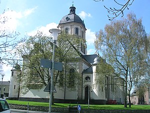
Würselen (German pronunciation: [ˈvʏʁzələn] , Ripuarian: Wöschele [ˈβœʃələ]) is a town in the borough of Aachen, in North Rhine-Westphalia, Germany.

Battle of Crucifix Hill
1944 battle of World War II
Distance: Approx. 1826 meters
Latitude and longitude: 50.79934167,6.13941667
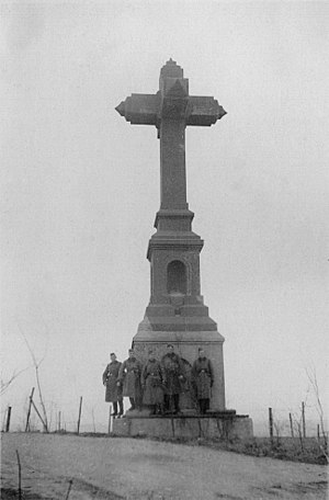
The Battle of Crucifix Hill was a World War II battle that took place on 8 October 1944, on Crucifix Hill (Haarberg, Hill 239), next to the village of Haaren in Germany and was a part of the U.S. 1st Division's campaign to seize Aachen, Germany. The Battle of Aachen was part of the Drive to the Siegfried Line. The hill was named after a large crucifix mounted on the top of the hill.

Aachen Merzbrück Airfield
Airport in Germany
Distance: Approx. 3113 meters
Latitude and longitude: 50.823333,6.186389
Aachen Merzbrück Airfield (German: Flugplatz Aachen-Merzbrück) (IATA: AAH, ICAO: EDKA) is an airfield located near Aachen, Germany.

Heilig-Geist-Gymnasium
Christian secondary school in Germany
Distance: Approx. 3795 meters
Latitude and longitude: 50.84361111,6.17444444
Heilig-Geist-Gymnasium is a Christian secondary school located in Broich in Würselen, Germany.

New Tivoli
Football stadium
Distance: Approx. 4108 meters
Latitude and longitude: 50.79333333,6.09722222
The Tivoli, colloquially known as the new Tivoli, is a football stadium in the Sportpark Soers in Aachen, Germany, that opened on 17 August 2009 replacing the nearby old Tivoli. It hosts the home matches of Alemannia Aachen in the 3. Liga.

Aachen Prison
Penal facility
Distance: Approx. 3580 meters
Latitude and longitude: 50.80083333,6.09861111
Aachen Prison is a penal facility located in the Soers in Aachen, North Rhine-Westphalia, Germany. As of 2007, 800 criminals are serving their sentences in the prison. Brigitte Kerzl serves as the director of the prison.
Waggonfabrik Talbot
Distance: Approx. 4039 meters
Latitude and longitude: 50.7859,6.1107
Waggonfabrik Talbot was a rolling stock manufacturer founded in Aachen, Germany, in 1838. The company was an early pioneer of self discharging freight wagons, and in the latter part of the twentieth century a major supplier to the Dutch State Railways (Nederlandse Spoorwegen). In the 1990s the company developed the Talent passenger train, and was acquired by Bombardier Inc.

Wildbach (Wurm)
River in Germany
Distance: Approx. 3164 meters
Latitude and longitude: 50.806,6.1015
Wildbach is a small river of North Rhine-Westphalia, Germany. It is 5.3 km (3.3 mi) long and is a left tributary of the Wurm, which it joins north of Aachen.

Eilendorf station
Railway station in Germany
Distance: Approx. 3411 meters
Latitude and longitude: 50.78565278,6.15486944
Eilendorf station is a station in the German state of North Rhine-Westphalia on the Cologne–Aachen high-speed railway. It is located in the eastern Aachen district of Eilendorf near the districts of Brand, Rothe Erde and Verlautenheide.
Haaren (Aachen)
Borough of Aachen in North Rhine-Westphalia, Germany
Distance: Approx. 2520 meters
Latitude and longitude: 50.79555556,6.12694444
The formerly independent municipality of Haaren lies four kilometers north of Aachen, into which it was incorporated in 1972. Haaren lies at the fork of the Wurm, itself a tributary of the Rur, and a smaller stream that shares its name with the community. Two kilometers farther east lies the predominantly rural Verlautenheide community.

Verlautenheide
Part of Aachen in North Rhine-Westphalia, Germany
Distance: Approx. 2280 meters
Latitude and longitude: 50.79638889,6.15555556
Verlautenheide is a rural section of northeast Aachen, with a population of around 3500. The community lies within the administrative district of Haaren. Its highest point is the Haarberg (around 240 m).
Weather in this IP's area
overcast clouds
1 Celsius
-1 Celsius
-1 Celsius
1 Celsius
1034 hPa
55 %
1034 hPa
1009 hPa
10000 meters
1.64 m/s
1.68 m/s
140 degree
94 %
