93.119.16.24 - IP Lookup: Free IP Address Lookup, Postal Code Lookup, IP Location Lookup, IP ASN, Public IP
Country:
Region:
City:
Location:
Time Zone:
Postal Code:
ISP:
ASN:
language:
User-Agent:
Proxy IP:
Blacklist:
IP information under different IP Channel
ip-api
Country
Region
City
ASN
Time Zone
ISP
Blacklist
Proxy
Latitude
Longitude
Postal
Route
db-ip
Country
Region
City
ASN
Time Zone
ISP
Blacklist
Proxy
Latitude
Longitude
Postal
Route
IPinfo
Country
Region
City
ASN
Time Zone
ISP
Blacklist
Proxy
Latitude
Longitude
Postal
Route
IP2Location
93.119.16.24Country
Region
extremadura
City
villanueva de la serena
Time Zone
Europe/Madrid
ISP
Language
User-Agent
Latitude
Longitude
Postal
ipdata
Country
Region
City
ASN
Time Zone
ISP
Blacklist
Proxy
Latitude
Longitude
Postal
Route
Popular places and events near this IP address

Villanueva de la Serena
City
Distance: Approx. 1128 meters
Latitude and longitude: 38.96666667,-5.8
Villanueva de la Serena (Spanish: [bi.ʎaˈnwe.βa ðe la seˈɾe.na] ) is a city in the Province of Badajoz, Extremadura, Spain. It has a population of 26,111 (2010) and forms part of a larger urban area with the neighbouring town of Don Benito.

Don Benito
Municipality in Extremadura, Spain
Distance: Approx. 6085 meters
Latitude and longitude: 38.95452778,-5.86172222
Don Benito (Spanish pronunciation: [dom beˈnito]) is a Spanish town and municipality in the province of Badajoz, Extremadura, near the left bank of the river Guadiana. According to the 2014 census, the municipality has a population of 37,011.
CD Don Benito
Spanish football team
Distance: Approx. 6109 meters
Latitude and longitude: 38.962733,-5.865696
Club Deportivo Don Benito is a Spanish football team based in Don Benito, in the autonomous community of Extremadura. Founded in 1928 it plays in Segunda Federación – Group 4, holding home matches at Estadio Vicente Sanz, with a capacity of 5,000 seats.
CF Villanovense
Association football club in Spain
Distance: Approx. 994 meters
Latitude and longitude: 38.974739,-5.786171
Club de Fútbol Villanovense is a Spanish football team based in Villanueva de la Serena, in the autonomous community of Extremadura. Founded in 1992 it plays in Segunda Federación – Group 4, holding home matches at Estadio Romero Cuerda, with a capacity of 5,000 seats.
La Haba
Municipality in Extremadura, Spain
Distance: Approx. 6782 meters
Latitude and longitude: 38.91666667,-5.78333333
La Haba is a municipality located in the province of Badajoz, Extremadura, Spain. According to the 2005 census (INE), the municipality has a population of 1441 inhabitants.

Rena, Badajoz
Place in Extremadura, Spain
Distance: Approx. 8174 meters
Latitude and longitude: 39.05,-5.8
Rena is a Spanish municipality in the province of Badajoz, Extremadura. It has a population of 650 (2007) and an area of 10.8 km².

Campiña Sur (Badajoz)
Comarca in Extremadura, Spain
Distance: Approx. 5431 meters
Latitude and longitude: 38.95,-5.85
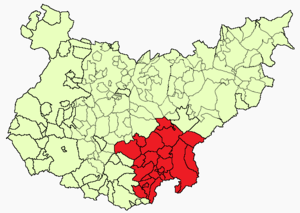
Campiña Sur (Extremaduran: Campiña Sul) is an administrative division (comarca) in the province of Badajoz, Extremadura, Spain. Its capital and administrative center is the municipality of Llerena. It contains 21 municipalities and 32,841 inhabitants in an area of 2,798 square kilometres (1,080 sq mi).

Las Vegas Altas
Comarca in Extremadura, Spain
Distance: Approx. 5431 meters
Latitude and longitude: 38.95,-5.85
Las Vegas Altas, also known as Vegas Altas del Guadiana, is a comarca in the province of Badajoz, Extremadura, Spain. Its capital and administrative center is the urban area of the municipalities of Don Benito and Villanueva de la Serena. The comarca contains 16 municipalities and 90,697 inhabitants (INE 2008).

Zújar (river)
River in Spain
Distance: Approx. 3722 meters
Latitude and longitude: 39,-5.76666667
The Zújar is a 214 km long river in Spain. It the largest left hand tributary to the Guadiana.
Weather in this IP's area
clear sky
12 Celsius
10 Celsius
12 Celsius
12 Celsius
1028 hPa
39 %
1028 hPa
992 hPa
10000 meters
2.67 m/s
4.45 m/s
83 degree