Country:
 Romania
Region:
City:
Latitude and Longitude:
Time Zone:
Postal Code:
IP information under different IP Channel
ip-api
Country
Region
City
ASN
Time Zone
ISP
Blacklist
Proxy
Latitude
Longitude
Postal
Route
IPinfo
Country
Region
City
ASN
Time Zone
ISP
Blacklist
Proxy
Latitude
Longitude
Postal
Route
MaxMind
Country
Region
City
ASN
Time Zone
ISP
Blacklist
Proxy
Latitude
Longitude
Postal
Route
Luminati
Country
RORegion
nt
City
roznov
ASN
Time Zone
Europe/Bucharest
ISP
Orange Romania S.A.
Latitude
Longitude
Postal
db-ip
Country
Region
City
ASN
Time Zone
ISP
Blacklist
Proxy
Latitude
Longitude
Postal
Route
ipdata
Country
Region
City
ASN
Time Zone
ISP
Blacklist
Proxy
Latitude
Longitude
Postal
Route
Popular places and events near this IP address

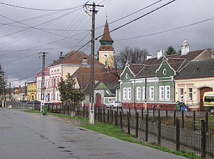
Râșnov
Town in Brașov, Romania
Distance: Approx. 2626 meters
Latitude and longitude: 45.59333333,25.46027778
Râșnov (Romanian pronunciation: [ˈrɨʃnov]; ‹See Tfd›German: Rosenau; Hungarian: Barcarozsnyó; Transylvanian Saxon dialect: Ruusenåå; Latin: Rosnovia) is a town in Brașov County, Transylvania, Romania with a population of 15,920 as of 2021. It is located at about 15 km (9.3 mi) southwest of the city of Brașov and about the same distance from Bran, on DN73, a road that links Wallachia and Transylvania.
Vulcan, Brașov
Commune in Brașov, Romania
Distance: Approx. 4753 meters
Latitude and longitude: 45.63527778,25.41722222
Vulcan (‹See Tfd›German: Wolkendorf; Hungarian: Szászvolkány) is a commune in Brașov County, Transylvania, Romania, 16 km west of the county capital Brașov. It is composed of two villages, Colonia 1 Mai (Konkordiabányatelep) and Vulcan. It also included Holbav village until 2004, when it was split off to form a separate commune.

Ghimbav
Town in Brașov, Romania
Distance: Approx. 5906 meters
Latitude and longitude: 45.66277778,25.50611111
Ghimbav (‹See Tfd›German: Weidenbach; Hungarian: Vidombák) is a town in Brașov County, Transylvania, central Romania.
Turcu
River in Brașov County, Romania
Distance: Approx. 7487 meters
Latitude and longitude: 45.5781,25.3916
The Turcu (also: Moieciu, in its upper course also: Bângăleasa or Grohotișul) is a right tributary of the river Bârsa in Romania. It discharges into the Bârsa in Tohanu Vechi near Zărnești. Its source is in the Bucegi Mountains.
Pârâul Mic (Ghimbășel)
River in Brașov County, Romania
Distance: Approx. 5450 meters
Latitude and longitude: 45.5675,25.45833333
The Pârâul Mic (in its upper course also: Pietrosu) is a right tributary of the river Ghimbășel in Romania. It flows into the Ghimbășel south of Râșnov. Its length is 12 km (7.5 mi) and its basin size is 67 km2 (26 sq mi).
Pârâul Cheii
River in Brașov County, Romania
Distance: Approx. 7074 meters
Latitude and longitude: 45.55388889,25.49305556
The Pârâul Cheii (also: Valea Cheii) is a right tributary of the Pârâul Mic in Romania. It flows into the Pârâul Mic southeast of Râșnov. Its length is 7 km (4.3 mi) and its basin size is 41 km2 (16 sq mi).
Sohodol (Bârsa)
Tributary of the Bârsa River in Romania
Distance: Approx. 3298 meters
Latitude and longitude: 45.6034,25.4328
The Sohodol is a right tributary of the river Bârsa in Romania. It flows into the Bârsa west of Râșnov. Its length is 16 km (9.9 mi) and its basin size is 41 km2 (16 sq mi).
Pănicel
River in Brașov County, Romania
Distance: Approx. 4515 meters
Latitude and longitude: 45.5854,25.4327
The Pănicel is a right tributary of the river Sohodol in Romania. It flows into the Sohodol near Râșnov. Its length is 14 km (8.7 mi) and its basin size is 17 km2 (6.6 sq mi).

Cristian, Brașov
Commune in Brașov, Romania
Distance: Approx. 2177 meters
Latitude and longitude: 45.6333,25.4833
Cristian (‹See Tfd›German: Neustadt; Hungarian: Keresztényfalva) is a commune in Brașov County, Transylvania, Romania. It is composed of a single village, Cristian.

Cumidava
Dacian fortified settlement
Distance: Approx. 2795 meters
Latitude and longitude: 45.590524,25.469504
Cumidava (also Comidava, Komidava, Ancient Greek: Κομίδαυα) was originally a Dacian settlement, and later a Roman military camp on the site of the modern city of Râșnov (15 km from Brașov) in Romania.

Râșnov Ski Jump
Distance: Approx. 4922 meters
Latitude and longitude: 45.57138889,25.47083333
Râșnov Ski Jump (Romanian: Trambulina Valea Cărbunării) is a ski jumping hill located within the Râșnov Sports Complex, in the Cărbunării Valley, southeast of Râșnov, Romania. It is the country's second largest ski jumping hill after the disused 110-meter Tintina. The whole ski jumping complex consists of four hills, with K-points of 90, 64, 35 and 15 meters, respectively.

St. Nicholas Church, Râșnov
Heritage site in Braşov County, Romania
Distance: Approx. 3620 meters
Latitude and longitude: 45.58358,25.46327
St. Nicholas Church (Romanian: Biserica Sfântul Nicolae) is a Romanian Orthodox church located at 14 Romulus Cristoloveanu Street, Râșnov, Brașov County, Romania. It is dedicated to Saint Nicholas.
Weather in this IP's area
overcast clouds
13 Celsius
12 Celsius
12 Celsius
13 Celsius
1012 hPa
96 %
1012 hPa
943 hPa
10000 meters
1.25 m/s
1.48 m/s
160 degree
100 %
07:21:32
18:51:08