Country:
Region:
City:
Latitude and Longitude:
Time Zone:
Postal Code:
IP information under different IP Channel
ip-api
Country
Region
City
ASN
Time Zone
ISP
Blacklist
Proxy
Latitude
Longitude
Postal
Route
Luminati
Country
Region
is
City
iasi
ASN
Time Zone
Europe/Bucharest
ISP
Orange Romania S.A.
Latitude
Longitude
Postal
IPinfo
Country
Region
City
ASN
Time Zone
ISP
Blacklist
Proxy
Latitude
Longitude
Postal
Route
db-ip
Country
Region
City
ASN
Time Zone
ISP
Blacklist
Proxy
Latitude
Longitude
Postal
Route
ipdata
Country
Region
City
ASN
Time Zone
ISP
Blacklist
Proxy
Latitude
Longitude
Postal
Route
Popular places and events near this IP address

Săvinești
Commune in Neamț, Romania
Distance: Approx. 4423 meters
Latitude and longitude: 46.8602,26.4686
Săvinești is a commune in Neamț County, Western Moldavia, Romania. It is composed of two villages, Dumbrava-Deal and Săvinești. The commune is situated at 8 km (5.0 mi) south of Piatra Neamț on DN15 road and it is regarded as one of Piatra Neamț's satellite towns.
Roznov, Neamț
Town in Neamț, Romania
Distance: Approx. 171 meters
Latitude and longitude: 46.83555556,26.51166667
Roznov is a town located in Neamț County, Western Moldavia, Romania. Roznov became a town in 2003. Two villages are administered by the town, Chintinici and Slobozia.
Cracău
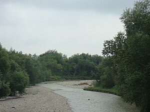
River in Romania
Distance: Approx. 2057 meters
Latitude and longitude: 46.8181,26.5259
The Cracău is a left tributary of the river Bistrița in Romania. It is formed at the confluence of its headwaters Cracăul Alb and Cracăul Negru in Magazia. It discharges into the Bistrița in Roznov.
Iapa (Bistrița)
River in Neamț, Romania
Distance: Approx. 1123 meters
Latitude and longitude: 46.83277778,26.49777778
The Iapa is a right tributary of the river Bistrița in Romania. It flows into the Bistrița in Chintinici near Roznov. Its length is 24 km (15 mi) and its basin size is 75 km2 (29 sq mi).
Nechit
River in Neamț County, Romania
Distance: Approx. 4950 meters
Latitude and longitude: 46.79972222,26.55361111
The Nechit is a right tributary of the river Bistrița in Romania. It discharges into the Bistrița in Ruseni. Its length is 27 km (17 mi) and its basin size is 106 km2 (41 sq mi).
Calul (Bistrița)
River in Neamț County, Romania
Distance: Approx. 2215 meters
Latitude and longitude: 46.83805556,26.48388889
The Calul or Calu is a right tributary of the river Bistrița in Romania. It discharges into the Bistrița in Piatra Șoimului, near Roznov. Its length is 20 km (12 mi) and its basin size is 62 km2 (24 sq mi).

Podoleni
Commune in Neamț, Romania
Distance: Approx. 9749 meters
Latitude and longitude: 46.78333333,26.61666667
Podoleni is a commune in Neamț County, Western Moldavia, Romania. It is composed of two villages, Negritești and Podoleni.

Borlești
Commune in Neamț, Romania
Distance: Approx. 6381 meters
Latitude and longitude: 46.777,26.505
Borlești is a commune in Neamț County, Western Moldavia, Romania. It is composed of five villages: Borlești, Nechit, Mastacăn, Ruseni, and Șovoaia.
Piatra Șoimului
Commune in Neamț, Romania
Distance: Approx. 6022 meters
Latitude and longitude: 46.83333333,26.43333333
Piatra Șoimului is a commune in Neamț County, Western Moldavia, Romania. It is composed of four villages: Luminiș, Negulești, Piatra Șoimului, and Poieni.

Zănești
Commune in Neamț, Romania
Distance: Approx. 3459 meters
Latitude and longitude: 46.81666667,26.55
Zănești is a commune in Neamț County, Western Moldavia, Romania. It is composed of two villages, Traian and Zănești. The commune is located on the banks of the Bistrița River, in the southern part of the county, 20 km (12 mi) southeast of the county seat, Piatra Neamț.

Dochia, Neamț
Commune in Neamț, Romania
Distance: Approx. 7874 meters
Latitude and longitude: 46.9,26.55
Dochia is a commune in Neamț County, Western Moldavia, Romania. It is composed of two villages, Bălușești and Dochia. These were part of Bahna Commune from 1864 to 1880, an independent commune from 1880 to 1968, part of Girov Commune from 1968 to 2003, and independent again since that year.

Rediu, Neamț
Commune in Neamț, Romania
Distance: Approx. 9405 meters
Latitude and longitude: 46.758,26.566
Rediu is a commune in Neamț County, Western Moldavia, Romania. It is composed of four villages: Bețești, Poloboc, Rediu, and Socea. The commune is located in the southern part of the county, close to the border with Bacău County, on the right bank of the river Bistrița.
Weather in this IP's area
broken clouds
13 Celsius
12 Celsius
13 Celsius
13 Celsius
995 hPa
53 %
995 hPa
964 hPa
10000 meters
4.98 m/s
8.22 m/s
161 degree
84 %
07:24:22
16:35:14


